
The Big Picture of the Book of Mormon
Mosiah’s, Zeniff’s and Limhi’s Travels
Part 7 of 10
Three generations. Three journeys. One geography—Do the directions fit?
Three generations. Three journeys. One geography—Do the directions fit?
What if we could take three journeys described in the Book of Mormon, put them on a modern map, and see whether the directions Mormon gave us actually make sense?
King Mosiah left the Land of Nephi.
Zeniff went back to the Land of Nephi.
And nearly 80 years later, his grandson Limhi escaped and went back to Zarahemla again.
They repeatedly traveled up and down between the same major lands.
So here's the question we're going to investigate:
Do these journeys actually fit the geography we've been building?
Let's follow the evidence.
BEGINNING
Hi, welcome back to the Mormon Mann Channel. I'm Kendall, the Mormon Mann.
This is Part 7 of my ten-part series, “The Big Picture of the Book of Mormon.”
In this series, we're taking the geographical descriptions written by the prophet Mormon and placing them onto a modern map.
And today, we're going to investigate something especially interesting:
The travels of three kings—and the directions Mormon says they traveled.
Those three men are Mosiah I, Zeniff, and Limhi.
Their journeys span more than 100 years of Nephite history.
And as we follow their movements, we're going to encounter the same words again and again:
UP.
And
DOWN.
Those words are not random.
They are clues.
And if the geography we've been building is correct, those clues should fit the terrain.
So let's start with the first journey.
CLUE #1 — MOSIAH LEAVES THE LAND OF NEPHI
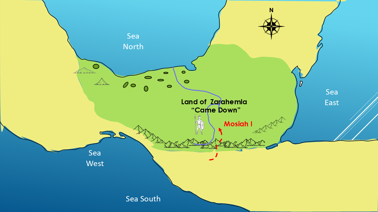
Around 225 BC, King Mosiah I was warned by the Lord to leave the Land of Nephi.
Mosiah gathered together those who would follow him and departed into the wilderness.
And then Mormon gives us an important geographical statement.
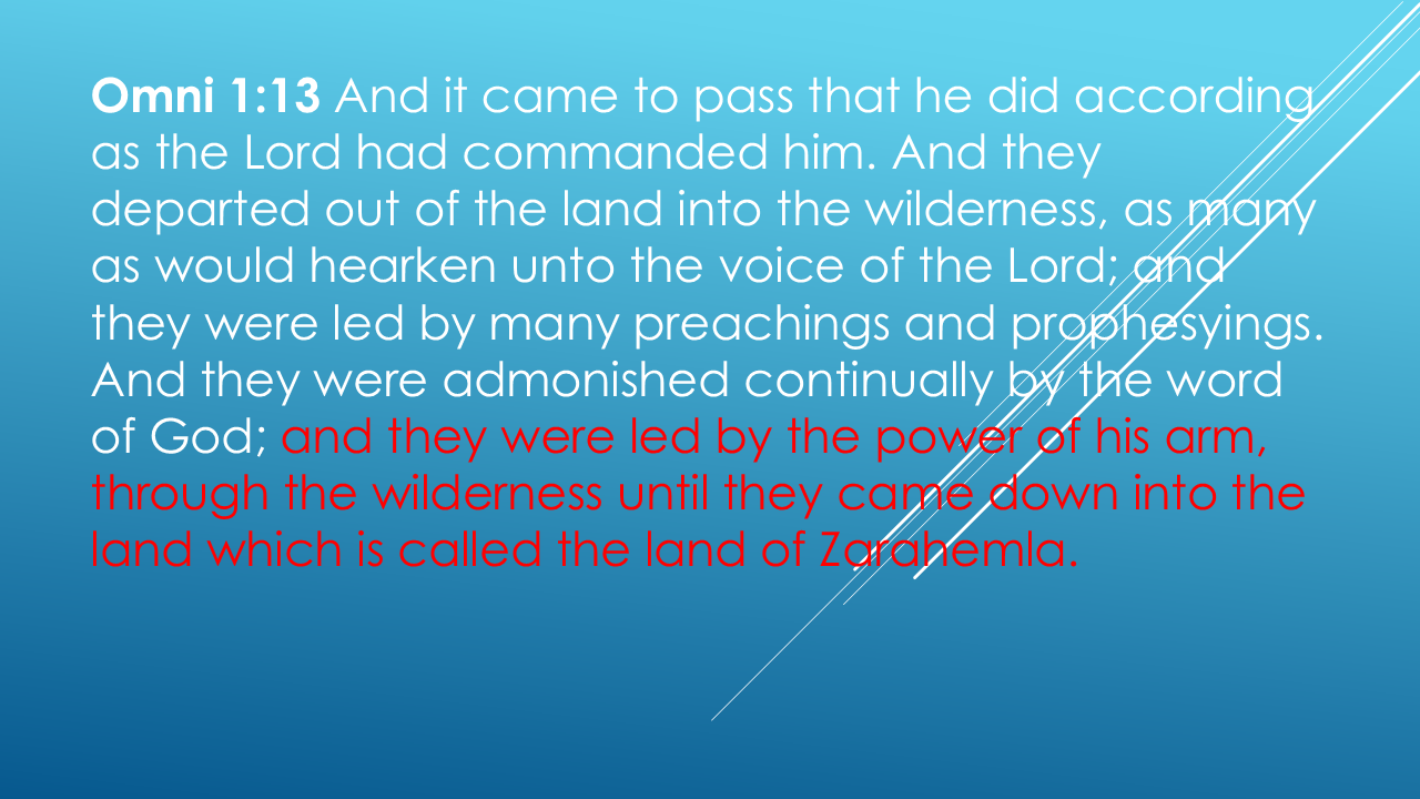
There it is.
They came DOWN into Zarahemla.
Now, here's something important.
When Mormon uses the words up and down, we should not automatically assume he means north and south.
The surrounding geography gives us another possibility:
elevation.
If the Land of Nephi occupies the higher mountainous country, and Zarahemla lies in the lower country to the north, then Mosiah's journey makes perfect geographical sense.
He traveled down from the higher country into the lower land of Zarahemla.
So, our first clue is:
NEPHI → DOWN → ZARAHEMLA
Keep that in mind.
Because the next journey reverses the direction.
CLUE #5 — ZENIFF GOES BACK UP
About 25 years later, another man named Zeniff decided to return to the Land of Nephi.
Zeniff wasn't a king yet.
He was a Nephite living in Zarahemla who became determined to reclaim the land of his ancestors.
And Mormon tells us exactly how he got there.
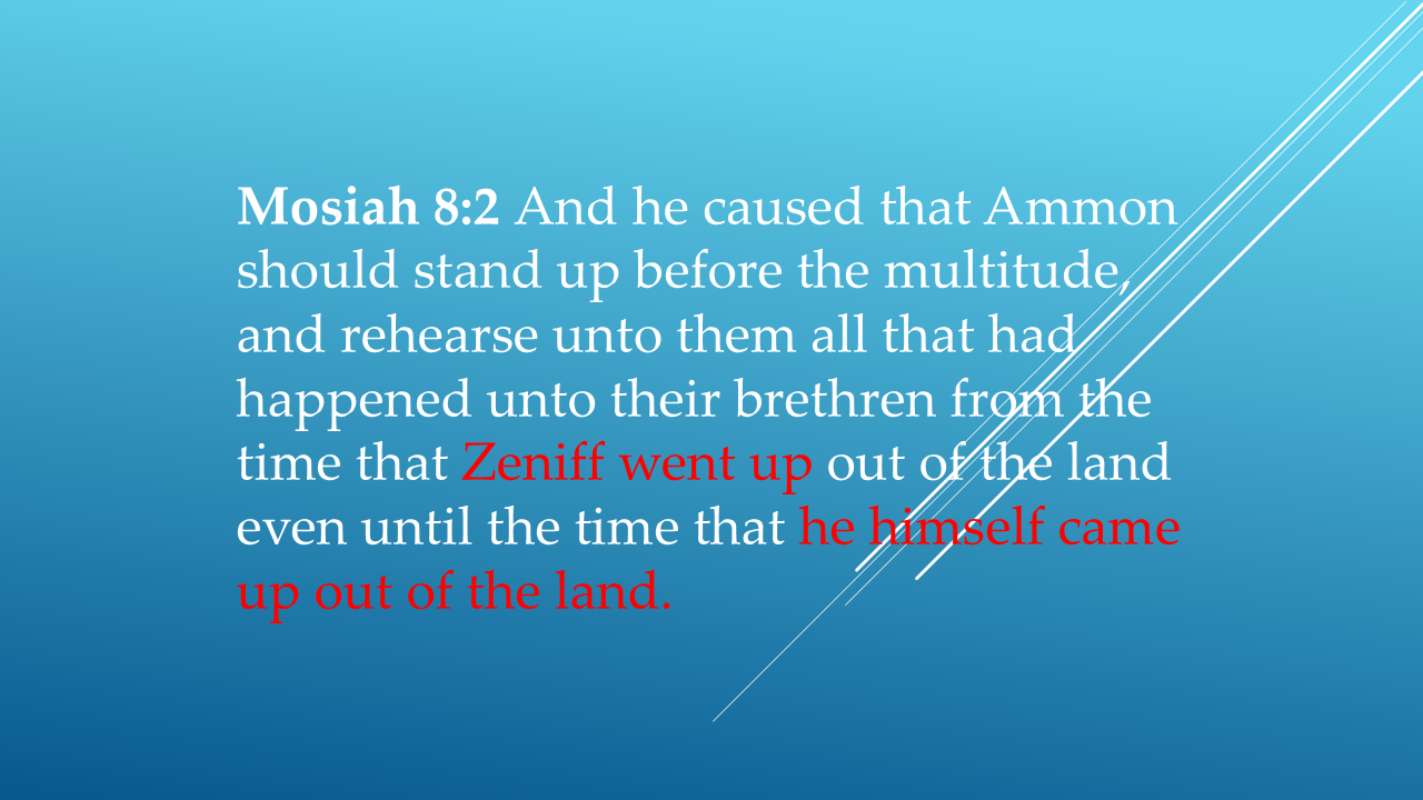
Wait a minute.
Mosiah went DOWN from Nephi to Zarahemla.
Now Zeniff goes UP from Zarahemla to Nephi.
That's exactly what we would expect if these lands occupied different elevations.
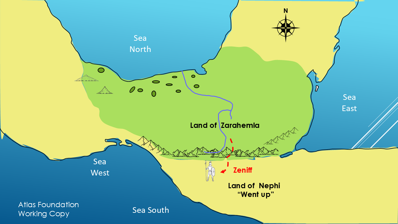
But Mormon gives us even more evidence.
Zeniff explains why he made the journey.
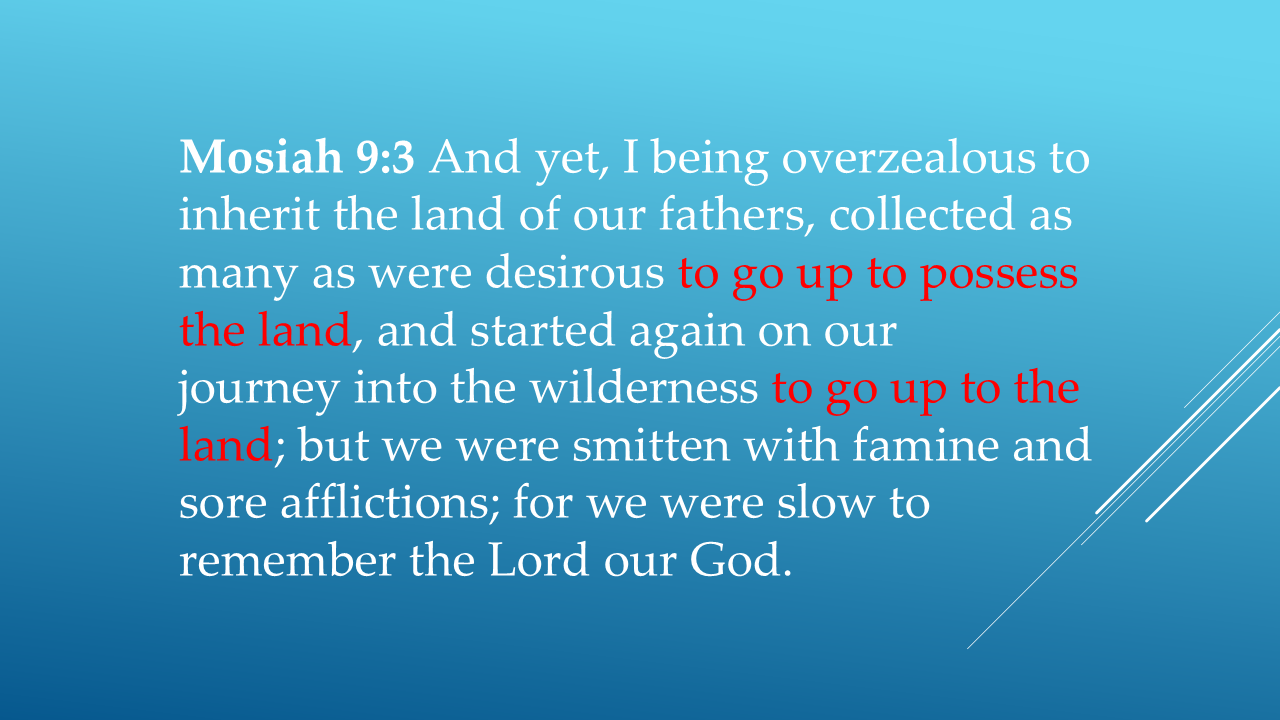
There it is again.
GO UP TO THE LAND.
And then Zeniff tells us what happened.
They were struck by famine and severe afflictions because they were slow to remember the Lord.
But eventually, they reached the Land of Nephi.
And notice how consistently the Book of Mormon describes this journey.
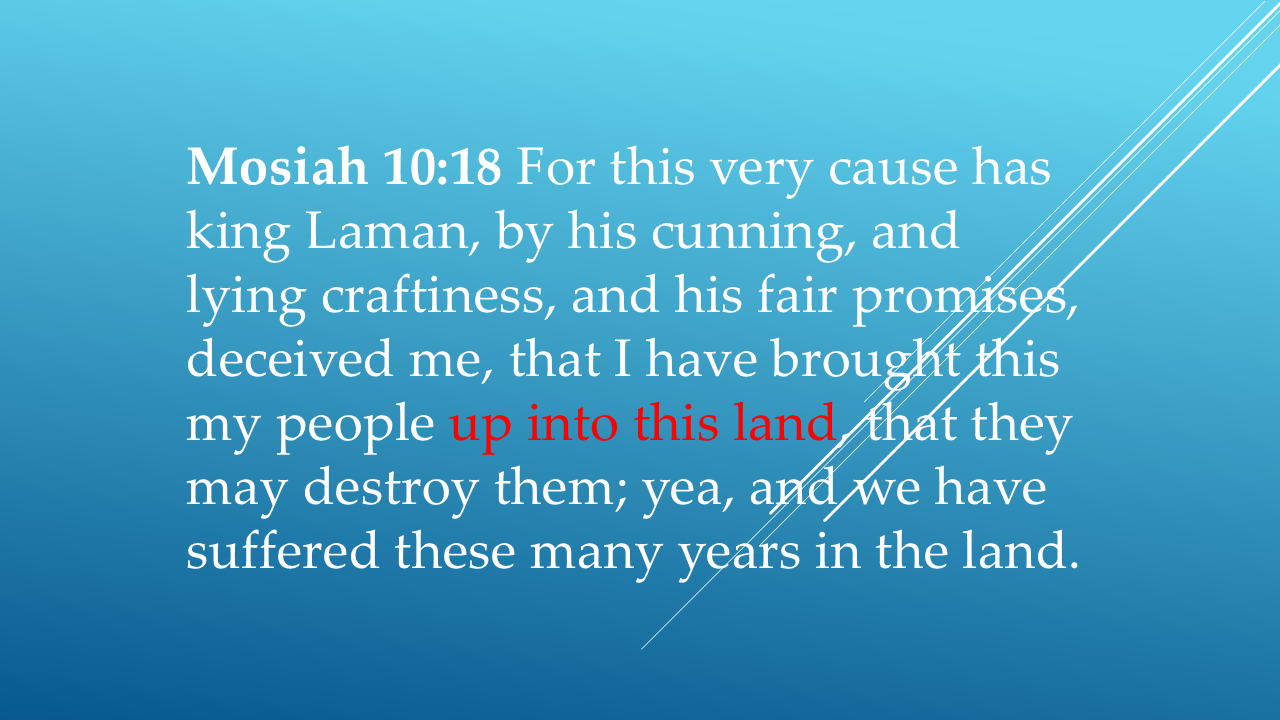
Three separate statements.
Went up.
Go up to possess the land.
Brought this people up into this land.
That's not just a single throwaway phrase.
It's a pattern.
CLUE #3 — LIMHI CONFIRMS THE SAME JOURNEY
Now let's jump ahead.
Zeniff eventually became king.
His son Noah became king.
And Noah's son was Limhi.
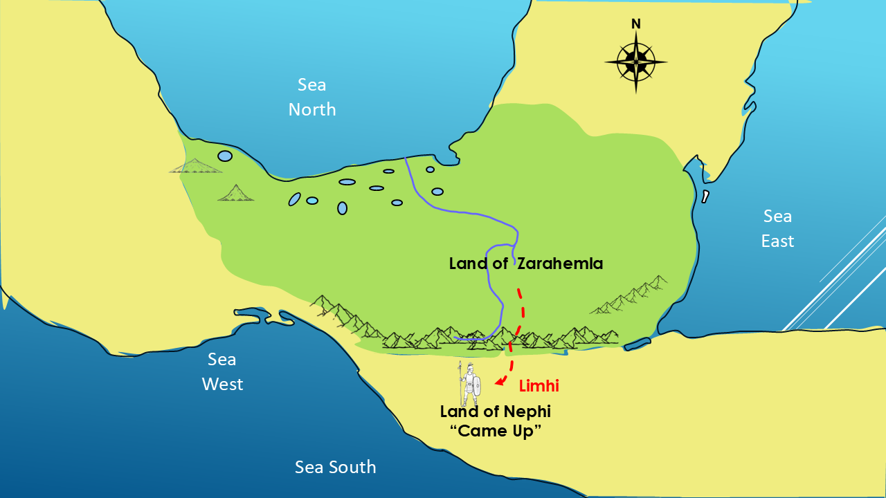
Many years later, Limhi describes his family's migration.
Once again:
UP.
Zeniff came up out of Zarahemla to the Land of Nephi.
So now we have a pattern established by multiple passages:
THE PATTERN
Mosiah I
Nephi → DOWN → Zarahemla
Zeniff
Zarahemla → UP → Nephi
And now comes the third journey.
And this one is particularly interesting.
Because this time, we're going to follow a man who desperately wanted to get out of the Land of Nephi.
CLUE #4 — LIMHI ESCAPES
By the time Limhi became king, his people were in bondage to the Lamanites.
Limhi and his people wanted to escape.
Eventually, they succeeded.
And where did they go?
Back toward Zarahemla.
This is approximately 121 BC—about 79 years after Zeniff made his original journey.
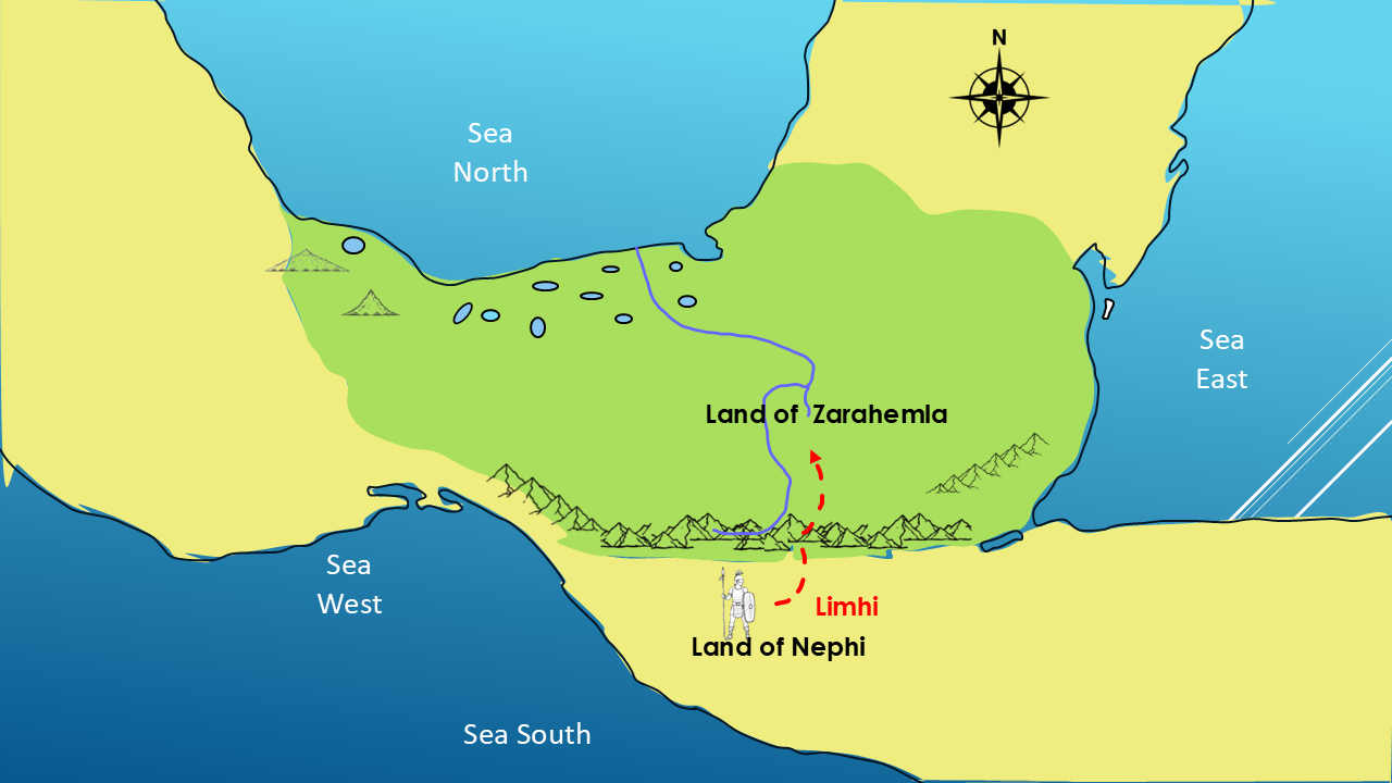
Notice what is happening.
Mosiah traveled down.
Zeniff traveled up.
Limhi traveled down again.
The same two major lands.
The same basic direction.
And the same elevation pattern.
THE THREE JOURNEYS
225 BC — Mosiah I
DOWN: Nephi → Zarahemla
~200 BC — Zeniff
UP: Zarahemla → Nephi
121 BC — Limhi
DOWN: Nephi → Zarahemla
[PAUSE]
That's the investigation.
And now we need to ask:
Does the geography we've constructed explain these movements?
A FOURTH CLUE: DOES MORMON USE “UP” AND “DOWN” THIS WAY ELSEWHERE? [
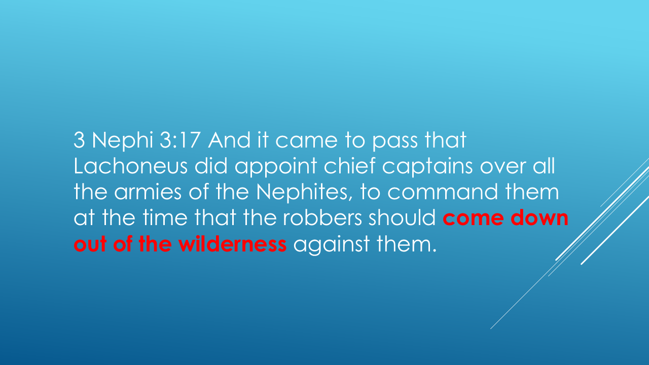
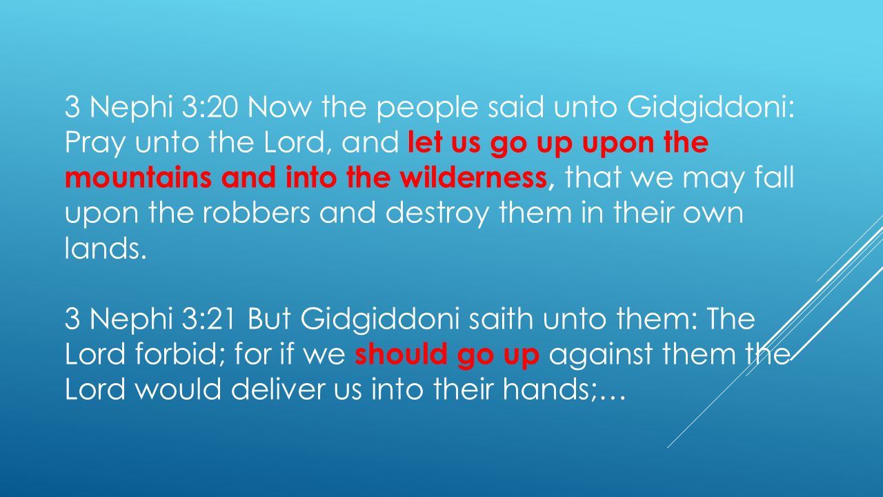
Now, this isn't one of the journeys we've been investigating. It's a different story, occurring hundreds of years later. But notice the language. People come DOWN out of the wilderness. Others want to go UP into the mountains and wilderness.
Once you begin looking for it, you realize Mormon consistently uses elevation language when describing movement through this geography.”
ANOTHER IMPORTANT CLUE — THE RIVER SIDON
There's another geographical clue that helps us orient the map.
Remember the River Sidon?
The Book of Mormon repeatedly describes the River Sidon as flowing down through the land of Zarahemla and toward the sea.
That makes sense when we're looking at an actual river.
Gravity pulls water downhill.
So, when Mormon says the River Sidon went down, we're dealing with actual elevation.
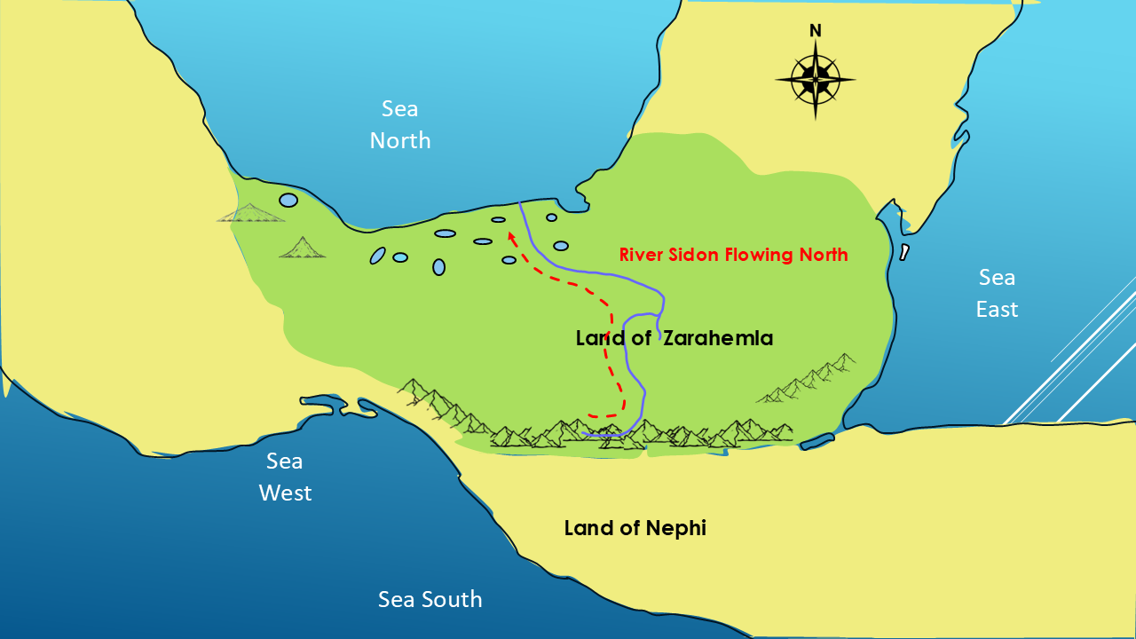
This gives us another reason to take Mormon's directional language seriously.
When the Book of Mormon says someone went up or down, we should ask:
Up or down relative to what?
And in this geography, the answer appears to be:
the elevation of the land.
ONE MORE QUESTION — WHAT DID THE NARROW NECK CONNECT?
Now let's step back and look at the larger map.
We've already identified the narrow neck of land.
But here's the question:
What exactly did the narrow neck connect?
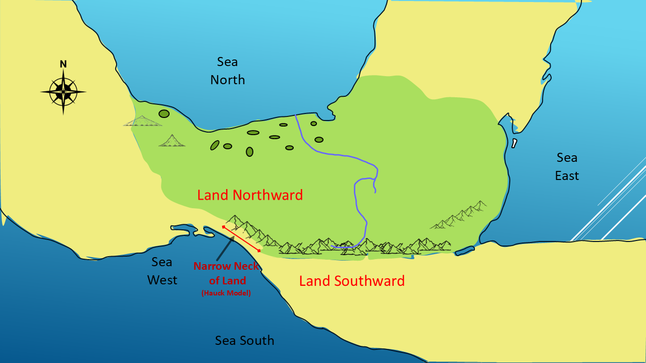
It connected the land northward with the land southward.
The narrow neck created a critical passage between these two great divisions of the Nephite world.
And Mormon tells us that this area was strategically important.
There was a major east-west transportation route through the narrow neck along the west side of the land.
And there was a border associated with this region.
So we're beginning to see something larger.
These aren't isolated geographical descriptions.
They're pieces of the same puzzle.
Lands
Rivers
Mountains
Seas
Wildernesses
Narrow passages.
And now—
Travel Routes.
Each new clue gives us another way to test the map.
THE BIG PICTURE
So what have we discovered in this investigation?
We've followed three generations of Nephite leadership.
Mosiah I left the Land of Nephi and went down into Zarahemla.
Zeniff later left Zarahemla and went up to reclaim the Land of Nephi.
And Limhi, Zeniff's grandson, eventually escaped from the Land of Nephi and traveled down toward Zarahemla.
Those journeys occurred over a period of roughly 100 years.
And every one of those journeys gives us another geographical clue.
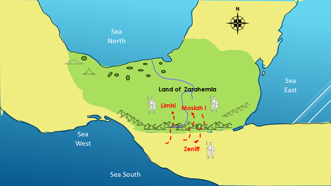
When we put them on the same map, something remarkable happens.
The directions don't fight the geography.
They fit it.
And that's exactly what we're looking for in this series.
Not one isolated verse.
Not one convenient coincidence.
But multiple geographical clues that begin to reinforce one another.
And there's something else worth noticing.
So far, every geographical direction we've examined has fit the map.
We haven't found a single description that contradicts it.
The question is: will that continue as we investigate the rest of Mormon's geographical clues?
THE PERSONAL DISCOVERY
And here's where this becomes really fun for me.
Once you start thinking geographically, you begin reading the Book of Mormon differently.
For example, I was recently reading 3 Nephi chapter 3.
And I came across these verses.
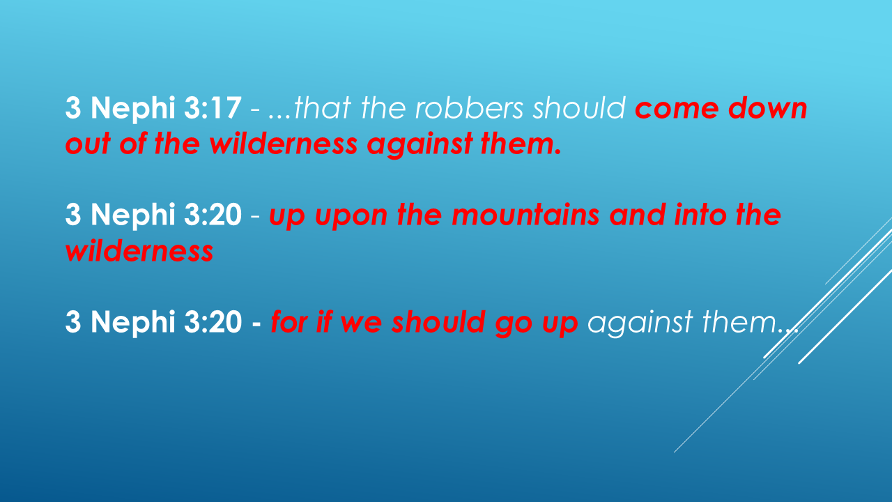
And when I read that, I thought:
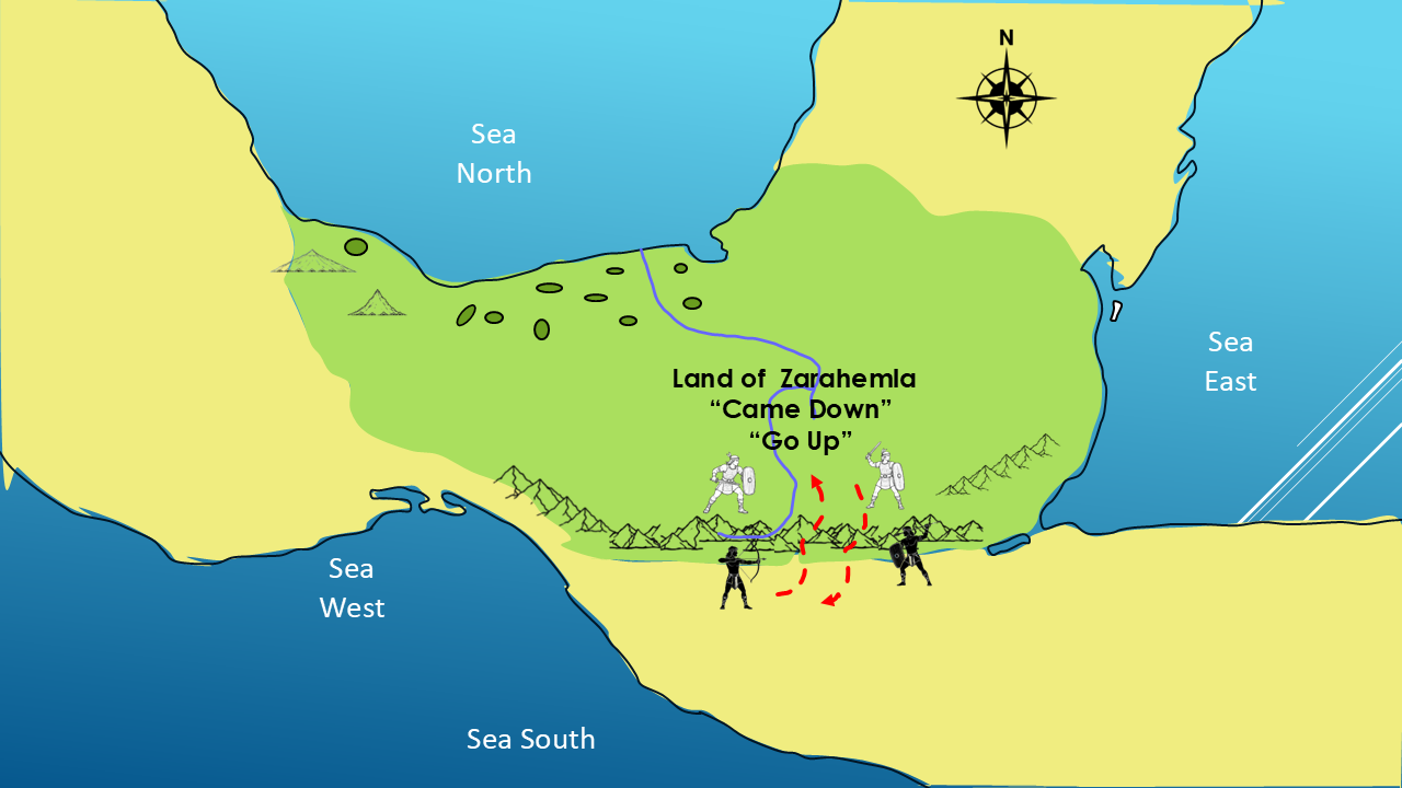
“Wait a minute. I know where that is!”
That's one of the things I love about this project.
The Book of Mormon stops being just a list of unfamiliar names.
You can begin to visualize the terrain.
You can begin to picture where people were standing.
You can begin to understand why Mormon described someone going up into the mountains or down from the wilderness.
The geography starts giving context to the story.
ENDING HOOK
And we're not finished.
Because we've now identified the major lands, seas, mountains, wildernesses, the narrow neck of land, the River Sidon—and we've followed the movements of three generations of Nephite kings.
But there's another geographical puzzle coming next.
The Book of Mormon appears to identify not one, but THREE different locations associated with the name “Bountiful.”
Are they actually three different places?
And if so—
where are they?
That's what we're going to investigate in Part 8.
CLOSING
If you're enjoying this investigation into the geography of the Book of Mormon, please hit the Like button.
And if you'd like to continue following the clues as we build the Big Picture, please Subscribe to the Mormon Mann Channel.
The more geographical clues we put together, the more interesting the Book of Mormon becomes.
Thanks for joining me.
I'm Kendall, the Mormon Mann.
And I'll see you in Part 8, where we investigate the Three Lands Bountiful.
Have a great day!