
The Big Picture of the Book of Mormon
Defining Mormon’s Directions
Part 2 of 13
How Did Mormon Define North, South, Up, and Down?
What if Mormon left us a geographical key that unlocks the entire Book of Mormon?
What if the directions he recorded nearly 2,000 years ago are so precise that they can still be traced on a modern map today?
In this video, we will examine Mormon's own descriptions of north, south, up, and down, and discover whether they point to a real place on the earth.
OPENING
Good morning, or good afternoon, or good evening.
I just hope the best for you this day!
I'm Kendall, the Mormon Mann.
Welcome to Part 2 of my thirteen-part series:
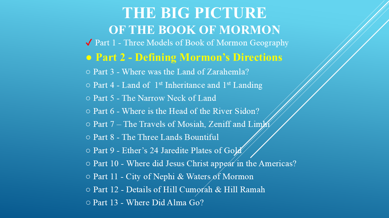
“The Big Picture of the Book of Mormon.”
In this series, we're taking the Book of Mormon's written descriptions of geographical locations and placing them onto modern maps.
But we're going to do something very important.
We aren't forcing the scriptures to fit a map.
We're letting the scriptures build the map.
Before we begin, I want to make one distinction.
The Book of Mormon is a collection of records written by several prophets, covering roughly a thousand years of history.
But much of the geographical information we will be investigating was compiled and abridged by the prophet Mormon.
Mormon was not simply telling us where events happened.
He repeatedly described the relationships between lands, mountains, wildernesses, rivers, and seas, and he used specific directional terms to describe them.
So, in this investigation, we're going to pay very close attention to Mormon's words.
And that's what we're going to investigate in Part 2: The prophet Mormon's directions.
THE THREE MODELS
In Part 1, I introduced three major geographical models that have been proposed for the Book of Mormon.
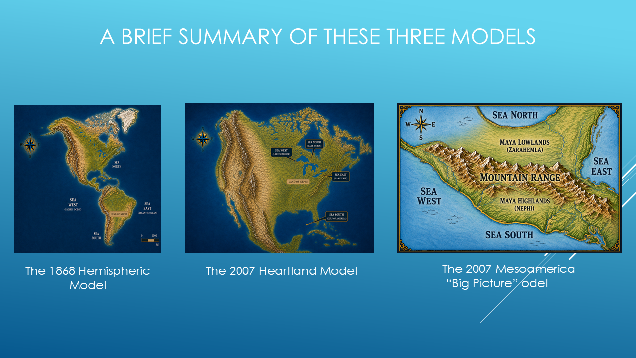
The first is the:
1868 Hemispheric Model.
The second is the:
2007 Heartland Model.
And the third is the:
2007 Mesoamerica “Big Picture” Model.
I explained the background of these models in Part 1, so if you haven't watched that video, I recommend starting there.
But now we're going to move from the proposed models to the actual evidence in the Book of Mormon.
And we're going to start with something very basic.
Which way is up?
And which way is down?
That may sound like a very simple question.
But when we're taking an ancient written history and trying to place its geography onto a modern map, it becomes extremely important.
When the prophet Mormon says someone went “up,” does that mean they went north?
And when he says they went “down,” does that mean they went south?
Or could up and down mean something completely different?
Could they be describing elevation?
Before we can begin locating the major lands and cities of the Book of Mormon, we need to answer that question.
So, let's investigate what the prophet Mormon actually tells us.
MESOAMERICA
For this investigation, we're going to be looking at the general area of Mesoamerica.
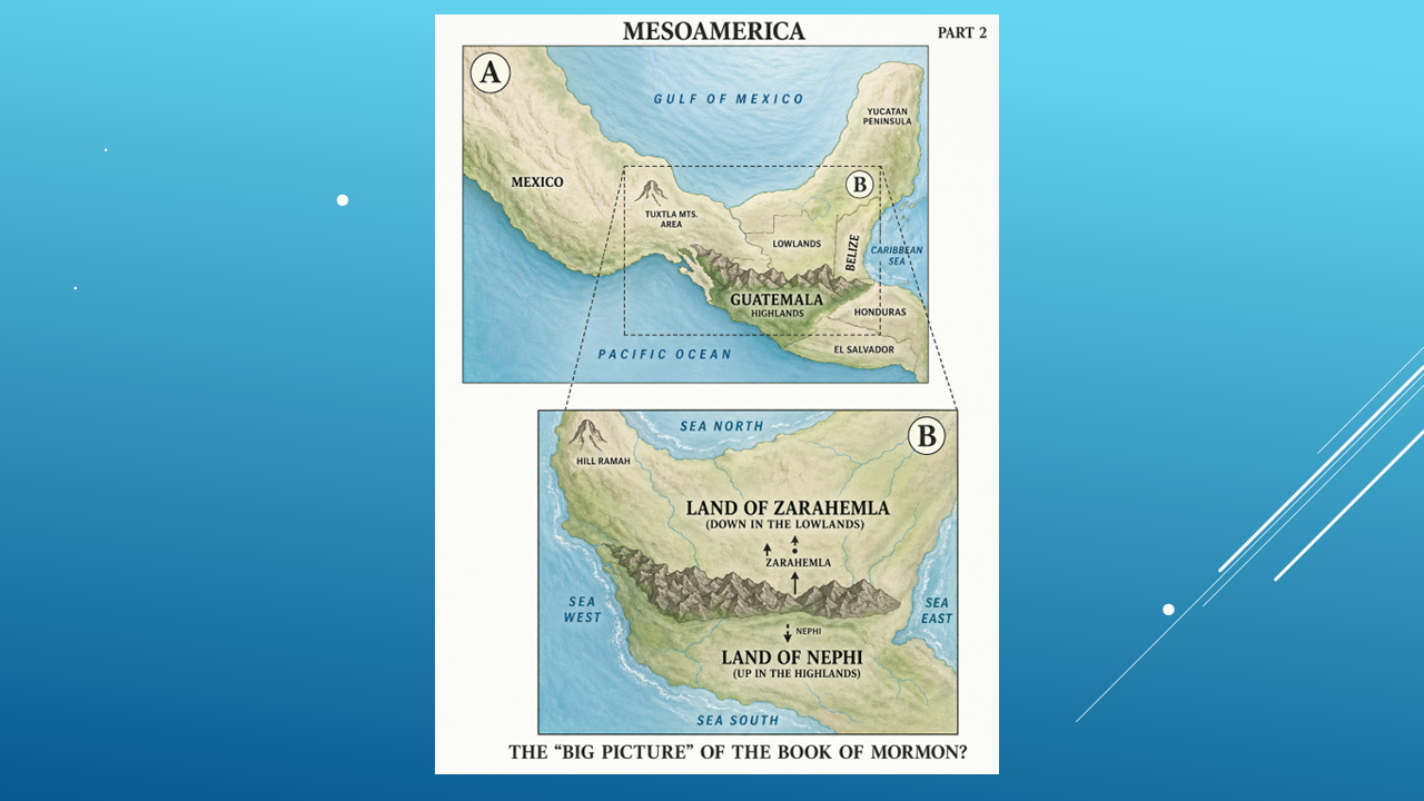
Map A shows the overall area, including southern Mexico, the Yucatán Peninsula, Guatemala, and the surrounding region.
[Brief pause.]
Map B shows the area we'll be focusing on — southern Mexico and Guatemala.
This is where we're going to begin our investigation.
OUR WORKING MAP
This is going to be our working map for this investigation.
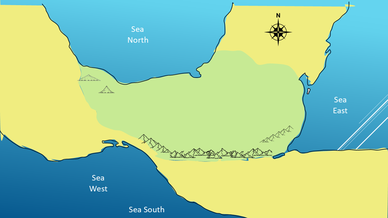
And I want you to notice something about it.
I'm not going to start by telling you:
“This is Zarahemla.”
And:
“This is the Land of Nephi.”
We're not there yet.
We're going to build this map from the prophet Mormon’s geographical descriptions.
For now, we've established our basic directional framework.
We have:
North
South
East
West
And we have the four seas described by Mormon:
Sea North
Sea South
Sea East
Sea West
And we have this significant mountain range running across the southern portion of our working map.
So, our first investigation is going to focus on those mountains.
Does the Book of Mormon describe a mountainous region between the Land of Zarahemla and the Land of Nephi?
Let's look at the evidence.
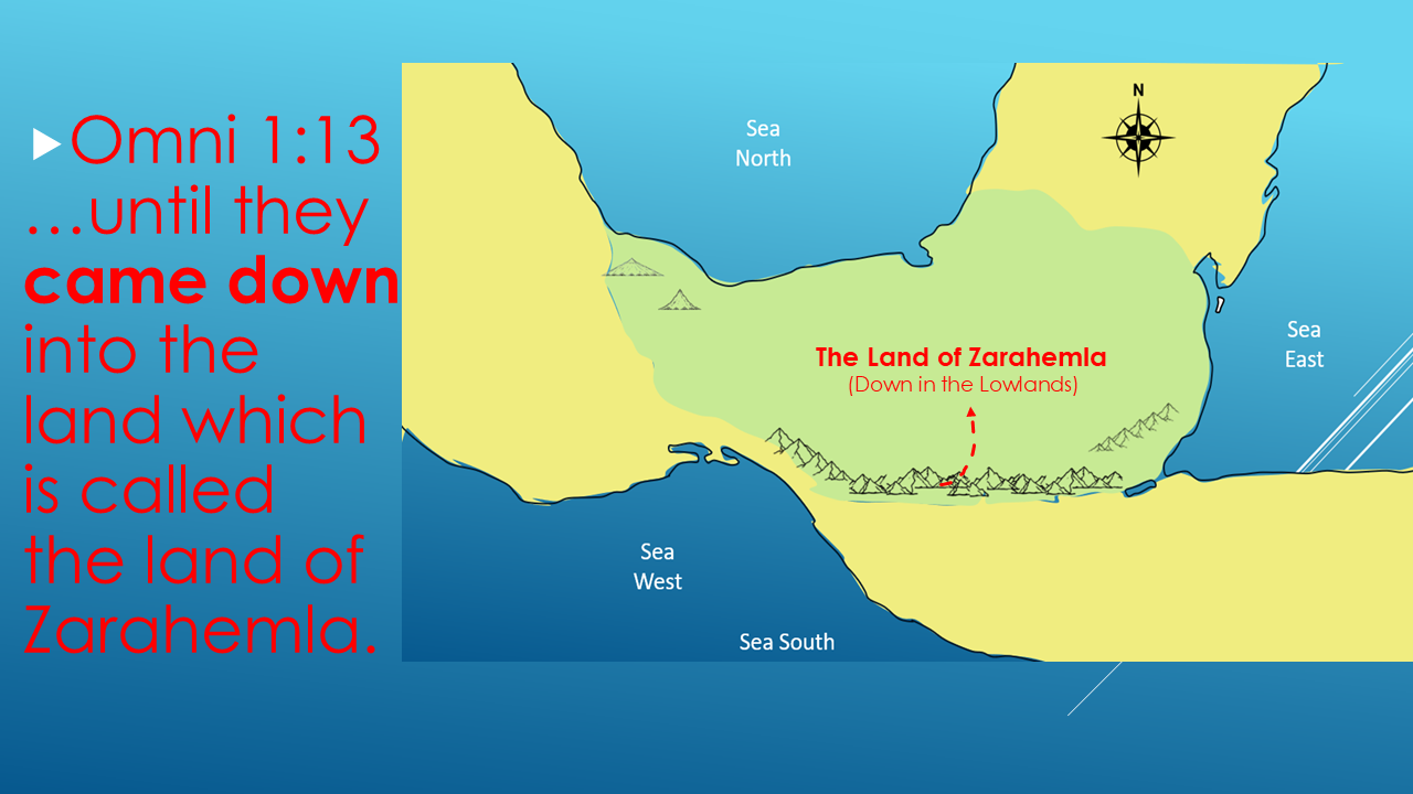
There are two words I want you to notice:
CAME DOWN
They came down into the Land of Zarahemla.
So, here's our first investigative question:
Down from where?
If they came down into Zarahemla, what was above it?
Let's keep looking.
THE LAND OF NEPHI
“Now Mormon gives us another important geographical clue.
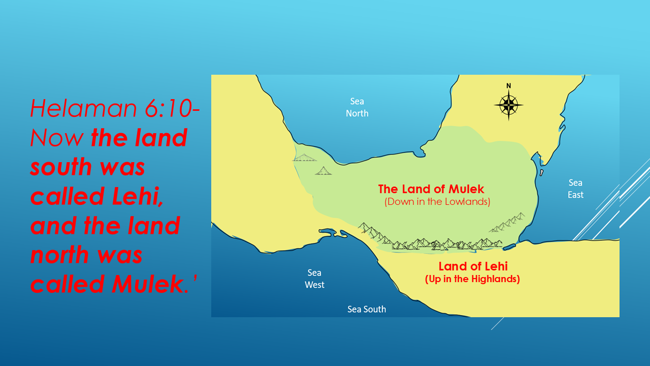
So Mormon is not simply using the words north and south as general directions. He identifies these two specific lands:
Lehi was the land south.
Mulek was the land north.
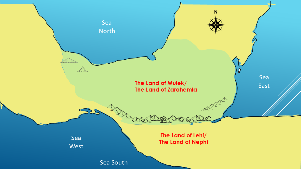
Now Mulek is associated with the Land of Zarahemla.
And Lehi was associated with the Land of Nephi.
Now we have two different kinds of geographical descriptions emerging.
Up and down appear to describe elevation.
North and south describe geographical direction.
That's an important distinction—and we're going to keep following Mormon's descriptions to see where they lead us.”
Mormon repeatedly describes travel up to the Land of Nephi and down from the Land of Nephi.
And this becomes especially interesting when we consider the physical terrain described in the record.
Mormon repeatedly refers to:
mountains
and
wilderness.
Let's look at one example.
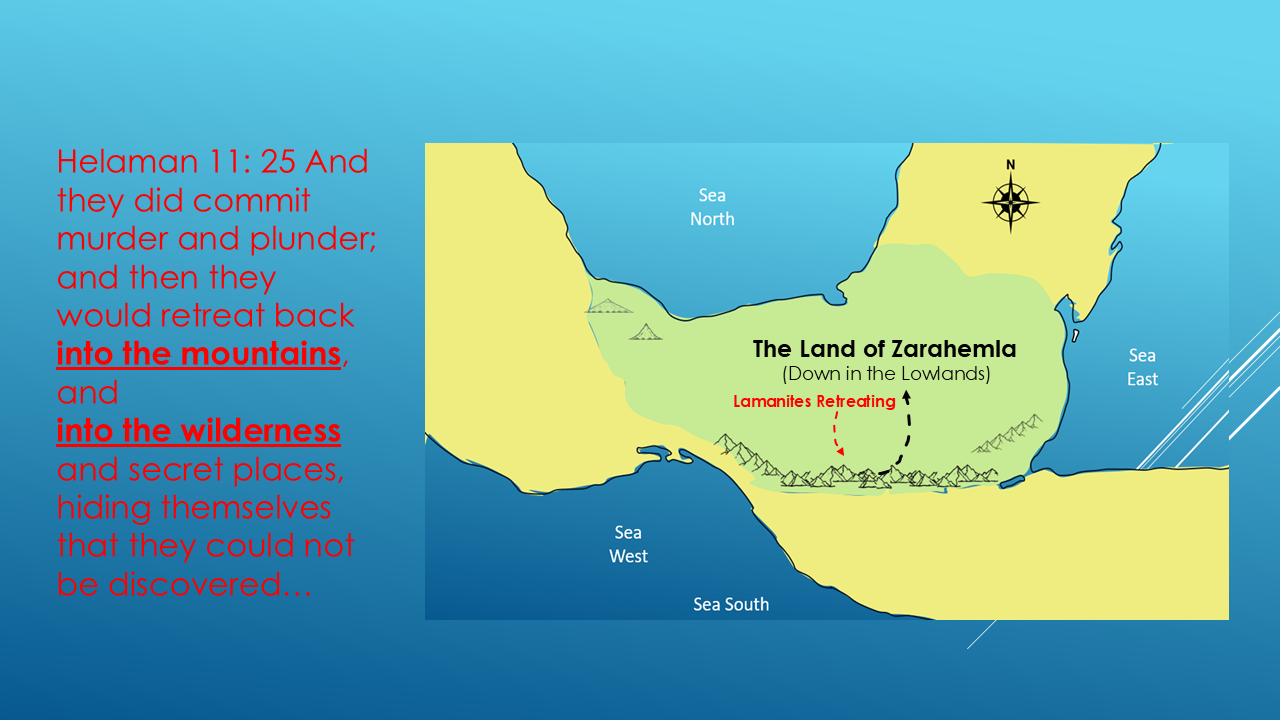
Helaman 11:25 says:
“And they did commit murder and plunder; and then they would retreat back into the mountains, and into the wilderness and secret places, hiding themselves that they could not be discovered...”
Now look at the geographical words Mormon is using.
They retreat into:
THE MOUNTAINS
and
THE WILDERNESS.
Could these mountains fit into the geographical relationships Mormon describes?
Let's continue.
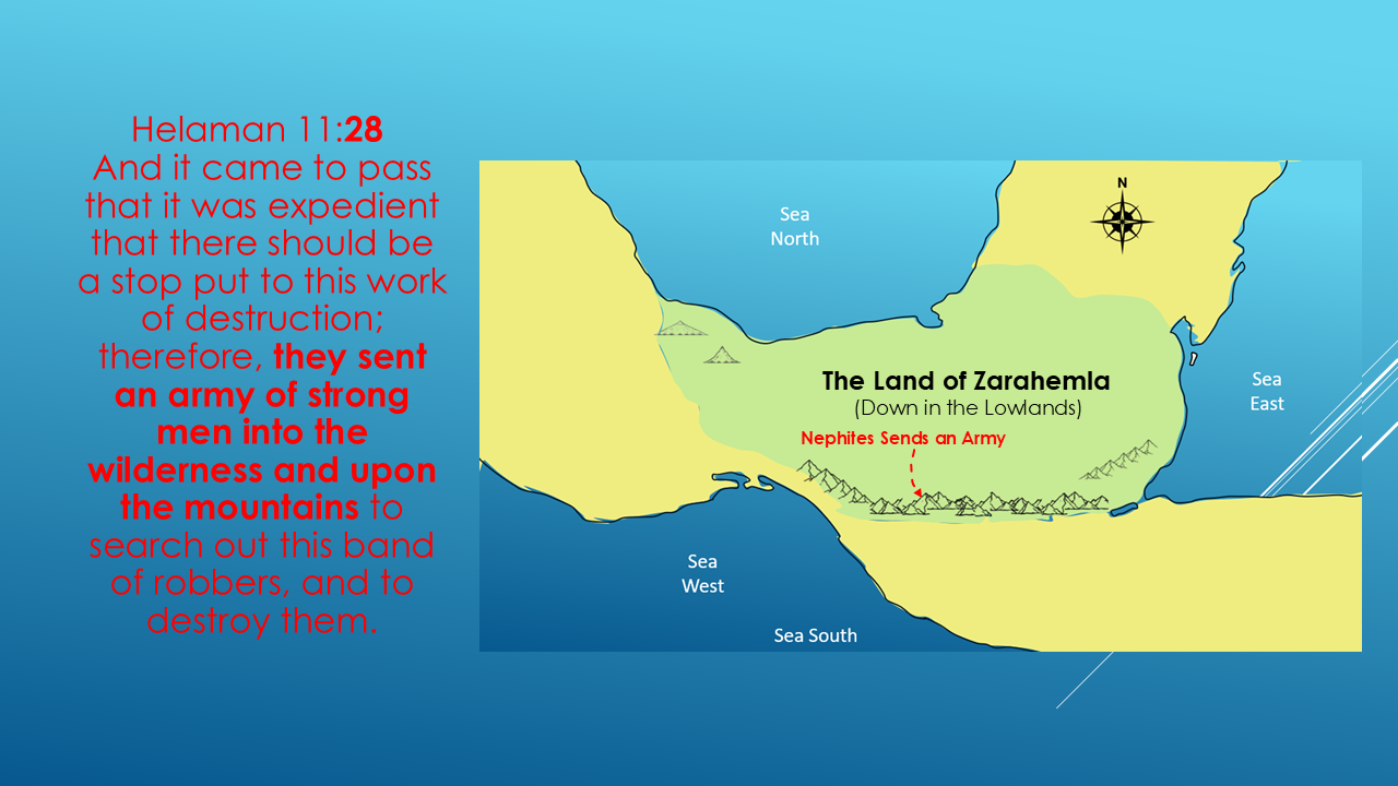
Again, Mormon connects:
the wilderness
with
the mountains.
So we're seeing the same geographical relationship repeatedly.
And then Helaman 11:31 says:
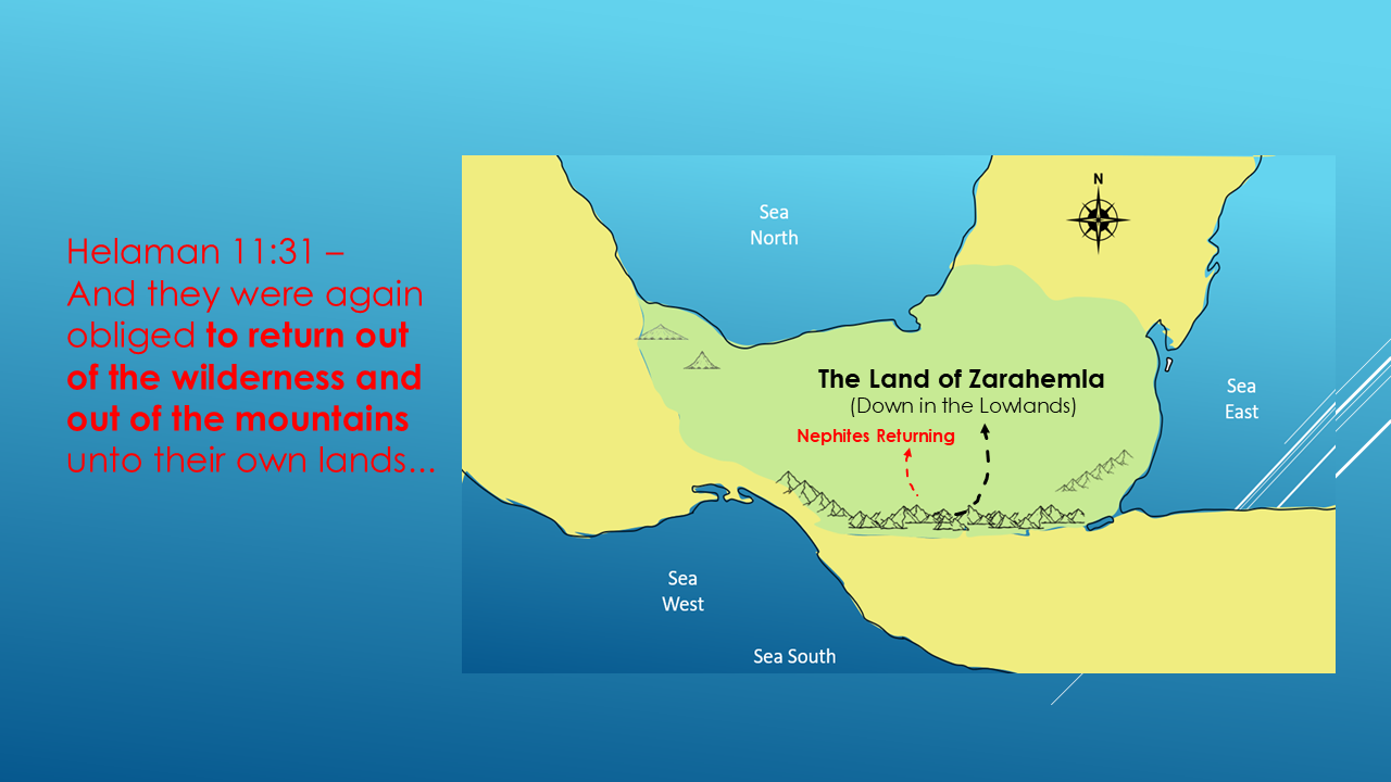
Now let's stop the investigation for a moment.
What have we actually learned?
Mormon repeatedly describes a landscape containing:
mountains
wilderness
lands
and movement between those areas.
And we also have repeated references to going down to the Land of Zarahemla.
So now let's return to our original question.
UP AND DOWN
What does “up” and “down” mean?
The evidence we're looking at suggests that Mormon's use of “up” and “down” is describing elevation, rather than simply north and south.
Think about how we still use these expressions today.
We say:
“I'm going up into the mountains.”
Or:
“I'm going down into the valley.”
We're not necessarily talking about north and south.
We're talking about elevation.
And that distinction is going to be extremely important as we build our map.
So, for our investigation, we're going to make this working distinction:
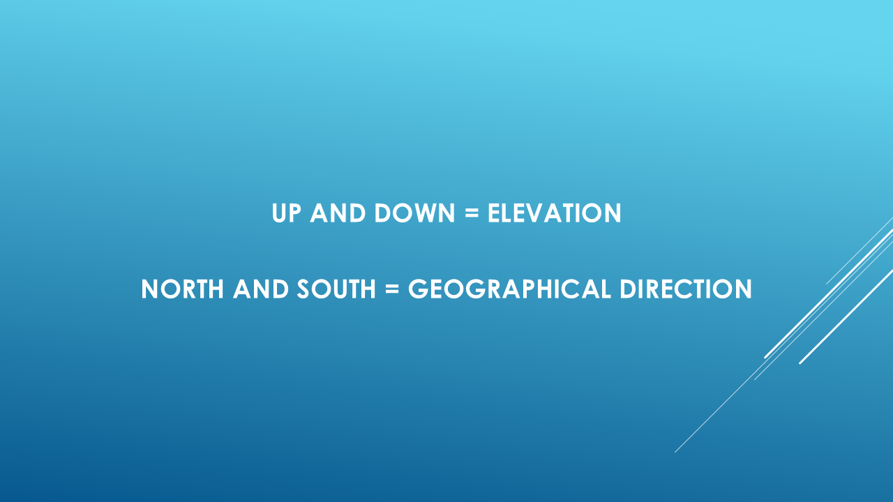
But now we have another question.
How did Mormon describe actual north and south?
HELAMAN 6:10
This is where Mormon becomes very specific. Remember
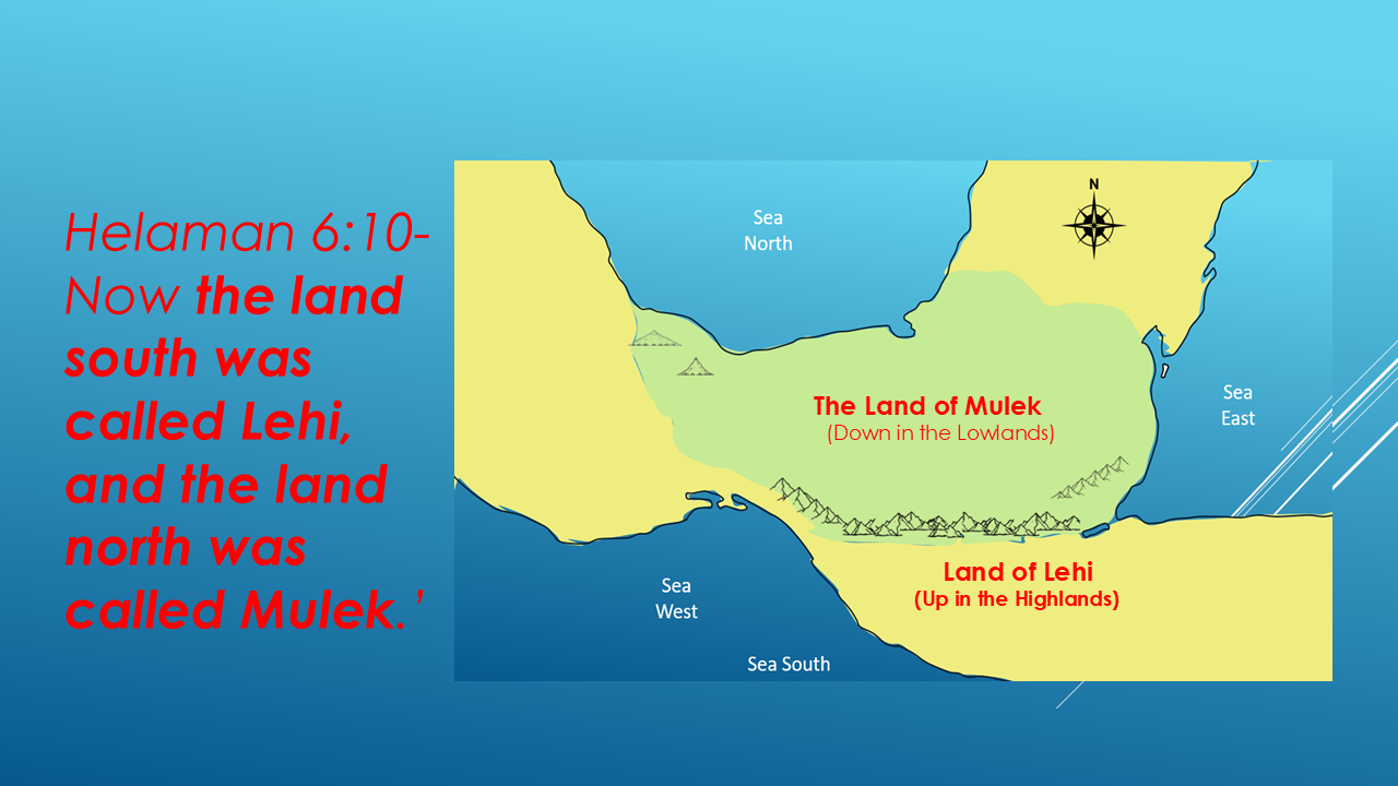
Look carefully at Mormon's wording.
He doesn't say:
the land up
and
the land down.
He specifically says:
THE LAND NORTH
and
THE LAND SOUTH.
That's important.
The Book of Mormon writers clearly used north and south as geographical directions.
And now we have something that we can test against other geographical descriptions.
THE FOUR SEAS
There is another passage that gives us an even broader directional framework.
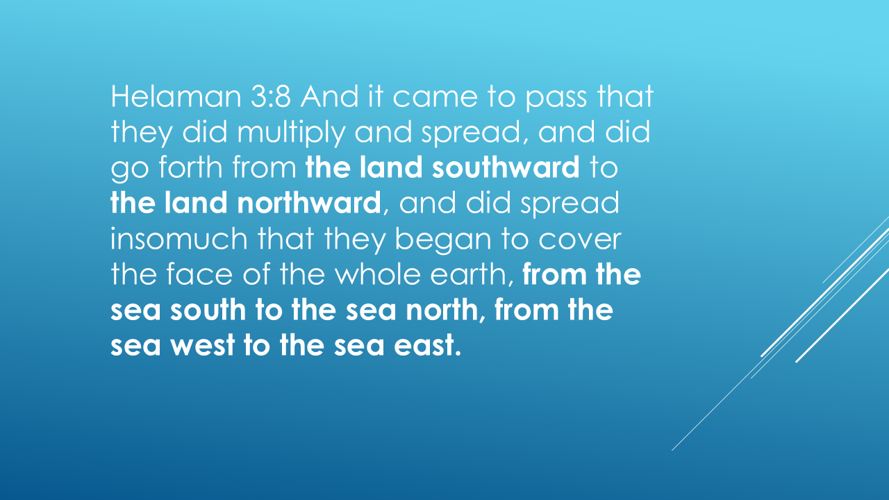
Now look at what Mormon has given us.
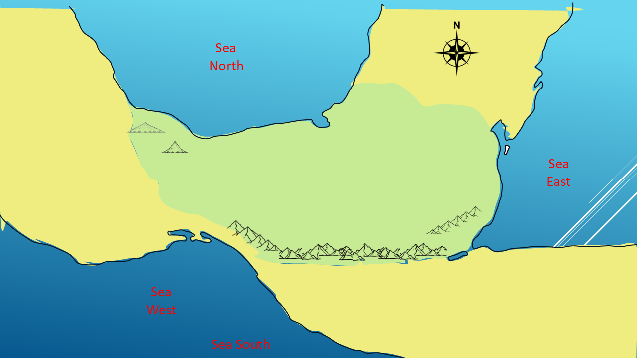
Four seas.
SEA SOUTH
SEA NORTH
SEA WEST
SEA EAST
This is a very specific directional system.
Mormon describes people spreading out:
Helaman 11:20 says the people had:
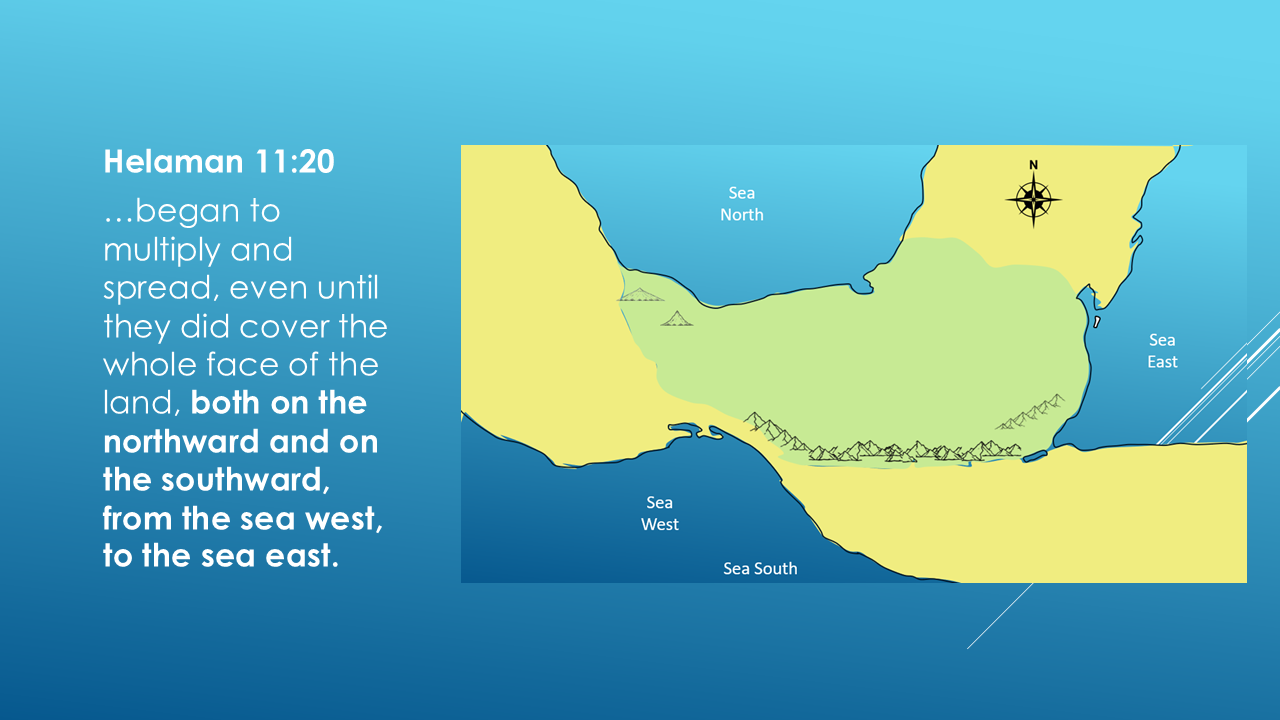
The people spread…from the land southward…to the land northward.
And the land extending:
from the sea west…to the sea east.
That gives us a geographical framework that we can actually put onto a map.
But we're still not going to jump ahead.
We're going to keep following the evidence.
WHAT HAVE WE ACTUALLY ESTABLISHED?
I want to be careful here.
We haven't proven where the Land of Zarahemla is.
And we haven't proved where the Land of Nephi is.
That's coming.
Now we have something to investigate.
THE BIG QUESTION
And that brings us to the next question.
WHERE WAS THE LAND OF ZARAHEMLA?
This is one of the most important questions in Book of Mormon geography.
Because once we begin identifying the Land of Zarahemla, we can compare its relationship to:
the Land of Nephi
the mountains
the wilderness
the seas
the rivers
and the many other geographical locations described by the prophet Mormon.
And that's when our working map begins to become the Big Picture.
We're going to build it, one geographical clue at a time.
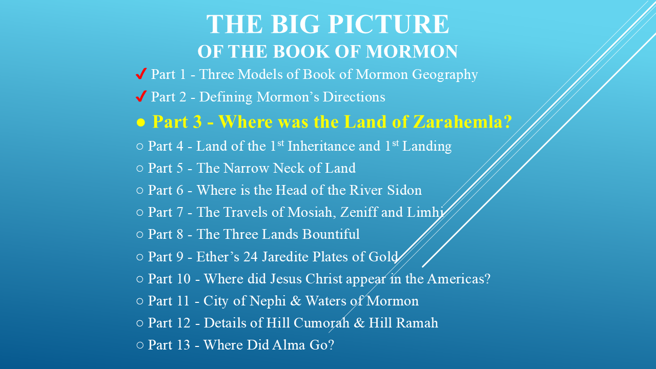
We're only at Part 2 of our thirteen-part investigation.
In the next video, we're going to investigate:
WHERE WAS THE LAND OF ZARAHEMLA?
And we're going to let Mormon's own geographical descriptions guide us.
Now, as you watch this investigation unfold, I want you to keep asking yourself a question.
Could Joseph Smith, a young man in the 1820s, with no documented experience traveling through Central America, have produced a geographical description that would fit an actual landscape?
I'm not asking you to accept my conclusion.
I'm asking you to watch the evidence accumulate.
Because as we go through these videos, the question isn't going to be:
“What does Kendall say?”
The question is:
“What does the Book of Mormon itself say?”
And then we can decide what those descriptions mean.
I'm Kendall, the Mormon Mann.
If you enjoyed this investigation, please hit the Like button.
And if you want to follow the investigation as we continue building the map, please subscribe to the channel.
I hope y'all have a great day!