
Part 6 - The Head of the River Sidon
Mormon gave us five clues to find it. Could we have found the Head of the River Sidon?
Hi, welcome back to the Mormon Mann Channel. I'm Kendall, the Mormon Mann.
In the first five videos of this series, we've been putting together pieces of Mormon's geographical puzzle.
We've identified lands, seas, directions, wildernesses, mountains and the narrow neck of land.
But now we're going to follow a clue that may be one of the most specific geographical clues Mormon ever gave us.
It's only three words:
“The head of the River Sidon.”
Where was it?
And more importantly...
What would we expect to find if we actually found it?
Mormon mentions the head of the River Sidon five different times.
That's unusual.
Most rivers don't begin at a single, obvious point. They begin with headwaters—little streams and springs that eventually join together.
So why does Mormon repeatedly identify the head of the River Sidon?
Could this be a geographical landmark that still exists today?
And if it does...
Can we find it?
But before we begin looking for it, I want to ask an even bigger question.
How did Joseph Smith know about it?
Think about what Joseph Smith was doing in 1829.
He wasn't simply telling a story.
He was dictating a book containing a surprisingly detailed geography.
Lands.
Seas.
Directions.
Wildernesses.
Mountain ranges.
Rivers.
Cities.
And geographical relationships between all of them.
And now we have something even more specific:
the head of a particular river.
Mormon didn't simply tell us that the River Sidon existed.
He repeatedly referred to its head.
He placed that head in relationship to Manti, the narrow strip of wilderness, the Land of Zarahemla, and the surrounding seas.
So ask yourself:
If Joseph Smith was creating this geography himself, where did all of these geographical details come from?
That's a fascinating question.
But I'm not going to try to answer it for you.
Instead, we're going to do something much more interesting.
We're going to investigate the clues.
We're going to see what Mormon actually said.
We're going to compare his descriptions with real geography.
And then you can decide for yourself how well those descriptions fit the world around us.
That's what we're going to investigate in this sixth video of The Big Picture of the Book of Mormon.
THE INVESTIGATION BEGINS
Okay, moving right along.
In this sixth video, we're going to investigate where the “head of the River Sidon” could be located.
The River Sidon is one of the most important rivers mentioned in the Book of Mormon.
Mormon tells us that its head was associated with the mountain range—or narrow strip of wilderness—that divided the Land of Zarahemla from the Land of Nephi.
The river then ran down into the Land of Zarahemla and continued northward toward the Sea North.
And Mormon gives us another remarkable detail.
The Nephites threw the bodies of slain Lamanites into the River Sidon.
The river carried those bodies downstream.
So, the question isn't simply:
“Can we find a river somewhere in Central America?”
The question is:
Can we find a river that fits ALL of Mormon's descriptions?
Let's start with the beginning.
WHERE DID THE RIVER SIDON BEGIN?
Where did the River Sidon start?
Mormon tells us that its head was up in the mountains.
It ran by the city of Manti and then went “down” into the Land of Zarahemla.
And remember from Part 2:
When the Book of Mormon says “up” and “down,” those words can describe elevation—not necessarily north and south.
So let's look carefully at Mormon's description. (Slide #4)
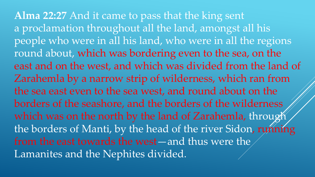
Look at how much geographical information Mormon gives us in just this one passage.
The narrow strip of wilderness ran: from the Sea East...
· through the borders of Manti...
· by the head of the River Sidon...
· and onward toward the Sea West.
And this boundary divided the Lamanites from the Nephites.
That gives us a remarkable set of clues.
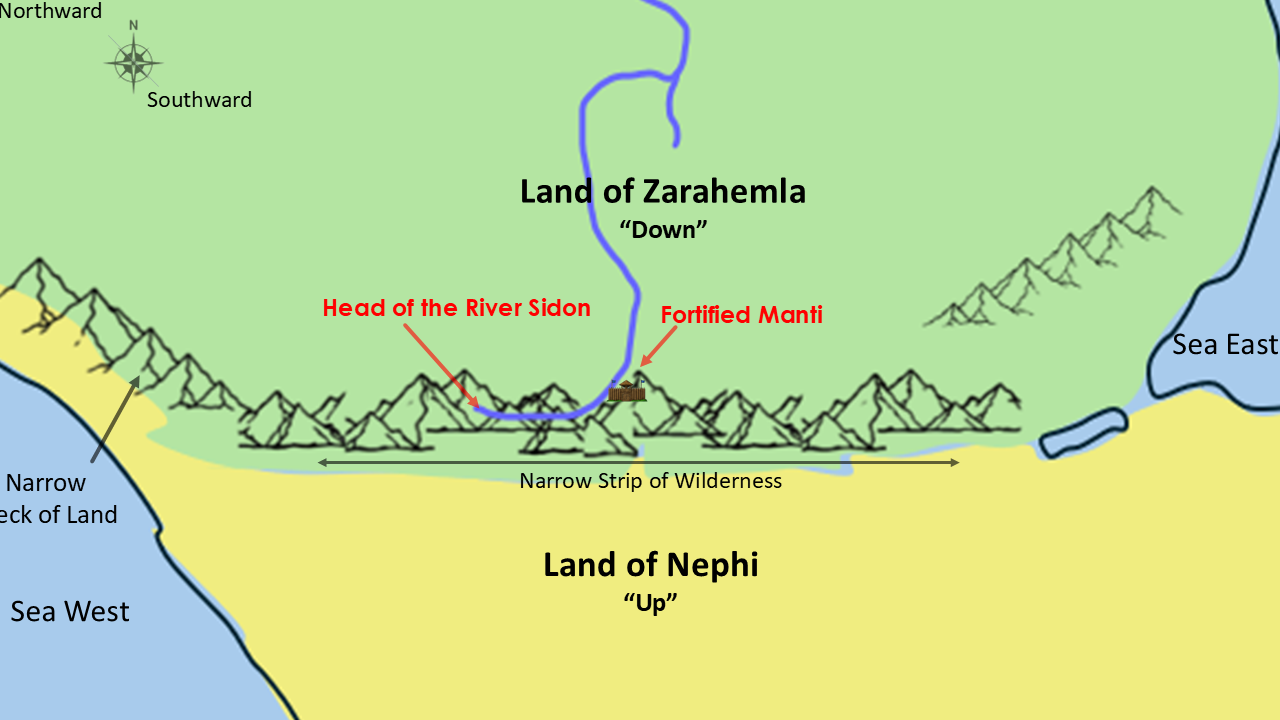
Sea East.
Sea West.
Narrow strip of wilderness.
Manti.
Head of the River Sidon.
And the River Sidon running from the east toward the west.
This isn't just a general description.
Mormon is giving us relationships between physical features.
And those relationships are what we can investigate.
ANOTHER CLUE: THE RIVER SIDON
Here's another passage talking about the River Sidon.
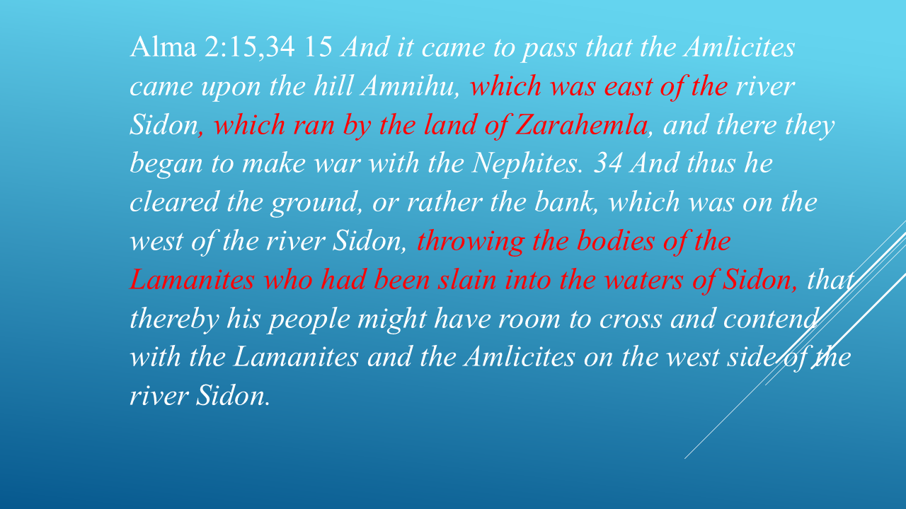
Now notice what Mormon tells us.
The hill Amnihu was east of the River Sidon.
The River Sidon ran by the Land of Zarahemla.
And there was a west bank of the river.
The Nephites actually cleared that bank and threw the bodies of the slain Lamanites into the waters of Sidon.
Why does that matter?
Because now we're not just looking for a river.
We're looking for a river that fits a particular geographical setting.
It has to run by the Land of Zarahemla.
It has an identifiable east and west side.
And its waters carry downstream toward the sea.
Mormon gives us another clue.
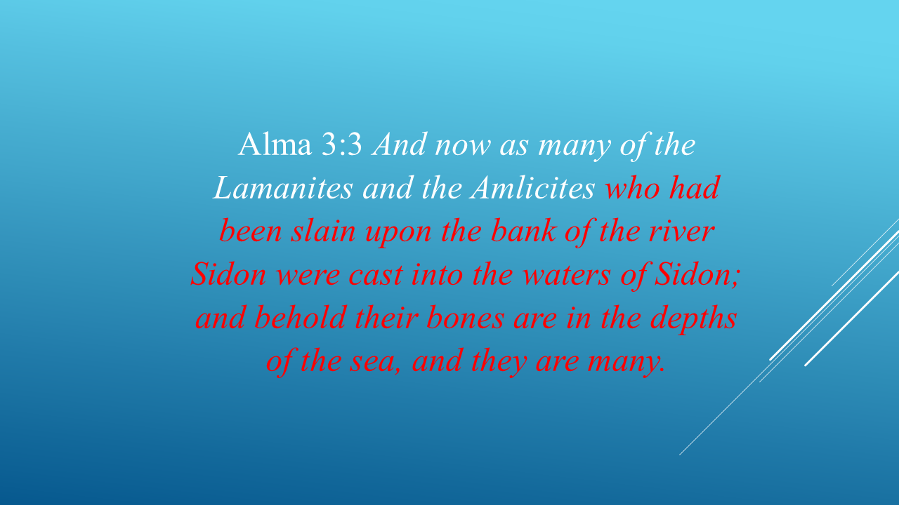
The bodies were cast into the waters of Sidon...
and Mormon says their bones were eventually in the depths of the sea.
So, the River Sidon had to be substantial enough and connected to the sea in a way that fits this description.
WHAT DOES “HEAD” MEAN?
Now we get to what I believe is one of the most interesting clues in this entire investigation.
Let's talk about how rivers begin.
Virtually all rivers that begin high in the mountains don't begin at one single point.
They have headwaters.
Tiny streams seep out of the mountains.
Those streams join other streams.
The streams become larger streams.
Eventually they become a river.
By the time they reach the sea, they may be enormous.
But occasionally, a river can begin at a very specific, identifiable source.
A head.
And Mormon repeatedly uses that expression:
“the head of the River Sidon.”
He doesn't simply say “the headwaters.”
He says “the head.”
And Mormon uses that phrase five times.
That makes me ask a very simple question:
Could the River Sidon have had a specific, identifiable source?
If so, that gives us something we can actually look for on a modern map.
There are FIVE REFERENCES TO THE HEAD
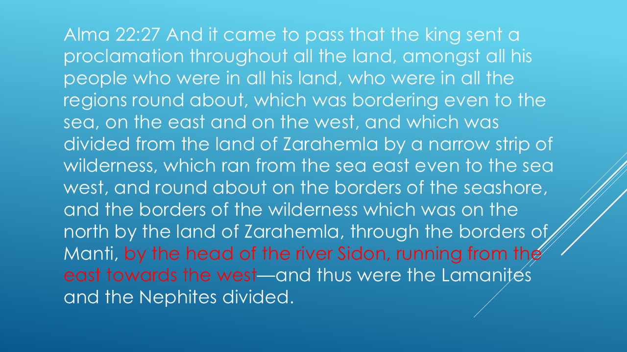
Mormon tells us that the narrow strip of wilderness ran from the Sea East, through Manti, by the head of the River Sidon, and onward to the Sea West.
Then Mormon gives us four more references.
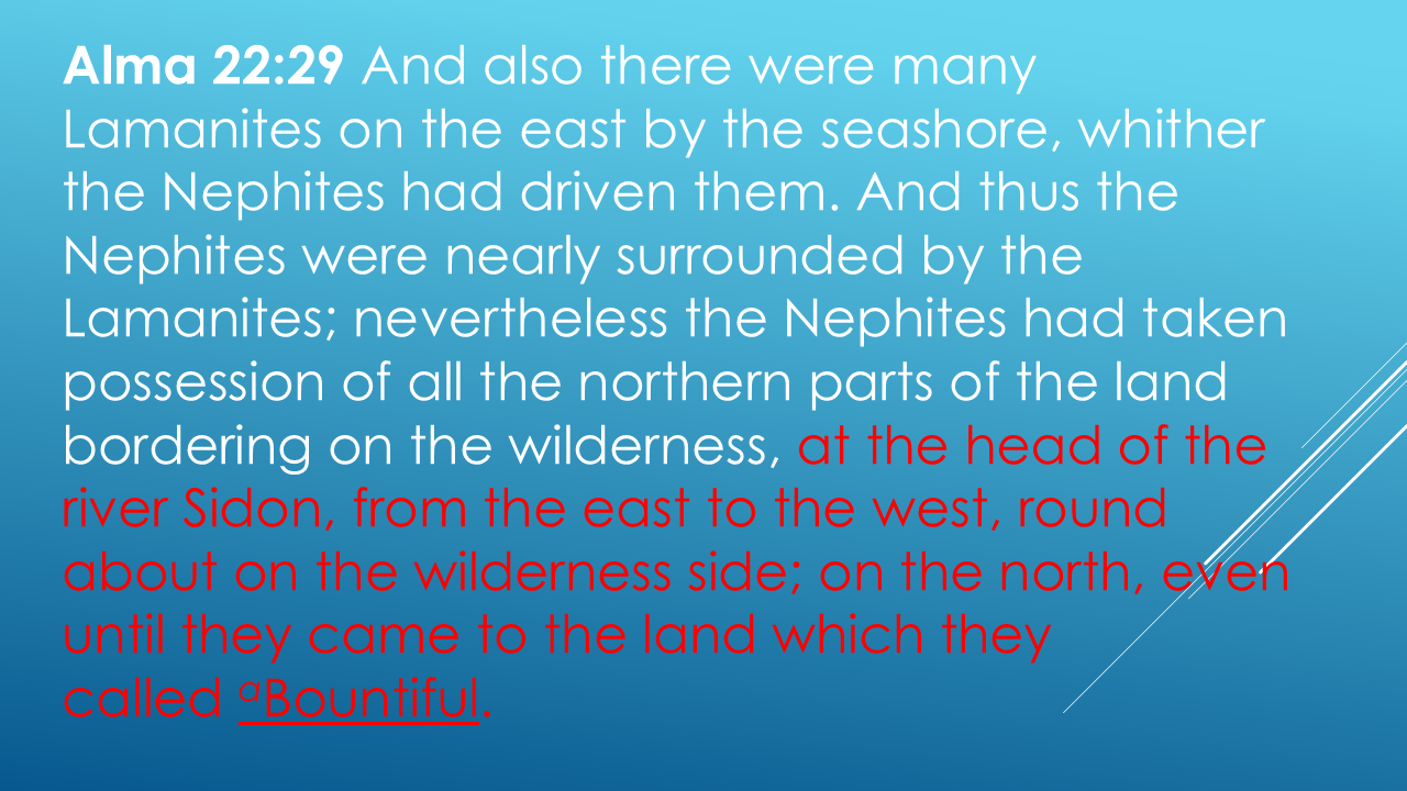
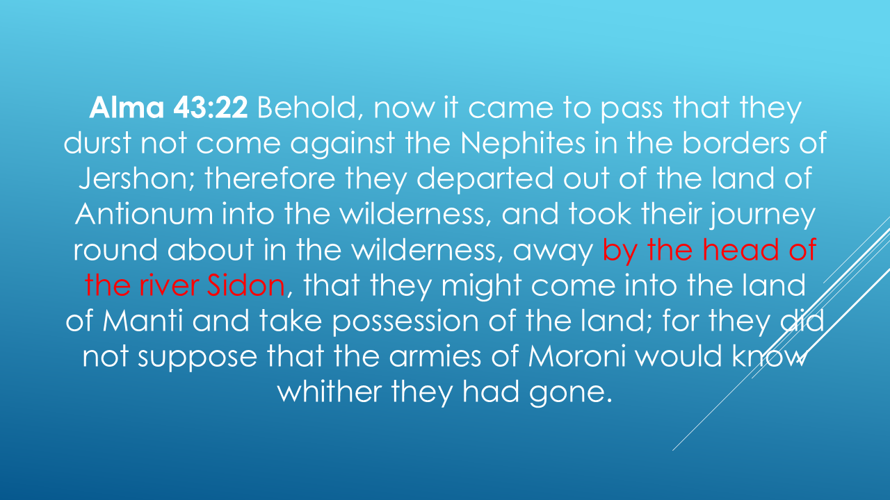
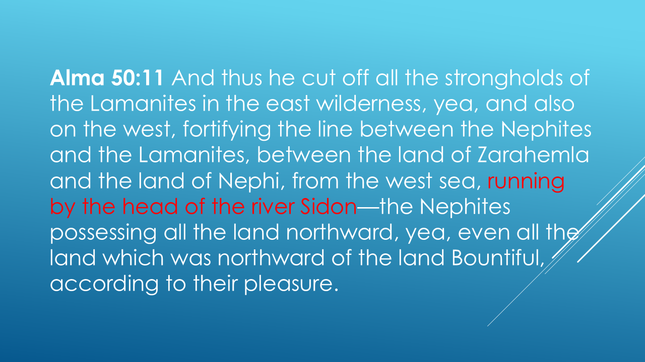
Notice what keeps appearing.
The head of the River Sidon.
That's four references.
And there's another remarkable clue. Mormon later tells us that the Lamanites did not dare to “cross the head of the River Sidon. (Slide #12)
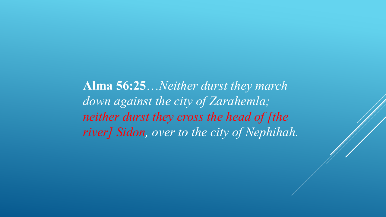
So, the head of Sidon wasn't merely the beginning of a river. It was a recognizable geographic feature that armies could cross.
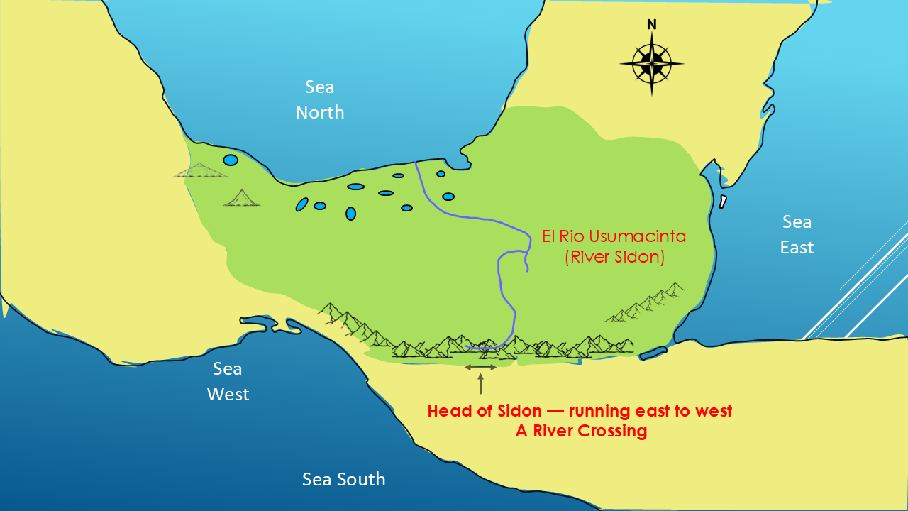
So, we're not simply looking for the place where a river begins. We're looking for a recognizable geographical feature that Mormon repeatedly used as a landmark.
Five opportunities to learn something about this location.
That makes the “head” an important geographical landmark.
And if we're going to identify a modern candidate for the River Sidon, I believe we should ask:
Does that candidate have a head?
TWO CANDIDATES
For roughly the last sixty years, two rivers have stood out as leading candidates for the River Sidon.
In the 1950s, Dr. M. Wells Jakeman of BYU proposed that the Usumacinta River was an excellent candidate.
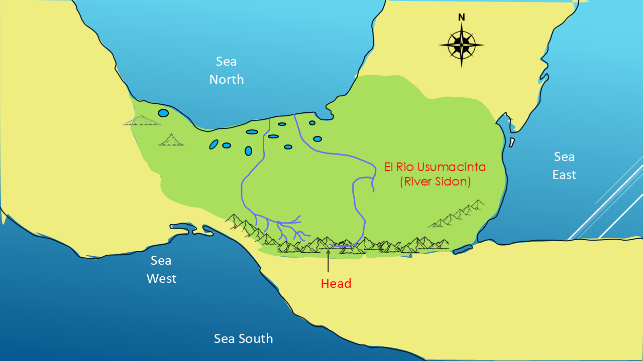
Later, one of his former students, Dr. John L. Sorenson, believed the Grijalva River was a better choice.
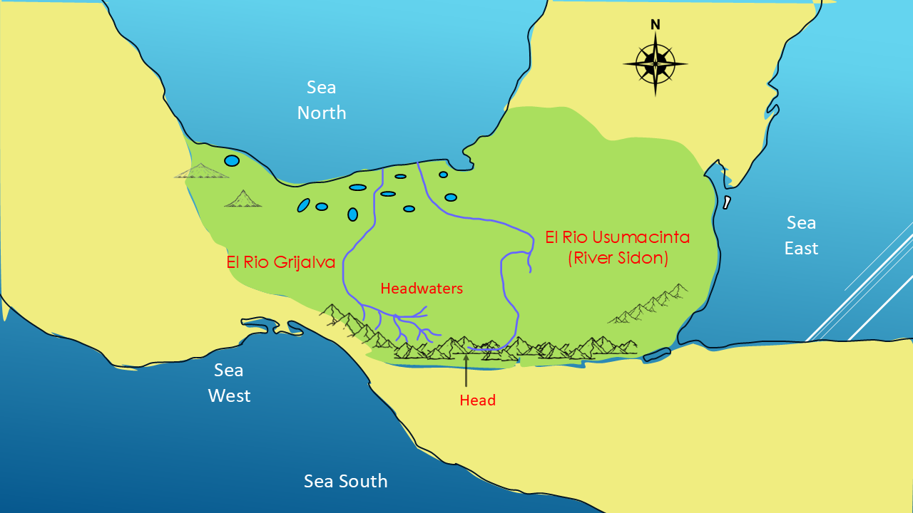
So, we have two leading candidates.
El Rio Usumacinta. and
El Rio Grijalva.
Which river begins with headwaters and which one starts at a single source?
So, for the last sixty years, the scholars have been about evenly divided between the two candidate rivers.
So, let's ask the question that Mormon's wording gives us:
Which one has the kind of “head” Mormon describes?
LOOKING AT THE MAP
Here's a snapshot of the western part of Guatemala.
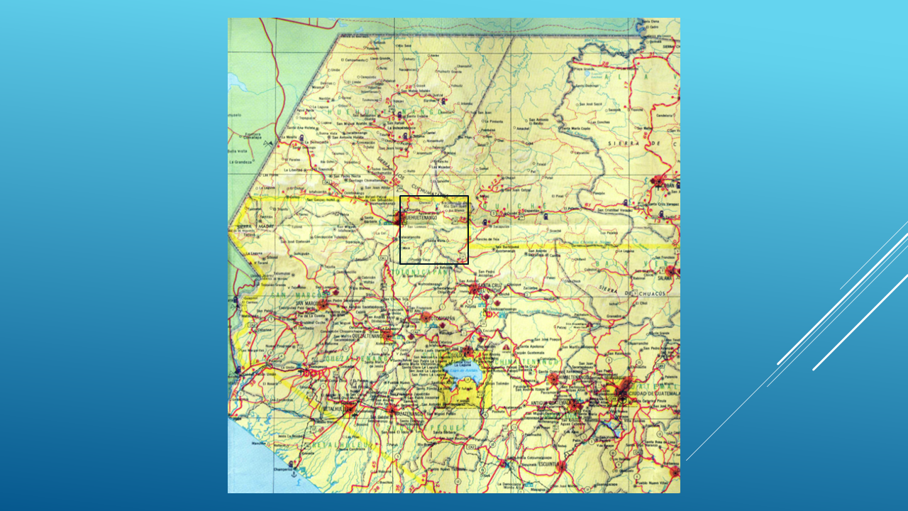
The black box shows the area we're going to investigate.
Let's zoom in.
We're near the city of Huehuetenango.
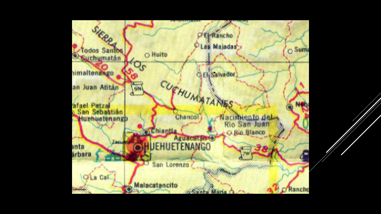
And right here...
we find something very interesting.
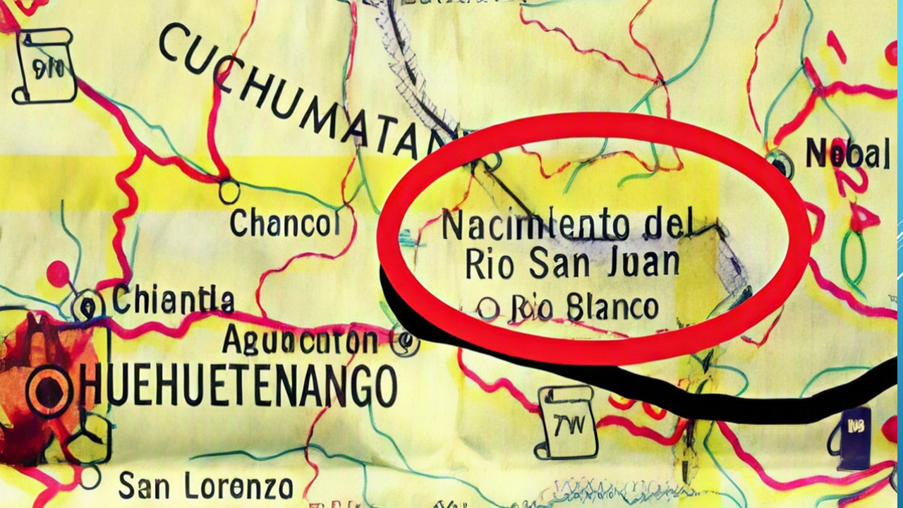
There is an actual geographical landmark identified on modern maps:
El Nacimiento del Río San Juan.
The Birth of the San Juan River.
The Spanish word nacimiento means birth, source, or beginning.
In other words...
the head of a river.
And it's not simply a name that someone put on a historical drawing.
It's an actual place.
It's identified on modern highway maps.
And the water actually emerges from the side of the hill.
FOLLOWING THE WATER
Now let's follow it.
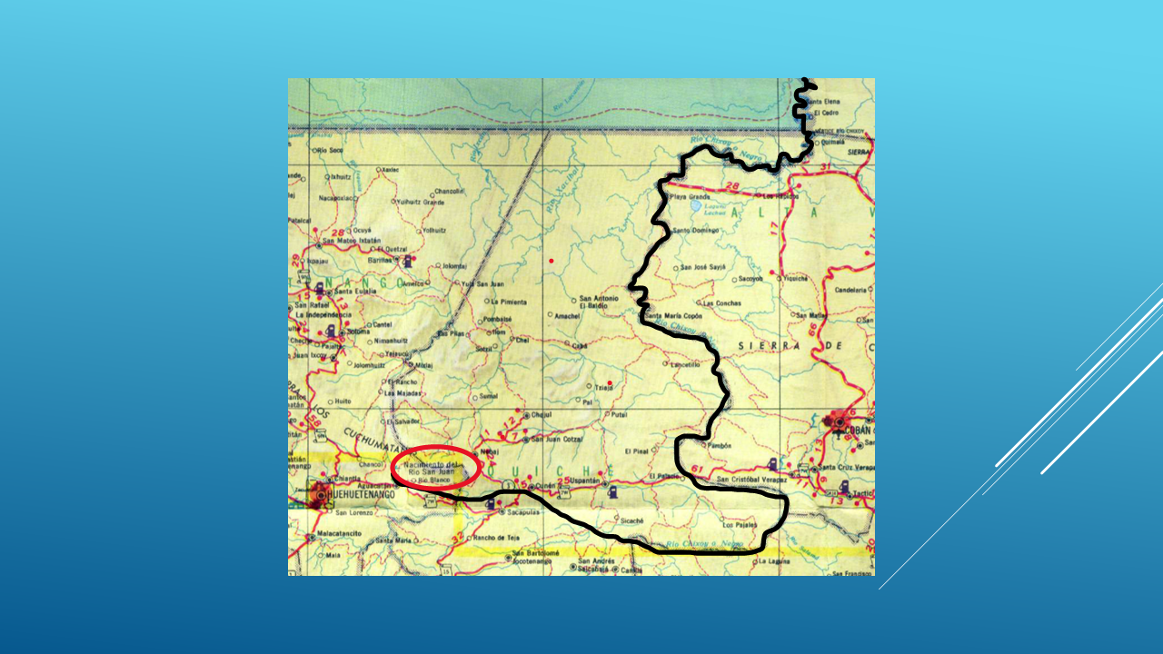
The river begins here.
It flows east for a distance. (Slide #19 – Map Rivers Going North)
Then it curves north toward Mexico.
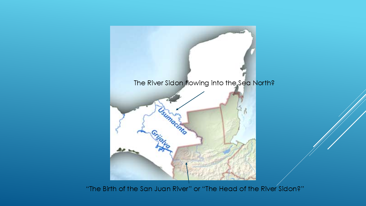
For part of its course, the river actually forms the boundary between Mexico and Guatemala.
And then it continues northward.
Eventually, the Usumacinta River continues toward the Gulf of Mexico.
Or perhaps...the Sea North.
Now look at what we have.
A specific geographical head in the mountains.
The river flows west to east.
The river could possibly be crossed.
A river system that continues northward.
And a river that ultimately reaches the Gulf of America or the Sea North.
Is this the head of the River Sidon?
I can't tell you that with absolute certainty.
But I can tell you this:
It is an extraordinarily interesting geographical match to our investigation!
THE BIRTH OF THE SAN JUAN RIVER
And here's where this investigation became personal for me.
While serving as Area Auditors in Central America for The Church of Jesus Christ of Latter-day Saints, and living in Guatemala City, my wife and I were able to visit this place.
The Birth of the San Juan River.
I took these pictures.
And I have to tell you...
It was an amazing spiritual experience.
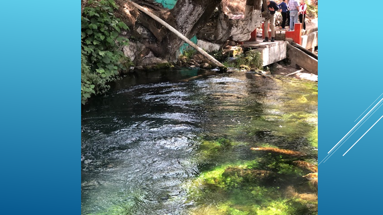
You're standing there looking at water literally bubbling out of the side of a hill.
You can see the river beginning.
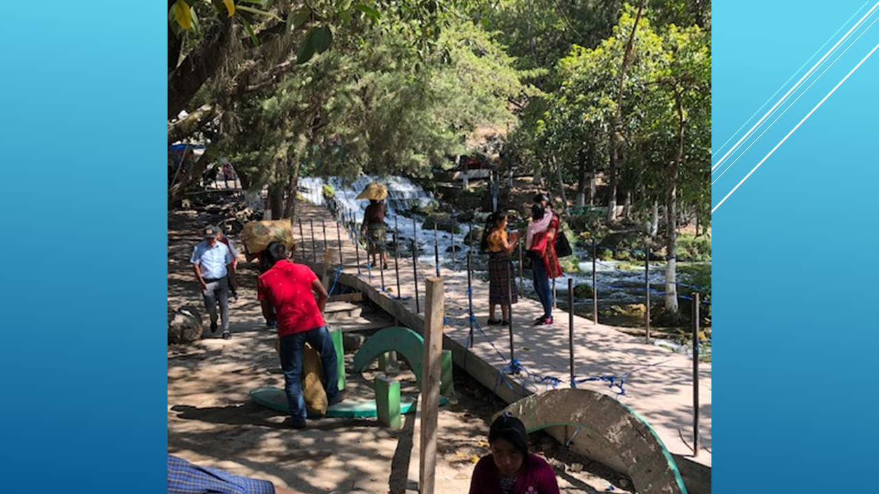
You can follow it downstream.
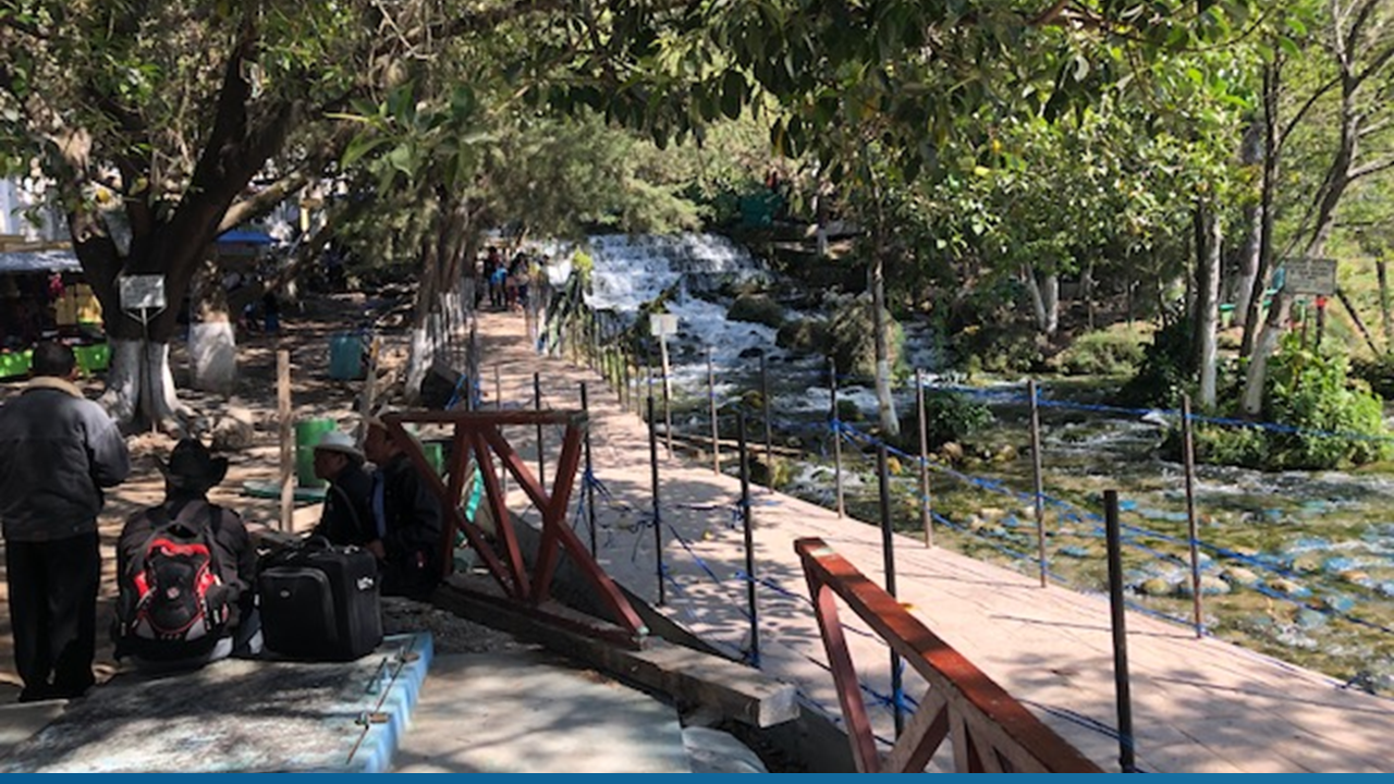
And you're standing at a place that modern maps actually identify as the Nacimiento del Río San Juan.
Could this be the geographical feature Mormon was referring to?
That's the question.
And that's why I wanted you to see it for yourself.
ENDING HOOK
So, where does that leave us?
We began with three words:
“The head of the River Sidon.”
Mormon mentions that head five times.
He places it near Manti.
He places it along the narrow strip of wilderness dividing the Land of Zarahemla from the Land of Nephi.
He tells us the River Sidon ran by the Land of Zarahemla.
And he tells us the waters eventually carried the dead to the sea.
We then looked at the two leading candidates:
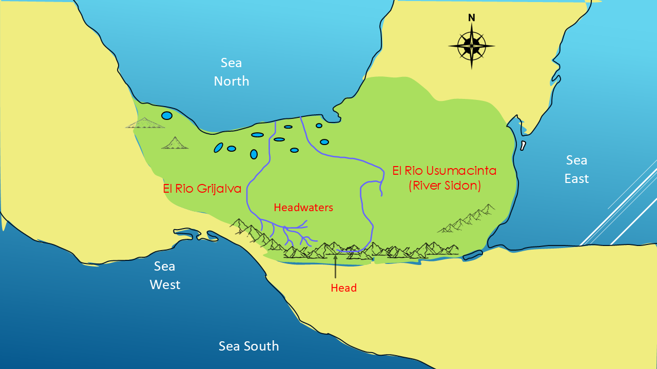
the Grijalva...
and the Usumacinta.
And then we found something very unusual:
An actual head of a river in the mountains of Guatemala.
The Nacimiento del Río San Juan.
Does that prove this is the River Sidon?
No.
But does it give us another remarkable piece of geographical information?
I believe it does.
And now I want you to investigate it for yourself.
Look at Mormon's descriptions.
Look at the geography.
Look at the rivers.
And ask yourself:
Which river best fits Mormon's words?
For me, this is new geographical information.
It is another critical piece connecting a few more dots in the Big Picture of the Book of Mormon.
And that's what this entire series is about.
Following the clues.
Letting Mormon draw the map.
And seeing where those clues lead us.
NEXT VIDEO
In the next video, we're going to follow another set of remarkable geographical clues.
In the next video, we're going to follow another set of remarkable geographical clues. (Slide #25 – Table of Contents)
We're going to track the travels of Mosiah, King Zeniff and King Limhi.
And once again, we're going to let the Book of Mormon give us the directions...
and see what happens when we put those directions on a modern map.
The Big Picture is getting bigger.
I'll see you in Part 7.