
The Big Picture of the Book of Mormon
Part 13 — Where Did Alma Go?
After escaping from King Noah's priests, Alma disappeared into the wilderness. But where did he go?

Where Did Alma Go?
Alma fled from a wicked king with his people, their families, and their flocks.
But where could they go to escape the king’s reach?
Mormon gives us a remarkable clue: eight days into the wilderness.
Can we follow that clue across the mountains of Guatemala and discover where Alma's people found refuge?
Let's investigate!
Welcome! I'm Kendall, the Mormon Mann.
We are now in Part 13 of 13.
Throughout this series, we're letting Mormon's own geographical descriptions guide our investigation.
If you prefer reading this information or would like to copy and paste it for further study,

you can find it on my website, themormonmann.com — that's Mann with two N's.
And please feel free to share this investigation with your family and friends.
Now, let's get started!
Mormon gives us a series of geographical clues that may help us trace Alma's journey, step by step.
Before we trace Alma’s journey, let’s take a closer look at a possible destination: the Valley of Almolonga in Guatemala.
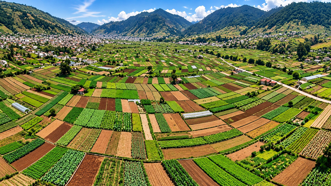
I’ve driven through this valley myself.
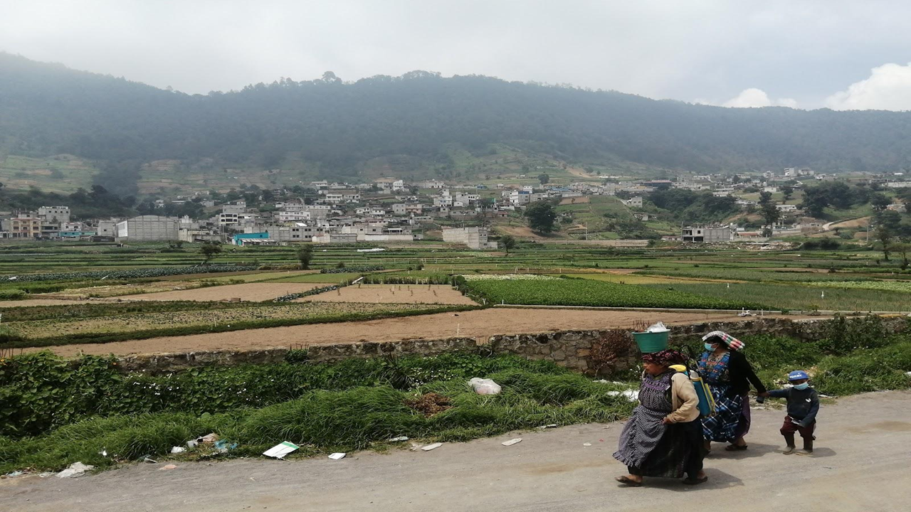
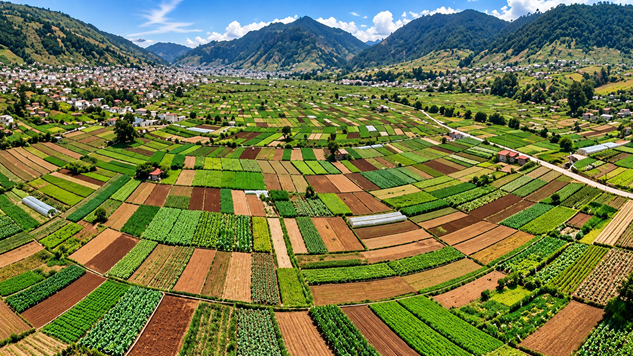
It sits high in the mountains, surrounded by steep terrain, and is often covered in clouds and mist.
Yet the valley has abundant water and remarkably fertile farmland.
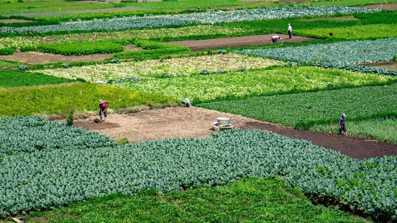
Today, it is known for producing vegetables that feed communities throughout the region.
Could a valley like this provide the water, farmland, and relative seclusion Alma’s people needed?
Let’s keep that question in mind as we investigate.
Now let’s look at the larger geographical picture.
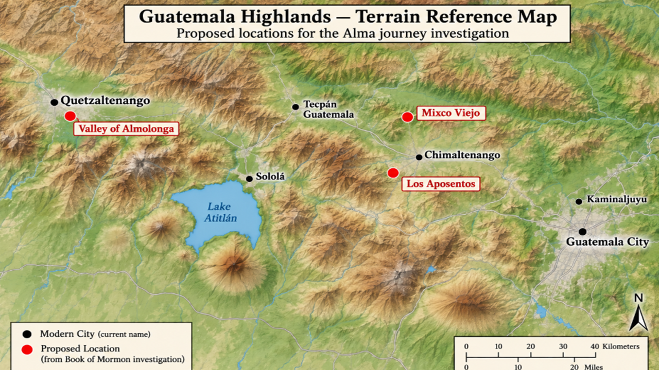
Our investigation begins at Mixco Viejo, which we have proposed as the City of Nephi.
Nearby is Los Aposentos, our proposed location for the Waters of Mormon.
And our destination is the Valley of Almolonga, a possible location for the Land of Helam.
These are proposed identifications, not established facts. The question is whether Mormon’s description of Alma’s journey FITS the geography.
How could Alma and his people have traveled from the Waters of Mormon to this distant valley in just eight days?
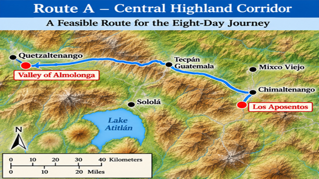
Route A: The Central Highland Corridor
Let's examine our first possible route.
Starting at the proposed Waters of Mormon near Los Aposentos, Alma and his people could have traveled west through the central highlands, passing through the Chimaltenango and Tecpán regions before continuing toward the Valley of Almolonga.
This route crosses highland valleys, ridges, and mountain passes.
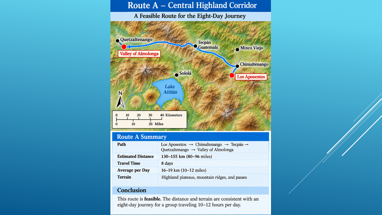
Our preliminary estimate is approximately 130 to 155 kilometers, or 80 to 96 miles.
Could Alma's people cover that distance in eight days?
Let's assume they traveled 10 to 12 hours a day.
Daily travel time Average distance per day
10 hours 8-10 miles
12 hours 10-12 miles
These are approximate averages based on the estimated route distance.
Considering the mountainous terrain and the fact that Alma's people traveled with families, flocks, and provisions, Yes, Route A appears feasible for an eight-day journey.
But is there a better possibility?
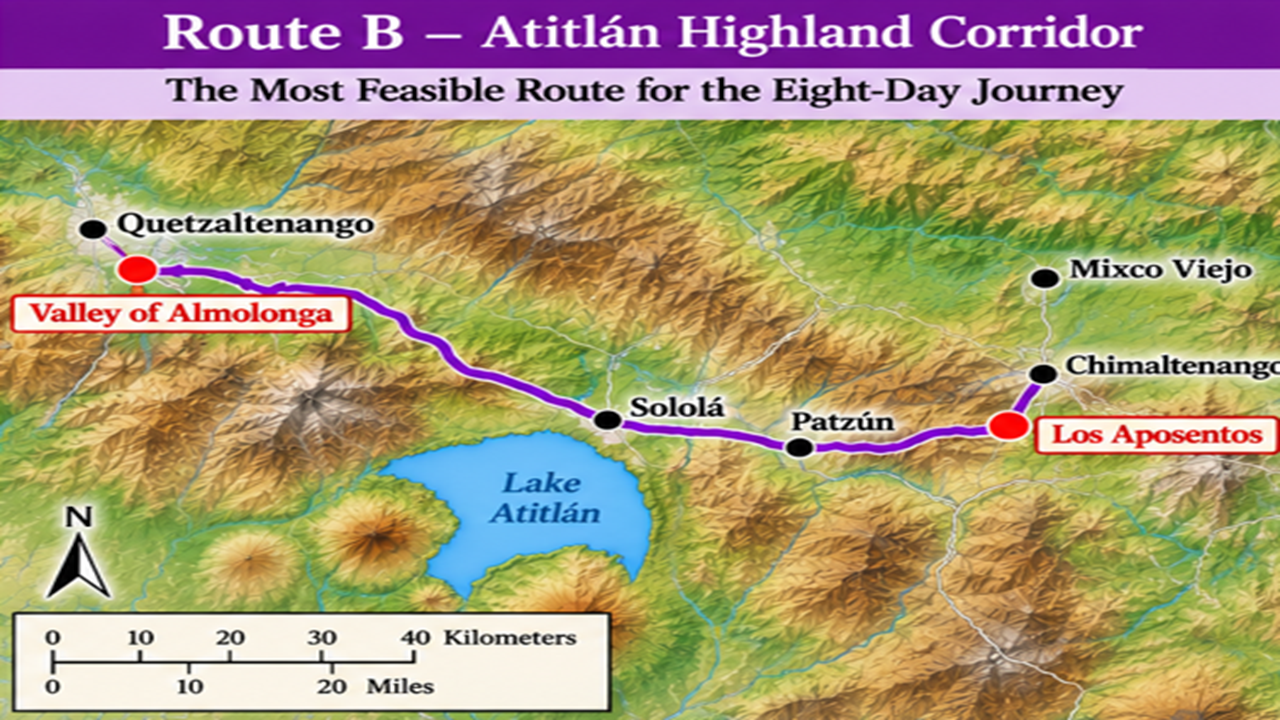
Now let's consider a second route.
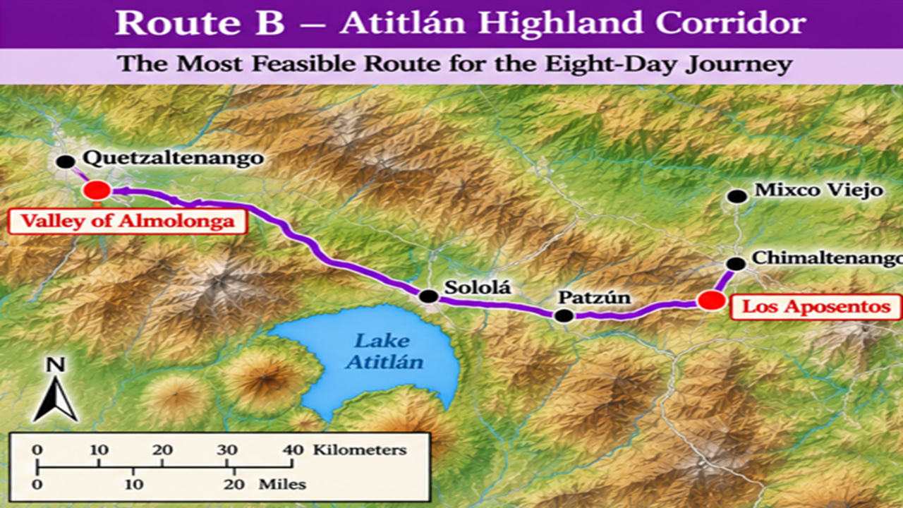
Instead of following the central highland corridor, Alma's people could have traveled through the Patzún region and the highlands around Lake Atitlán before continuing west toward Almolonga.
There's an important reason to consider this route.
The Guatemalan highlands were connected by ancient trade and travel corridors.
Archaeological research shows that communities exchanged goods and maintained connections across these mountainous regions long before the Spanish arrived.
These corridors often followed natural valleys and mountain passes, connecting settlements and providing access to water and resources.
We cannot say that Alma followed any particular ancient trade route. But the existence of these corridors gives us another geographical possibility to investigate.
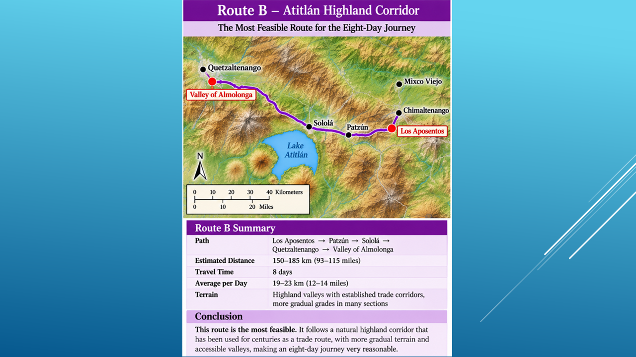
Our preliminary estimate for this route is 150 to 185 kilometers, or 93 to 115 miles.
Daily travel time
Average distance per day
10 hours
10–12 miles
12 hours
12–14 miles
These are approximate averages based on our proposed route distance.
Although Route B may be longer, the availability of natural corridors and established connections between highland communities could have made parts of the journey more practical for a large group traveling with families, flocks, and provisions.
Of our two proposed routes, I consider Route B the most promising possibility that fits Mormon’s directions.
Its historical context and natural geography make it worth comparing with Mormon's eight-day account.
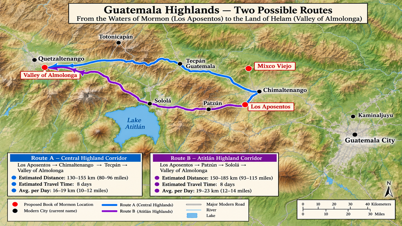
We’ve now examined two possible routes from the Waters of Mormon to the Valley of Almolonga.
Route A follows a more direct corridor through the central highlands.
Route B takes a different path through the highlands around Lake Atitlán.
Both routes cross mountainous terrain, and either would have presented challenges for Alma’s group, traveling with families and flocks.
Based on our proposed geography, both Routes A and B appears feasible and FITS Mormon’s geological directions!
But remember, these are estimated routes. We cannot establish the exact trail Alma followed.
So, let’s turn from the journey to the destination itself.
Does the Valley of Almolonga fit Mormon’s description of the Land of Helam?
In Mosiah 23, Mormon tells us that Alma’s people settled in the Land of Helam.
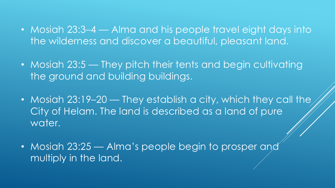
Our proposed location has several characteristics worth considering.
The Valley of Almolonga is surrounded by mountains, has access to water, and is known for its fertile agricultural land.
Those features make it a reasonable candidate that FITS Mormon’s descriptions.
Of course, modern conditions cannot prove that Alma lived here. We must ask whether the rest of the Book of Mormon’s geographical clues also fit.
But Alma’s story doesn’t end in Helam.
In Mosiah 24, the people face a new crisis.
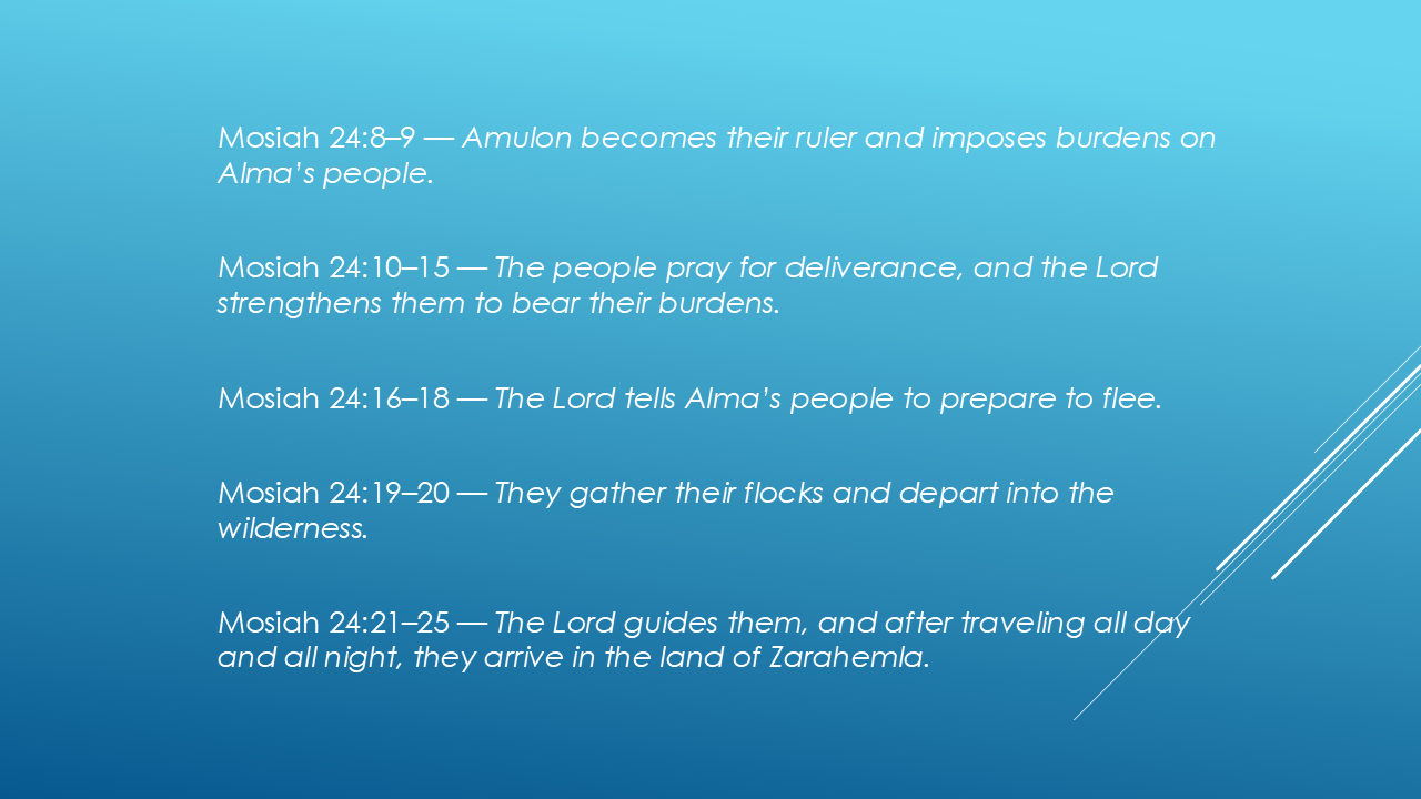
Mormon gives us another remarkable geographical clue:
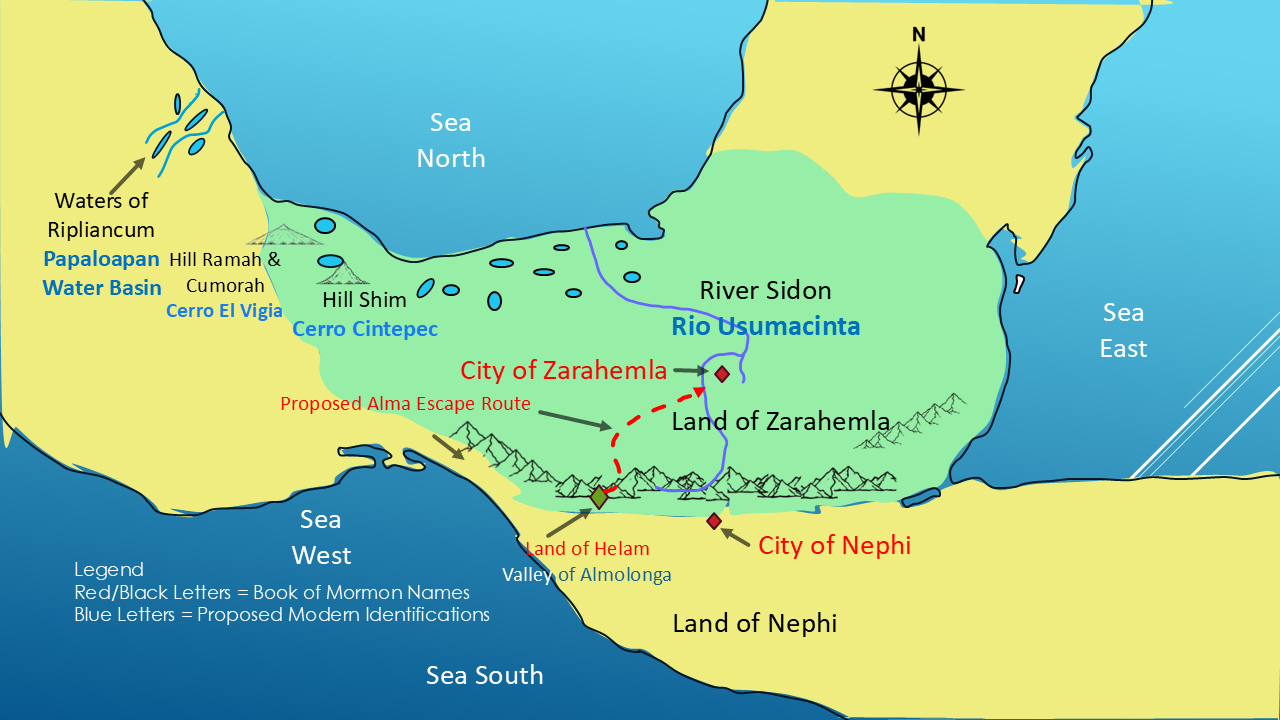
After leaving the Land of Helam, Alma’s people traveled through the wilderness and eventually arrived in the Land of Zarahemla.
Can the distances and directions in this next part of the story help us test our proposed location for Helam?
Our proposed City of Zarahemla lies farther northeast, beside the River Sidon, which we identify with the Usumacinta River.
According to Mosiah 24:19–20, Alma’s people gathered their flocks and departed into the wilderness. They traveled all day and all night and they eventually arrived in the Land of Zarahemla.
But what does geography tell us about this journey?
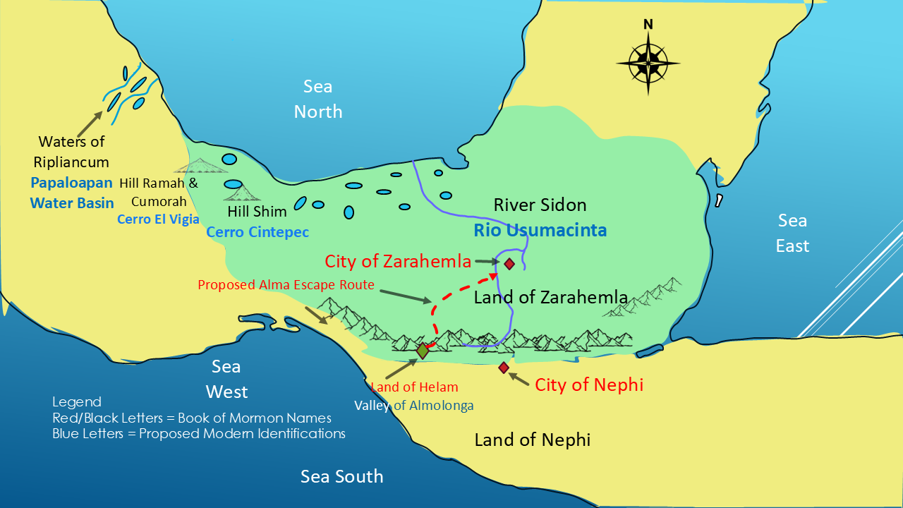
To reach the lowlands from a mountain valley, Alma’s people would have needed to cross or travel around rugged terrain. Valleys and natural corridors could have provided possible routes through the mountains.
The terrain presents challenges, but it also gives us paths to investigate.
Here is an important limitation: Mormon does not tell us the exact distance, direction, or route they followed during this escape. We cannot calculate their travel speed or establish the precise trail from the text alone.
This route remains only a proposed geographical possibility, not a proven identification. But it does fit the story!
We have now examined several clues: the eight-day journey into Helam, the character of the valley, and the later escape to Zarahemla.
But there’s another kind of evidence we haven’t investigated yet.
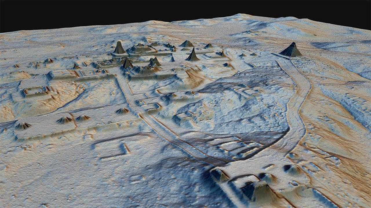
Imagine using laser technology to see through dense jungle vegetation and reveal ancient roads, buildings, terraces, and entire settlements hidden beneath the trees.
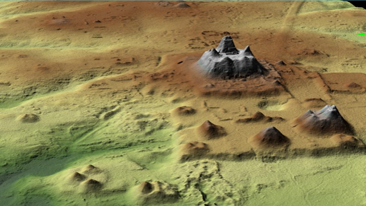
That’s what LiDAR technology is helping archaeologists do in parts of Central America, including Guatemala.
What have researchers discovered? And could these discoveries change what we know about the ancient world described in the Book of Mormon?
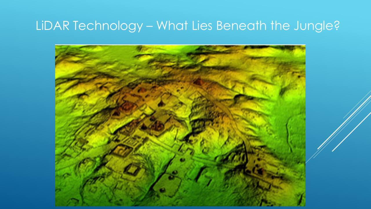
Join me for our first Special Investigation: LiDAR — What Lies Beneath the Jungle?
Conclusion
Thank you for joining me on this journey through the Big Picture of the Book of Mormon.
Throughout this series, we’ve examined Mormon’s geographical descriptions and compared them with possible locations in the real world. We haven’t proven every identification, but we’ve explored the clues and asked questions worth investigating.
If you’d like to review the maps, read the scripts, or copy information for further study, visit my website at themormonmann.com — that’s Mann with two N’s.

Please share this series with your family and friends, and if you’ve enjoyed our investigation, hit the Like button and subscribe so you won’t miss what comes next.
I’m Kendall, the Mormon Mann.
Thanks for watching. And remember, the investigation continues!