
The Big Picture of the Book of Mormon
Part 3 - Where Is Zarahemla?
Mormon Left Us the Clues. Can We Follow Them?
The Big Picture of the Book of Mormon
Part 3 - Where Is Zarahemla?
For nearly 200 years, people have searched for Zarahemla.
But what if we've been asking the wrong question?
Instead of asking:
“Where is Zarahemla?”
what if we first ask:
“What did Mormon tell us about the land around Zarahemla?”
Because Mormon didn't give us just a name.
He gave us a landscape.
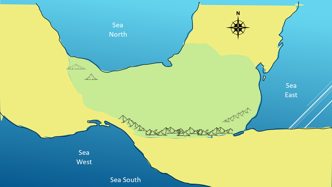
And that landscape may give us our first real clue to where Zarahemla was.
We are currently in our PART 3 of 13 Parts — WHERE WAS THE LAND OF ZARAHEMLA?
I'm Kendall, the Mormon Mann.
And in this investigation, we're going to let Mormon's own geographical descriptions guide us.
WHERE DO WE BEGIN?
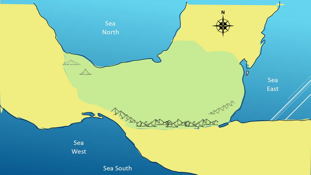
In Part 2, we began examining Mormon's geographical language.
We looked at Which way was:
up and down,
north and south,
east and west,
Where were the mountains,
wilderness,
and the four seas.
We also identified two important geographical names:
Mulek in the north,
and Lehi in the south.
Now we're going to narrow our focus to two of the most important lands in the Book of Mormon:
the Land of Zarahemla
and
the Land of Nephi.
Let's start looking for clues.
CLUE #1
ZARAHEMLA IS “DOWN”
Our first clue comes from Omni.
Amaleki describes Mosiah and his people traveling through the wilderness…until they came down into the land which is called the land of Zarahemla.”
They came down into Zarahemla.
That's our first clue.
Mormon is giving us a relationship between direction and geography.
Zarahemla is down.
But down from where?
Let's look at the other direction.
CLUE #2
NEPHI IS “UP”
In Mosiah 7, King Mosiah gives permission for a group of men to search for their brethren.
Verse 2 says:
“...go up to the land of Lehi-Nephi...”
Verse 3 says:
“On the morrow, they started to go up...”
And verse 4 again says:
“...to go up to the land of Lehi-Nephi...”
Three times.
Go up to Nephi.
Now put our first two clues together.
That's a very interesting geographical relationship.
But what exactly does Mormon mean by up and down?
CLUE #3
THE MOUNTAINS
Let's look at Mormon's descriptions of the terrain.
In Helaman 11, Mormon describes people retreating:
Then an army is sent:
And later they return:
Notice the language.
Into the mountains.
Out of the mountains.
Into the wilderness.
Out of the wilderness.
This is physical geography.
And when we put this together with people going up to Nephi and down to Zarahemla, the evidence suggests that Mormon's use of up and down is describing elevation, rather than simply north and south.
Think about how we use those words today.
We go up into the mountains.
We come down into the valley.
So, our first three clues are beginning to fit together:
Zarahemla — down
Nephi — up
Mountains — associated with the higher country
But Mormon gives us another kind of geographical information.
CLUE #4
LEHI IS SOUTH — MULEK IS NORTH
Remember back in Part 2? In Helaman 6:10, Mormon tells us:
Now the land south was called Lehi, and the land north was called Mulek...”
Now we're dealing with something different.
Here Mormon is clearly using directional geography.
North.
South.
And in Part 2, we established the relationship between these names and the two major lands we're examining.
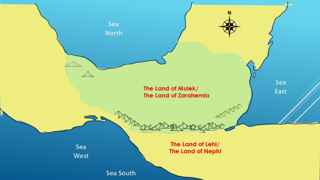
So now we have another piece of the puzzle.
Zarahemla — associated with Mulek — north
Nephi — associated with Lehi — south
But remember the distinction:
North and south describe direction.
Up and down describe elevation.
That distinction is important as we build the map.
CLUE #5
PUTTING ZARAHEMLA ON THE MAP
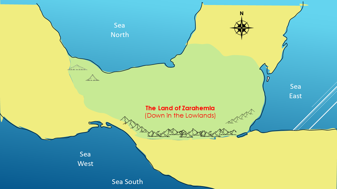
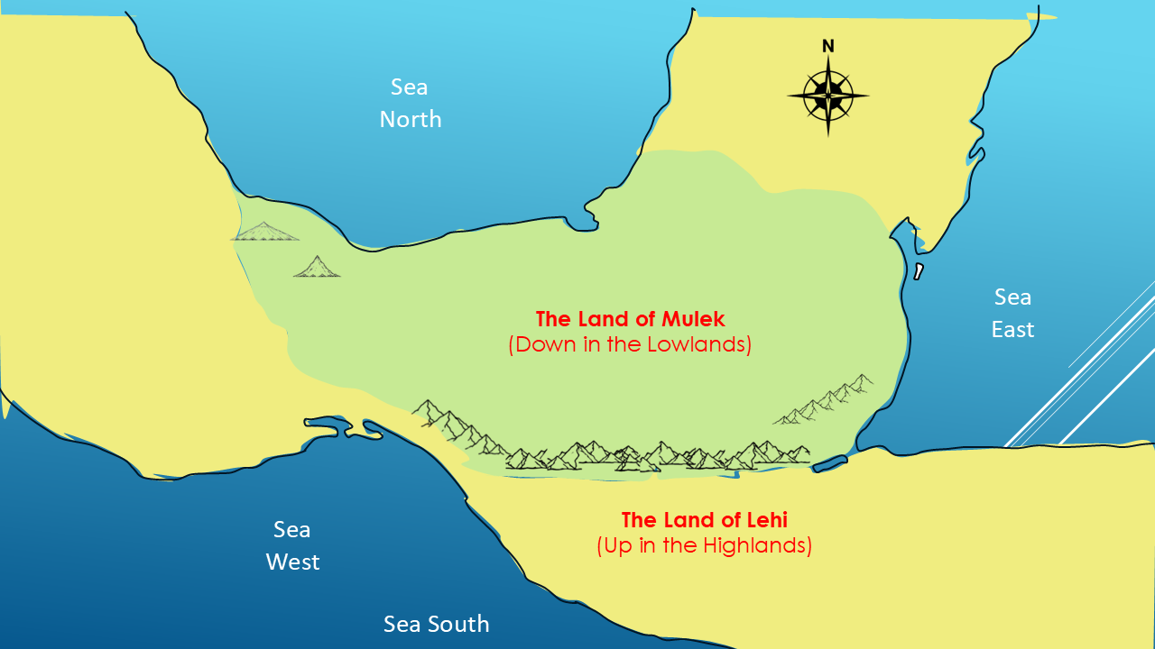
This is the Land of Zarahemla.
[PAUSE]
Remember our first clue.
Mormon said they “came down into the land which is called the land of Zarahemla.”
So we're placing Zarahemla in the lower country of our working map.
This isn't a random placement.
It follows the geographical relationship Mormon gave us.
CLUE #5 — CONTINUED
PUTTING NEPHI ON THE MAP
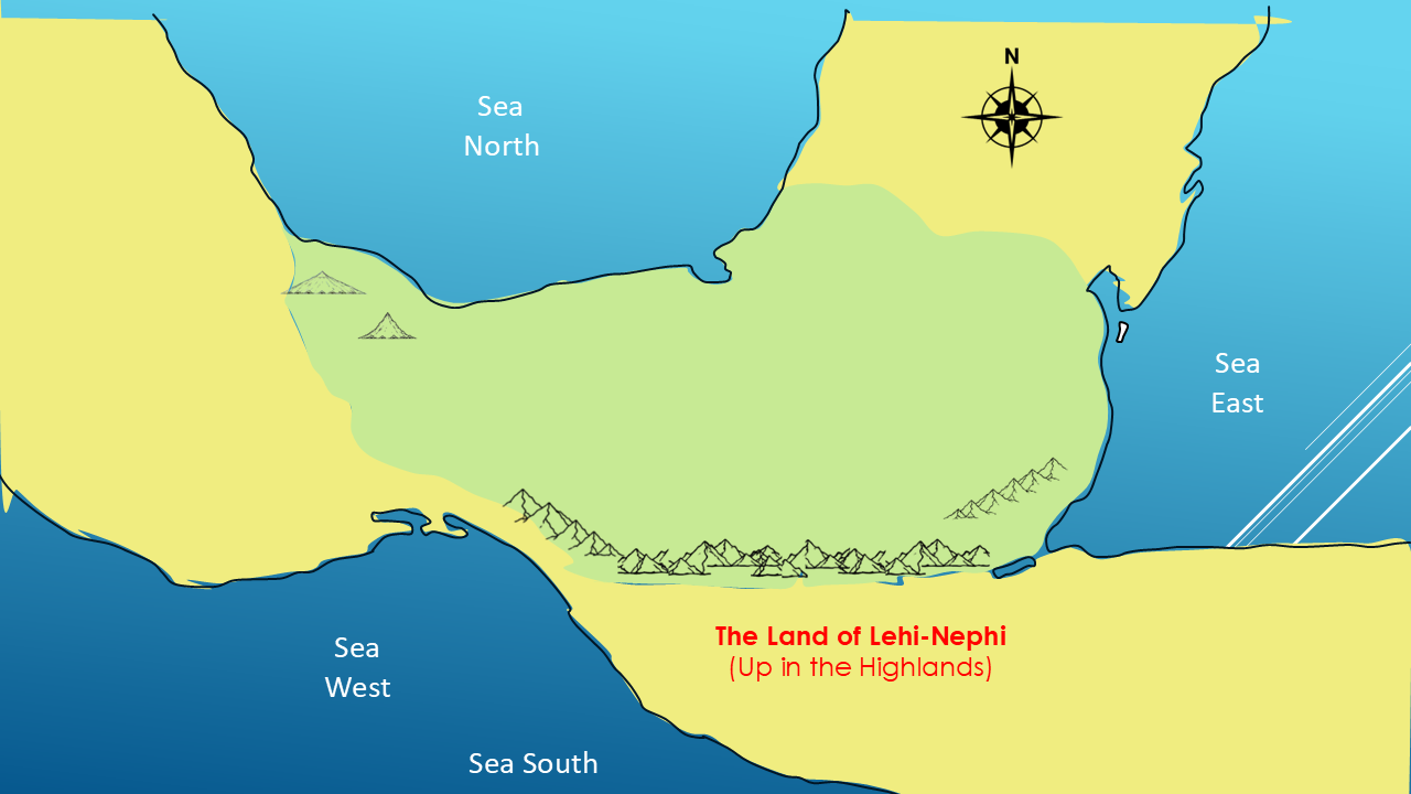
And now we can identify the other major land.
This is the Land of Nephi.
Mormon repeatedly describes people going up to the land of Lehi-Nephi.
And Nephi is associated with the higher, mountainous country.
So we're placing Nephi in the higher country of our working map.
LOOK AT WHAT WE HAVE
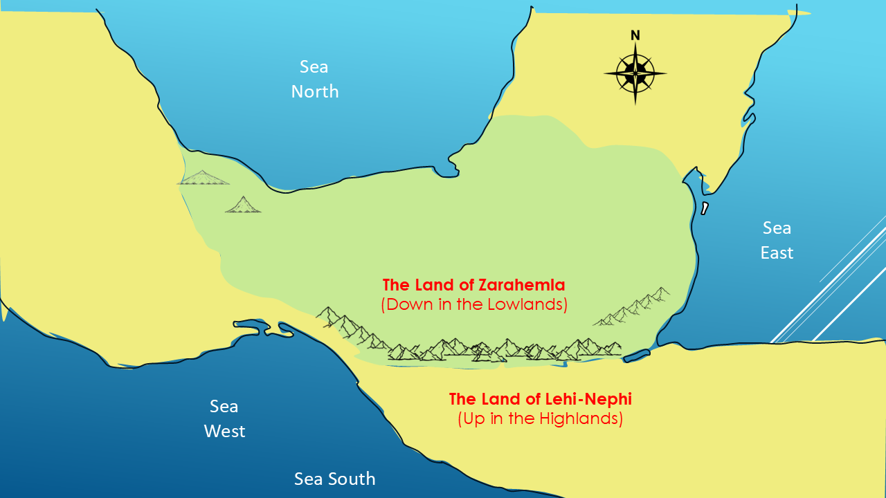
Now look at what we've accomplished.
For the first time, our working map has two of the most important lands identified.
LAND OF NEPHI
Up in the Highlands
and
LAND OF ZARAHEMLA
Down in the Lowlands
This is our first major geographical framework.
We're not claiming that every geographical feature has been identified.
We're not claiming we've found every city.
But we now have two of the most important lands in the Book of Mormon on our map.
CLUE #6: A WILDERNESS BETWEEN NEPHI AND ZARAHEMLA
We've now identified two major lands on our map:
The Land of Nephi.
And farther to the north:
The Land of Zarahemla.
But Mormon gives us another important piece of information.
He tells us that these two lands were separated by a wilderness.
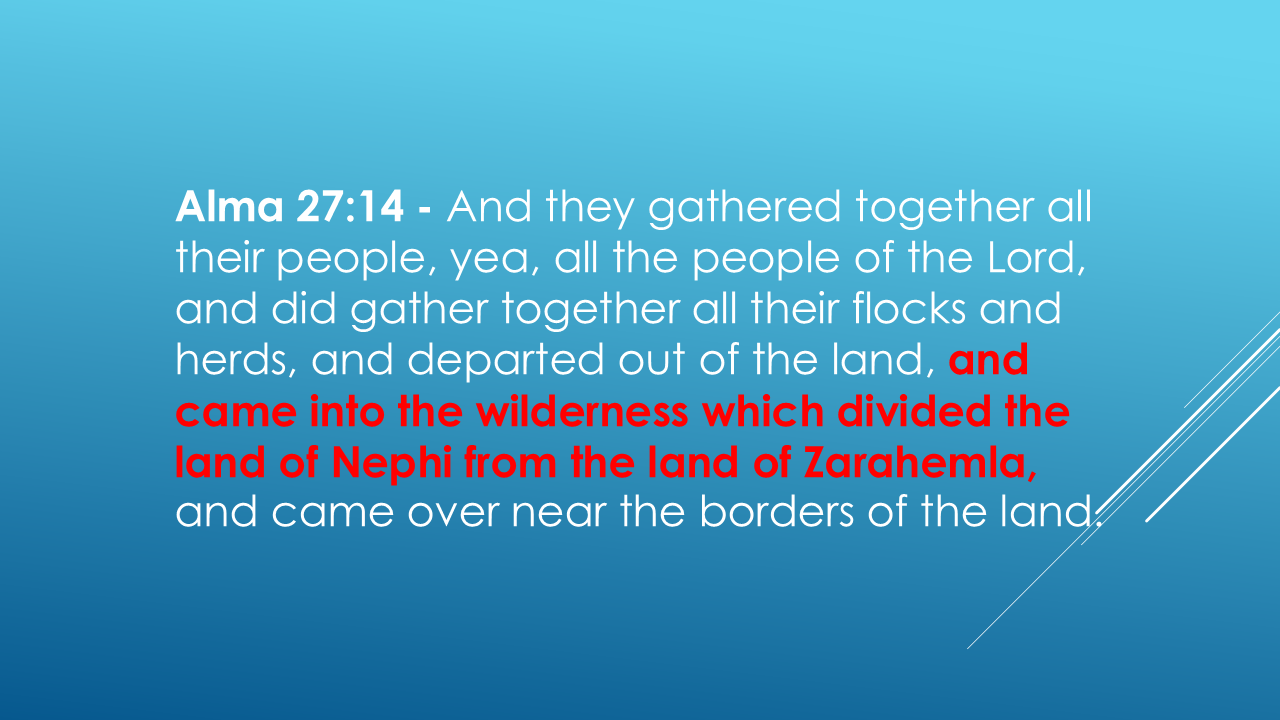
Pause
That's remarkably clear.
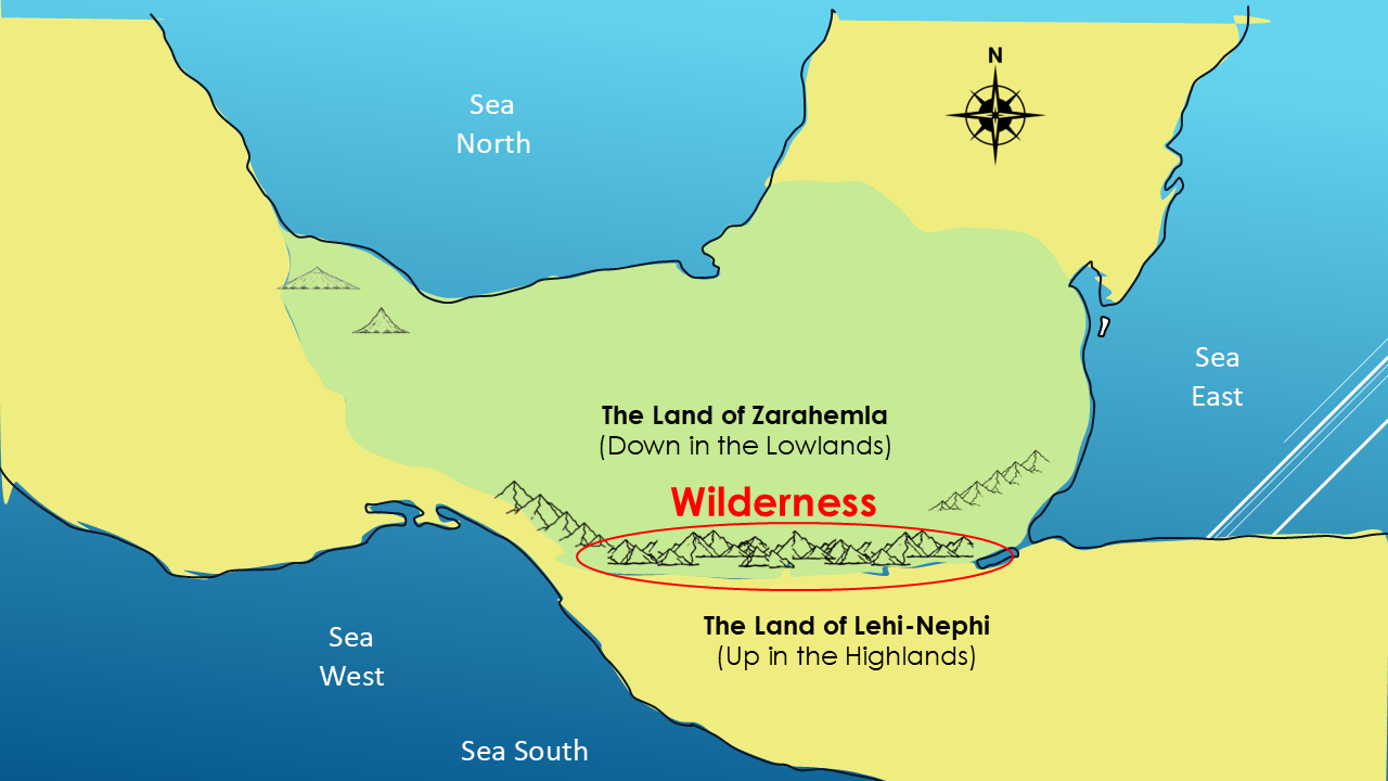
Mormon doesn't simply tell us that Nephi and Zarahemla were in different places.
He tells us that a wilderness divided them.
And then, in the very next verse, the direction of travel becomes clear.
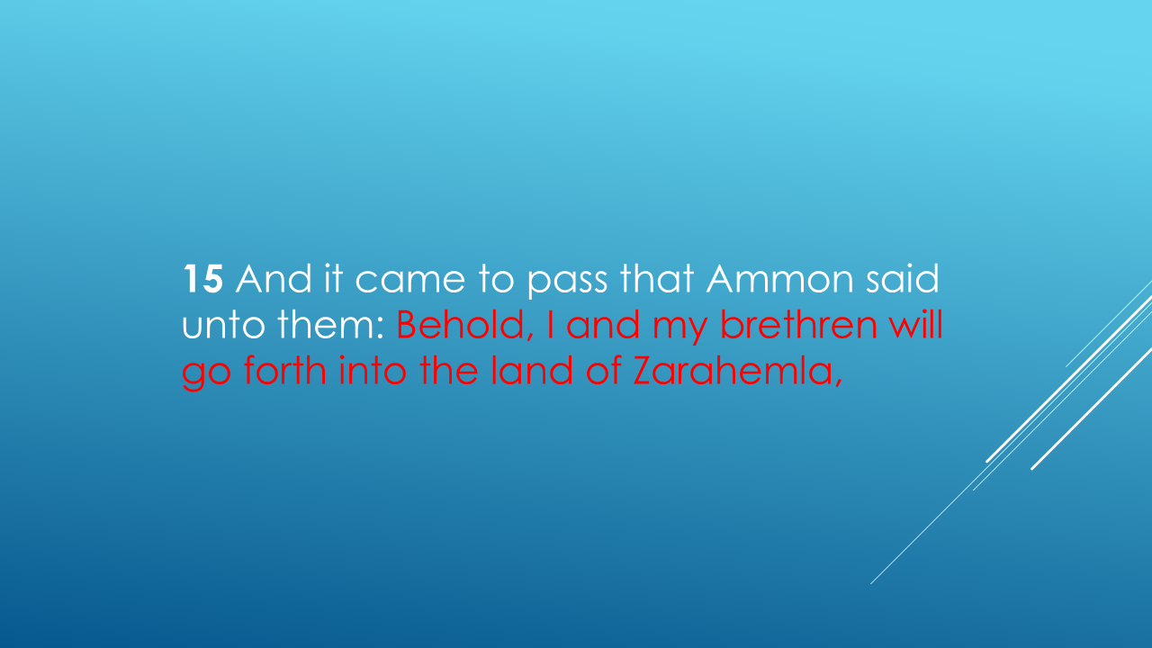
So, our map now has another geographic relationship to account for:
The Land of Nephi → Wilderness → Land of Zarahemla
That's another clue.
And it's one we need to keep on our map as we continue.
DOES THE LANDSCAPE FIT?
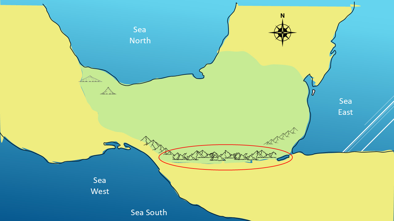
Now let's look at the modern landscape we're investigating.
Our area of focus is southern Mexico and Guatemala.
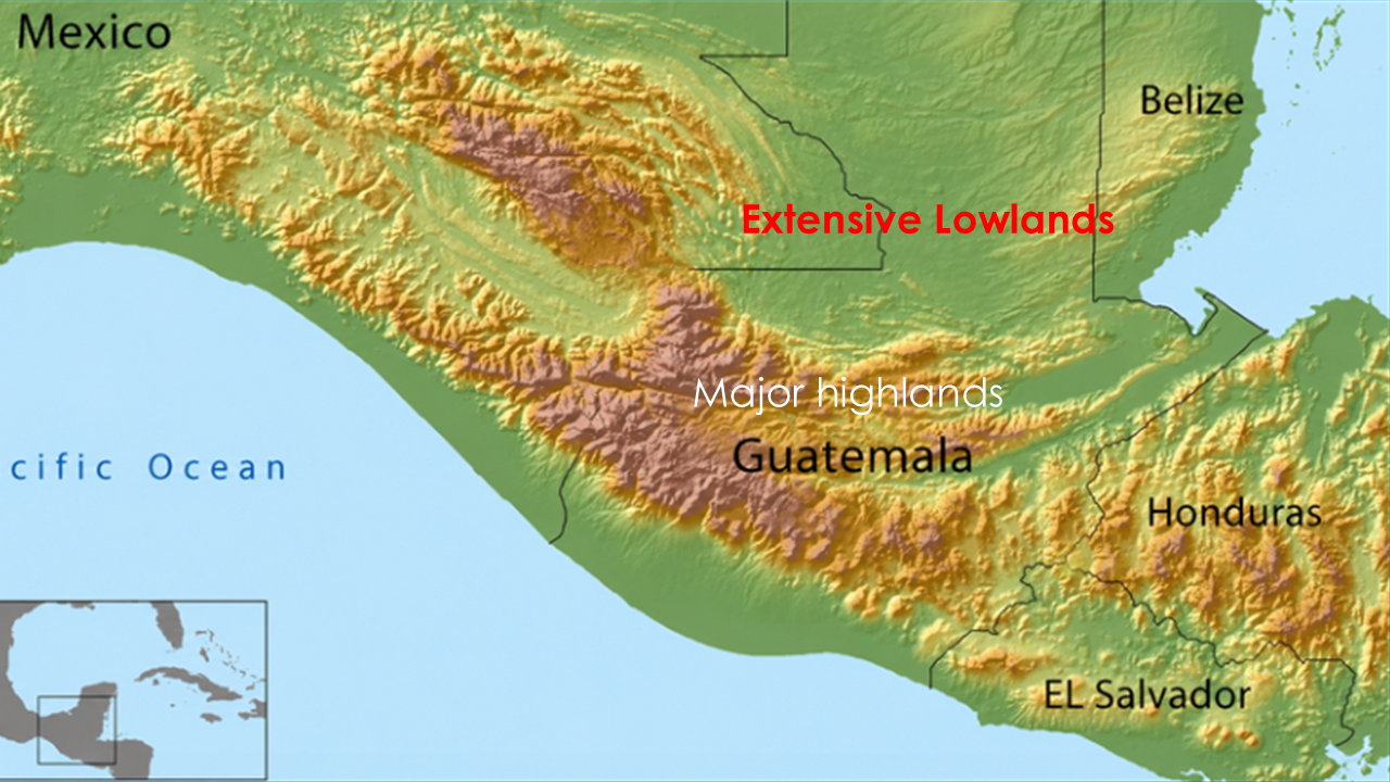
And look at the terrain.
There are extensive lowlands.
There are major highlands.
And there are substantial mountain ranges between them.
So, the basic geographical relationship Mormon describes—
higher country and lower country
—is present in this landscape.
But a similar-looking landscape does not, by itself, establish the identification.
We're going to keep investigating.
A NEW KIND OF EVIDENCE
There's another development we need to introduce.
For decades, archaeologists studying Mesoamerica faced a significant problem.
The Book of Mormon describes a landscape with large populations, cities, villages, roads, agriculture, fortifications, and extensive settlements.
But when archaeologists looked across the jungles of southern Mexico and Guatemala, much of that landscape simply wasn't visible.
And that created a serious question:
Where was all the evidence?
Where were the cities?
Where were the roads?
Where were the farms?
Where were the structures needed to support such large populations?
Based on what archaeologists could see from the ground and through traditional aerial surveys, the ancient landscape appeared far less developed than the Book of Mormon descriptions seemed to require.
For some, that became an argument against placing the Book of Mormon in this region.
But then something changed.
A new technology became available.
It's called LiDAR.
LiDAR uses laser pulses to measure the ground beneath the forest canopy.
And when archaeologists began using it across Mesoamerica, they started seeing something they had never been able to see on this scale before.
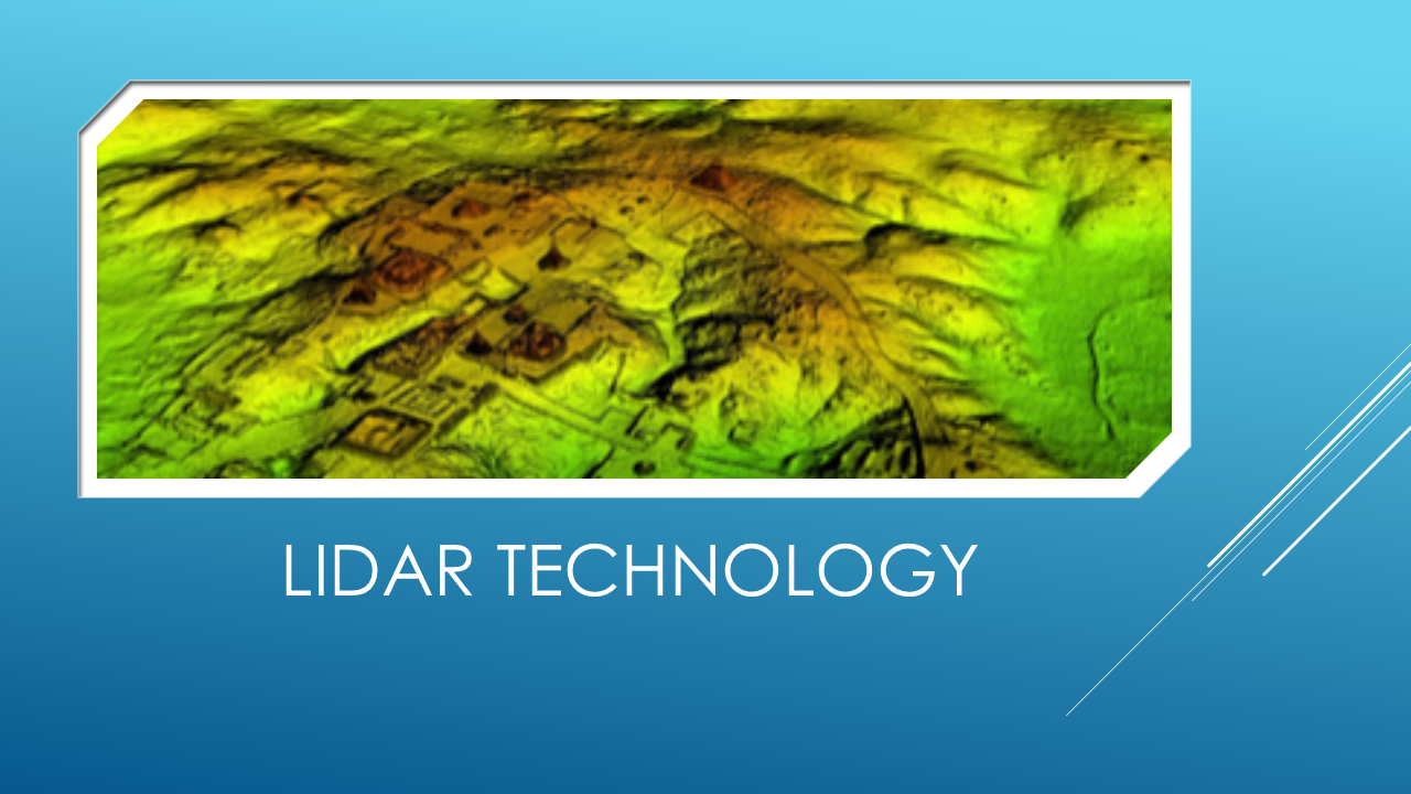
This is actually an X-ray of what is below the jungles!
Thousands upon thousands of ancient structures.
Roads.
Agricultural terraces.
Reservoirs.
Fortifications.
Entire settlements hidden beneath the jungle.
Suddenly, some of the assumptions about what was—or wasn't—possible in this landscape had to be reconsidered.
The question was no longer simply:
“Where is the evidence?”
Now we could ask:
“What have we been unable to see?”
And that gives us something earlier investigators never had:
a way to examine the ancient landscape beneath the jungle.
And that raises a fascinating question:
What happens when we compare the landscape revealed by LiDAR with the geographical landscape Mormon described?
We're going to investigate that in a separate Special Investigation.
But for now, we're going to stay with Mormon.
WHAT HAVE WE ACTUALLY ESTABLISHED?
Let's be precise.
Mormon describes people:
coming down to Zarahemla
and
going up to Nephi.
He associates Nephi with the higher, mountainous country.
He identifies:
Lehi as the land south
and
Mulek as the land north.
And we've used those clues to place:
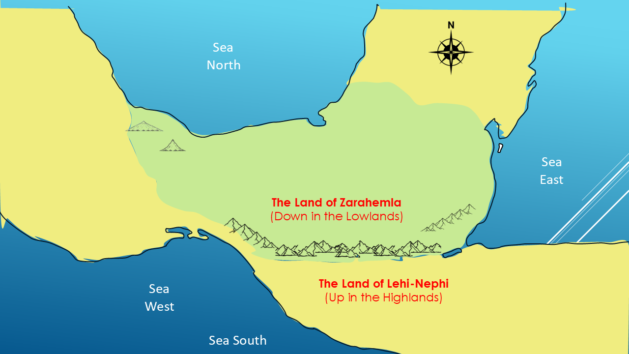
THE LAND OF ZARAHEMLA
and
THE LAND OF NEPHI
on our working map.
That's a significant step.
But there is much more to investigate.
THE INVESTIGATION CONTINUES
Where did Lehi first land?
Where was the Land of First Inheritance?
What did Mormon mean by the Narrow Neck of Land?
And where was the head of the River Sidon?
We're not going to answer all those questions in one video.
Each one deserves its own investigation.
PART 4 - THE LAND OF FIRST INHERITANCE
In Part 4, we're going back to the beginning.
We're going to investigate:
THE LAND OF FIRST INHERITANCE
We'll also examine Mormon's description of Lehi's first landing and see where that location fits into the map we've now begun to build.
That's where we'll go next.
I'm Kendall, the Mormon Mann.
If this is making sense to you, hit the Like button. And I'll see you in the next video.”
From Mormon’s description in Alma 22:27, it most likely did.
Alma 22:27
And it came to pass that the king sent a proclamation throughout all the land, amongst all his people who were in all his land, who were in all the regions round about, which was bordering even to the sea, on the east and on the west, and which was divided from the land of Zarahemla by a narrowstrip of wilderness, which ran from the sea east even to the sea west, and round about on the borders of the seashore, and the borders of the wilderness which was on the north by the land of Zarahemla, through the borders of Manti, by the head of the river Sidon, running from the east towards the west—and thus were the Lamanites and the Nephites divided.
It ran from the sea EAST, past fortified Manti, past the “head” of the river Sidon and on towards the sea WEST, where it curved, “roundabout on the borders of the seashore”, forming a narrow corridor.