
Part 10 - Where Did Jesus Christ Appear in the Americas?
The Book of Mormon Gives Us Clues!
Hi, welcome back to the Mormon Mann Channel
I'm Kendall, the Mormon Mann.
This is Part 10 of The Big Picture of the Book of Mormon.
And although this is the tenth video in the series, it isn't the end of the investigation.
Over the past nine videos, we've taken Mormon's descriptions of the geography of the Book of Mormon and placed those descriptions onto modern maps.
We've followed the rivers.
We've followed the mountains.
We've followed the seas.
We've identified lands, cities, wildernesses, borders, and directions.
And now we're going to use those geographical clues to investigate one of the most important events in the entire Book of Mormon.
The appearance of Jesus Christ to the people in ancient America.
But I'm not asking you to simply accept my conclusion.
Let's investigate the Book of Mormon's own descriptions and see if the geography fits.
Before we begin, I want to repeat something Moroni asked the reader to do.
After reading the record, he invites us to ask God sincerely whether these things are true.
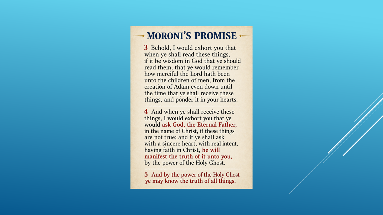
So, as we investigate these geographical descriptions, I invite you to do exactly what Moroni asked.
Read the record. Consider the evidence. And ask God, our Heavenly Father, for yourself.
THE INVESTIGATION CONTINUES
We've come a long way in this investigation.
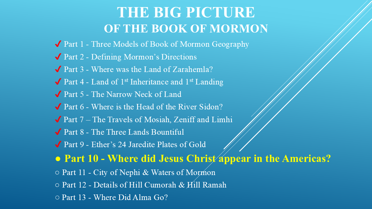
But as we've followed Mormon's geographical descriptions, we've discovered that answering one question often leads to another.
We've identified many of the major lands, seas, rivers, mountains, and geographical features described in the Book of Mormon.
But there are still some important locations we haven't investigated.
For example:
Where was the City of Nephi?
Where were the Waters of Mormon?
Where was the Land of Mormon?
And after Alma fled from King Noah, where did he go?
Then there's another fascinating question:
What can we learn about the Hill Cumorah and the Hill Ramah?
These aren't just names on a map.
Each one comes with geographical clues.
And those clues may tell us more than we might expect.
So, this investigation is not over yet.
There are still several locations to investigate, and we'll be looking at those in the videos ahead.
So, make sure you're subscribed to the Mormon Mann Channel if you'd like to follow along.
But for now, let's return to our main question:
Where did Jesus Christ appear in the Americas?
Before Jesus Christ was crucified, He taught His apostles.
During one particular conversation, He told them:
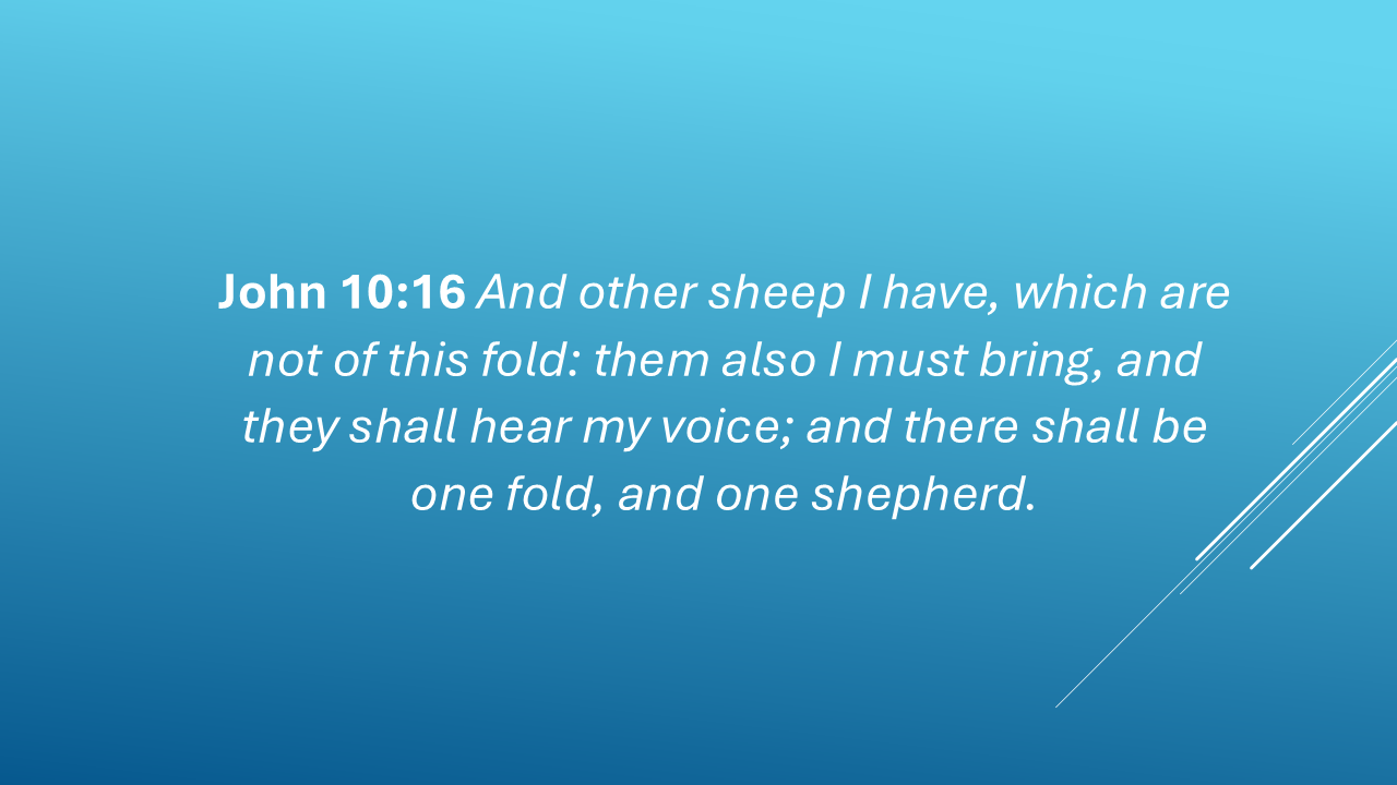
So, here's our first question:
WHO WERE THESE “OTHER SHEEP”?
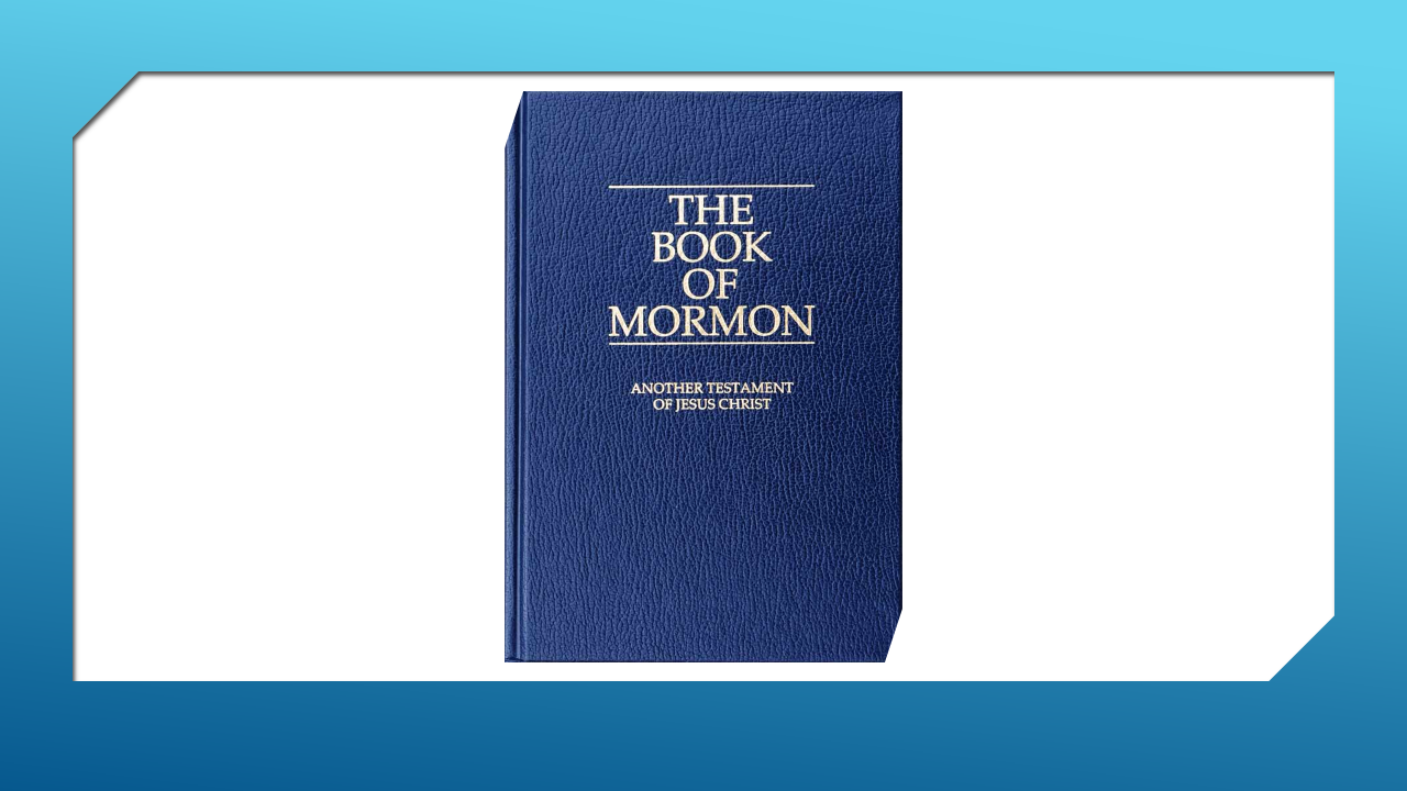
The Book of Mormon presents itself as another testament of Jesus Christ.
It testifies that He lived.
That He atoned for our sins.
That He died.
That He was resurrected.
And that He appeared to another group of His sheep in ancient America.
So, let's see what Mormon tells us.
Notice that.
The people were gathered:
“round about the temple”
and the temple was:
“in the land Bountiful.”
Now continue.
And then something extraordinary happened.
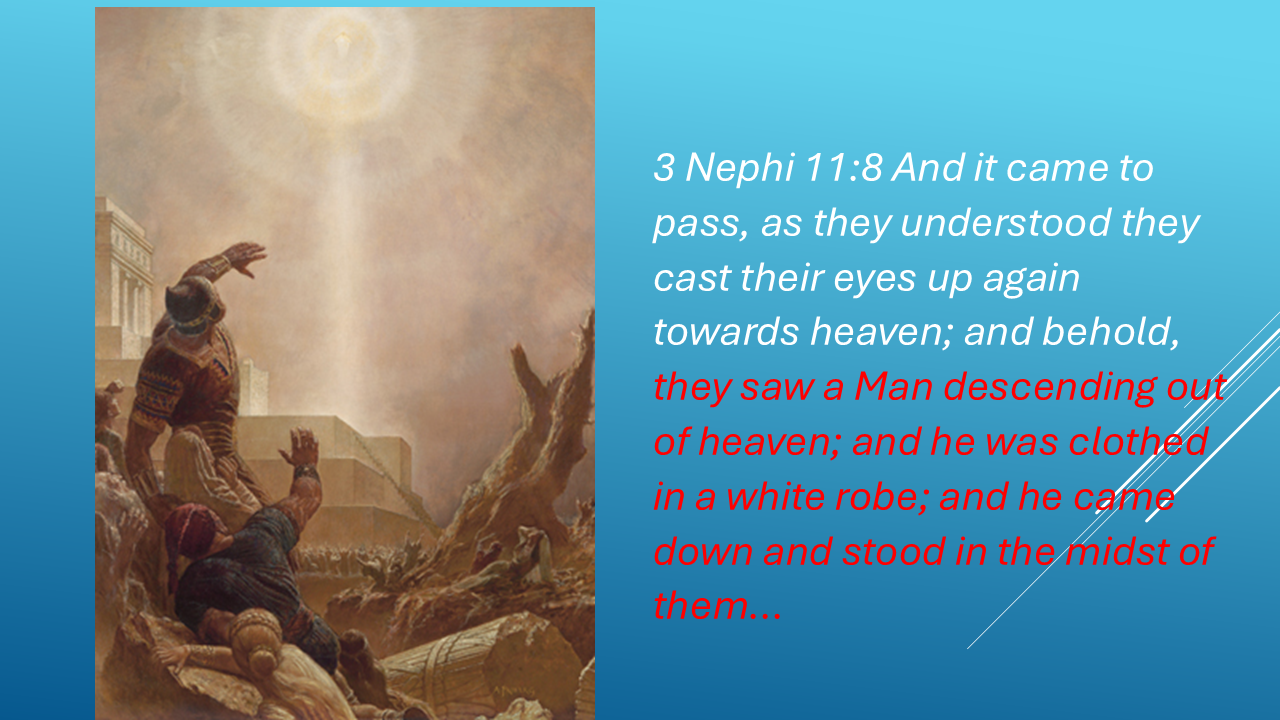
And then:
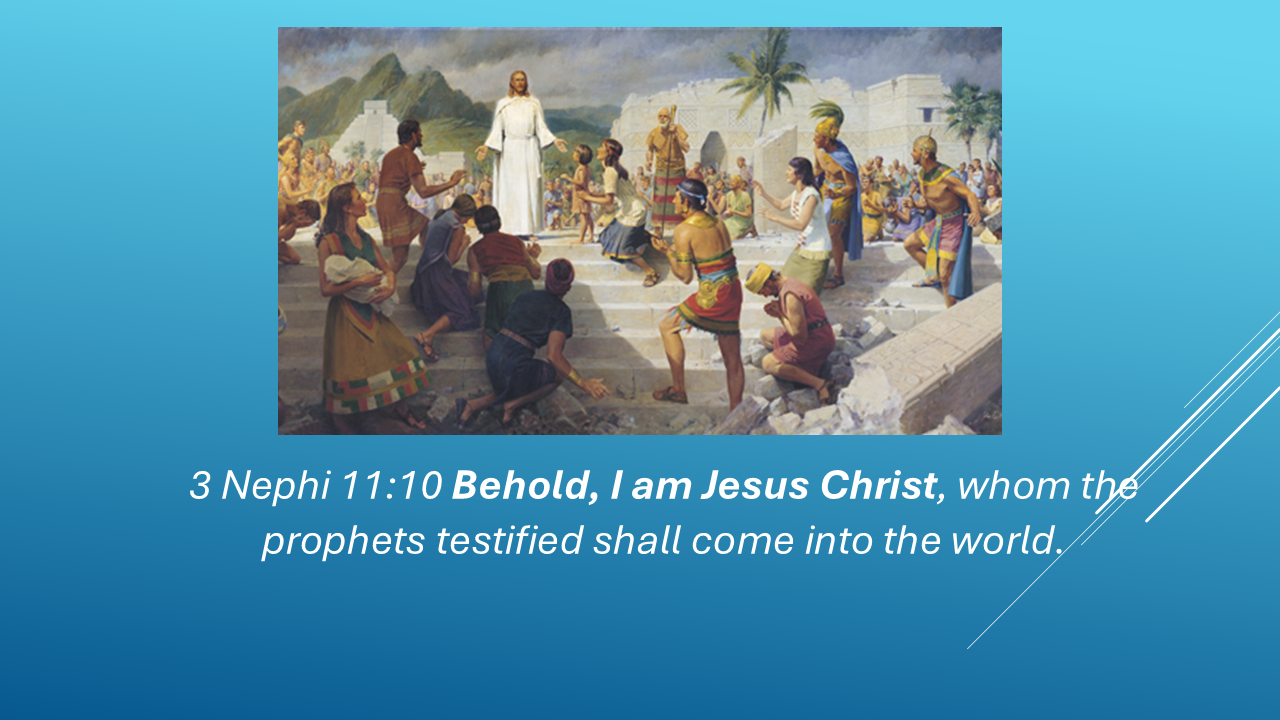
So now we have our geographical clue.
The people were gathered around a temple.
The temple was in the land Bountiful.
And Jesus Christ descended from heaven and appeared to them there.
Which brings us to our investigation:
WHERE WAS THIS TEMPLE?
TWO BOUNTIFULS
Remember in Part 8, we identified two possible lands Bountiful in Central America.
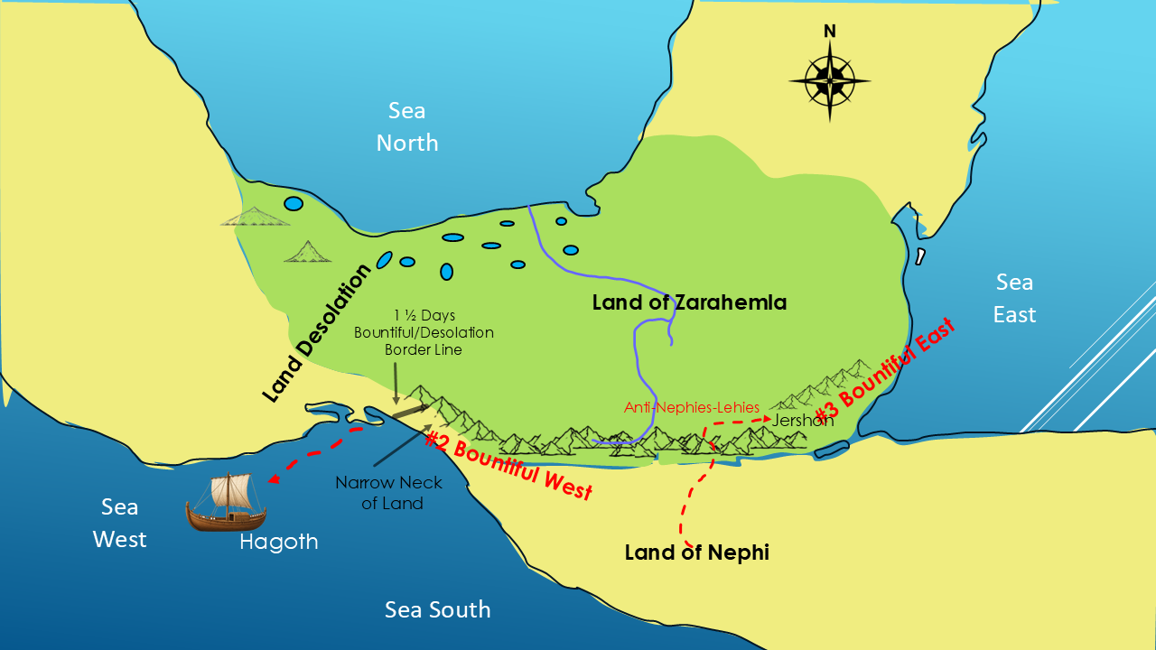
One was the Land Bountiful East.
The other was the Land Bountiful West.
So, here's the question:
EAST OR WEST?
Was the temple where Jesus appeared located in the eastern Bountiful?
Or was it in the western Bountiful?
The Book of Mormon doesn't simply give us a modern name and tell us where to put it.
But Mormon gives us additional geographical descriptions that may provide another clue.
THE RETREAT NORTH
Near the end of the Book of Mormon, around 328 AD, a war began between the Nephites and Lamanites in the borders of Zarahemla, near the River Sidon.
Mormon had lived in the land northward.
But when he was only eleven years old, his father took him into the land southward, to the land of Zarahemla.
At fifteen, Mormon saw the Lord.
And by the age of sixteen, he was leading the Nephite armies.
But when the Lamanites attacked, Mormon's army became frightened.
Mormon decided to withdraw from the land of Zarahemla altogether and return toward the north.
So they retreated:
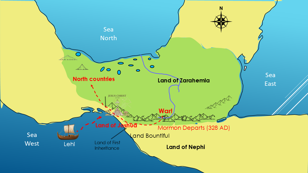
“towards the north countries.”
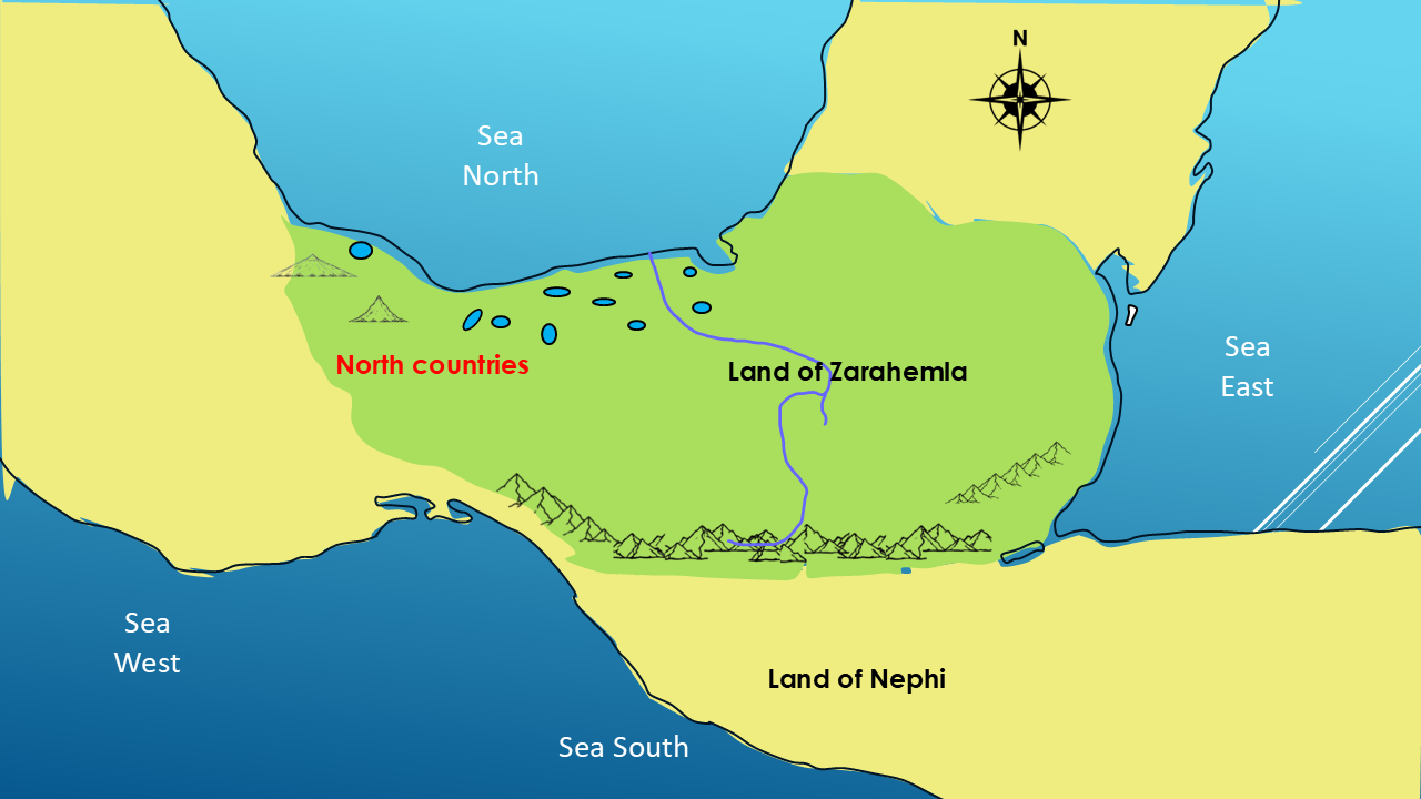
And those north countries were in the land northward, beyond the narrow neck of land.
Now watch what happens next.
As Mormon and his army retreated northward, they followed the western coastal route.
Mormon tells us they marched:
There it is.
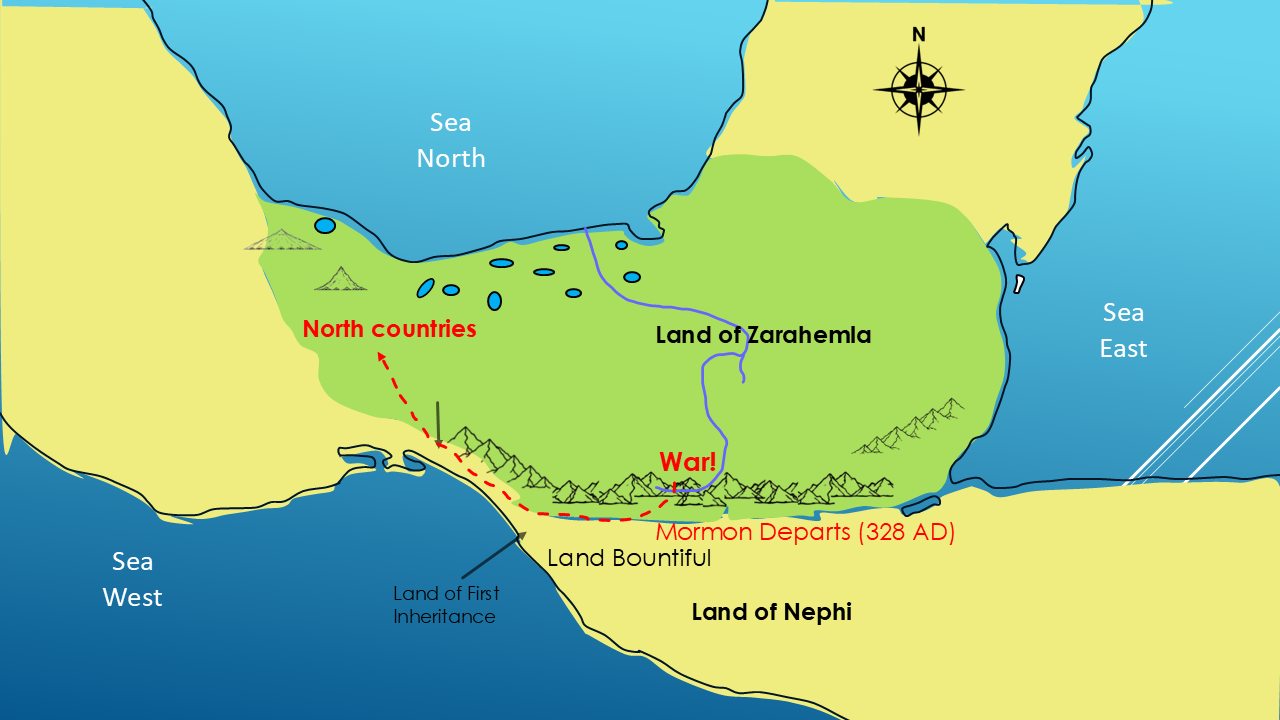
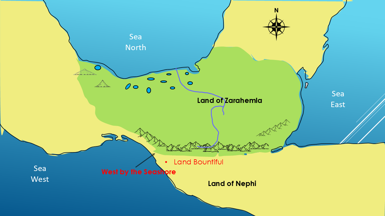
WEST BY THE SEASHORE.
That description gives us another geographical clue.
And this is where the investigation becomes especially interesting.
WHAT'S AT THE WESTERN BOUNTIFUL?
We've now narrowed our investigation to the western side of our proposed Land Bountiful.
But is there actually anything there that could fit the description of the Book of Mormon?
There is.
IZAPA
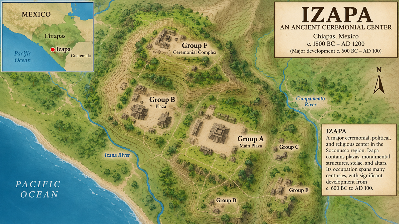
Izapa is an ancient archaeological center located in Chiapas, Mexico, near the Pacific coast.
And this isn't simply a collection of ruins.
Mexico's National Institute of Anthropology and History describes Izapa as a ceremonial, political, and religious center of the Soconusco region for nearly a thousand years.
The site contains plazas, monumental structures, carved stone monuments, stelae and altars.
And its occupation extends across the very period of history we're investigating.
So now we have something very interesting.
A major ancient ceremonial center…
on the western side of our proposed Land Bountiful…
near the seashore.
But now we’re going to look at something much more specific.
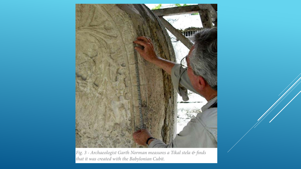
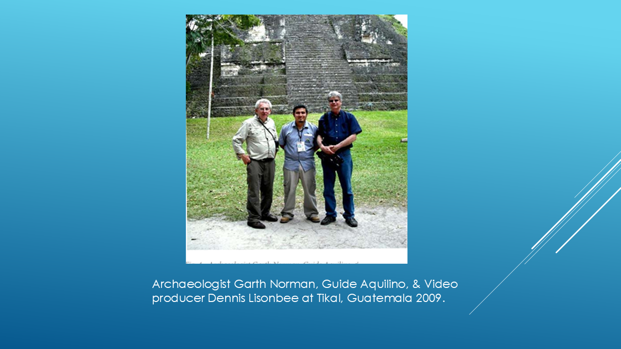
This is archaeologist V. Garth Norman conducting field research in Mesoamerica.
Norman spent decades studying the monuments and architecture of ancient Mesoamerica.
And while examining ancient monuments, he began looking very closely at their measurements.
In particular, he reported repeatedly finding a measurement of approximately 495 millimeters—
about 19 and a half inches.
Norman believed this measurement was significant because it corresponded to what is known as the Royal Babylonian cubit.
And he didn't simply find the measurement once.
He reported finding the same basic measurement in monuments at several Mesoamerican sites.
[Pause.]
But there was something even more interesting.
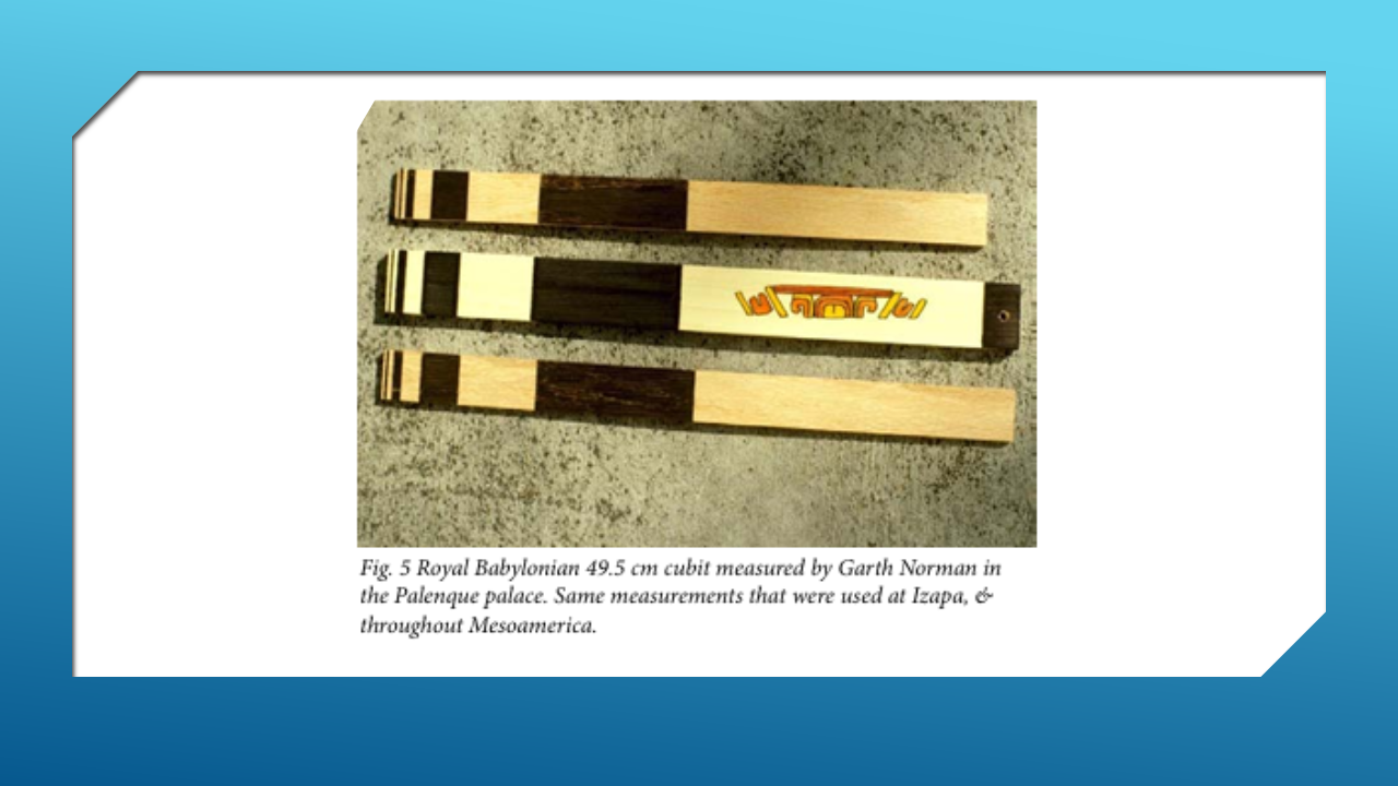
Norman reported that he identified what he believed was an Izapan cubit measuring rod.
Here we can see examples of the 49.5-centimeter measurement that Norman associated with the Royal Babylonian cubit.
That's about 19 and a half inches.
Norman reported that this same measurement was found at Izapa and elsewhere in Mesoamerica.
His argument was that the repeated use of this precise unit was difficult to explain as an independent coincidence.
He believed it pointed to a possible ancient Near Eastern connection.
Now, I want to be very careful.
This is Norman's interpretation of the evidence.
It is not accepted by mainstream archaeology as proof of an ancient Near Eastern migration.
But the measurements themselves can be examined.
And that's what we're doing.
We're investigating the evidence.
And this wasn't simply an idea Norman developed from studying photographs or books.
He spent years in the field examining ancient sites and monuments firsthand.
He measured them.
He compared their dimensions.
And he looked for patterns that might reveal how these ancient structures were designed.
His work eventually led him to a much larger question:
Were some Mesoamerican structures built according to measurement systems and architectural patterns that originated in the ancient Near East?
[Pause.]
And that's where our investigation takes another fascinating turn.
A TEMPLE PATTERN FROM THE OLD WORLD?
Remember something very important from the Book of Mormon.
When Nephi established his people in the land of Nephi, he said:
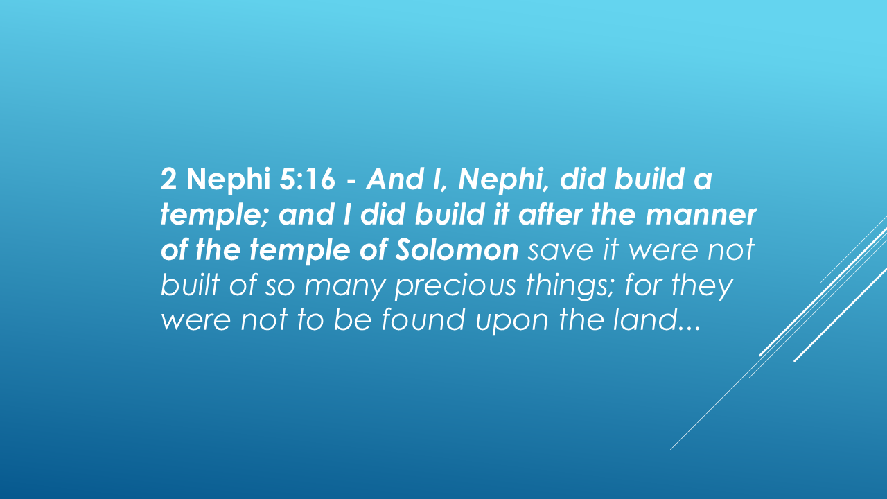
So, the Book of Mormon itself gives us an architectural standard:
The Temple of Solomon.
Now look at what researcher Dr. Richard Hauck reported about Group B at Izapa.
Hauck studied the layout and proportions of the structures at Group B and compared them with the sacred architecture described in the Bible.
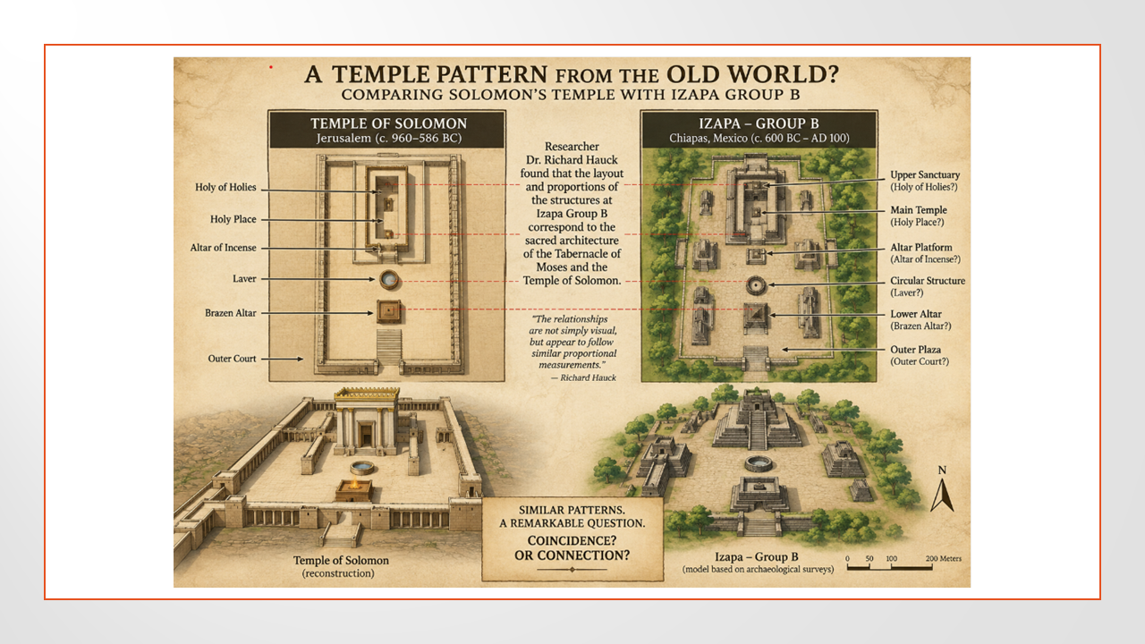
He reported similarities in the layout and proportions of the structures to the Temple of Solomon and the Tabernacle of Moses.
[Let the graphic sit on screen.]
The question isn't whether these structures look exactly like Solomon's Temple.
They obviously don't.
The question is whether the underlying proportions and spatial relationships could reflect a similar architectural pattern.
COINCIDENCE OR CONNECTION?
(Pause)
[Show the Izapa Group B portion larger.]
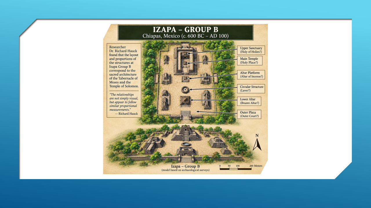
So, what do we have?
We've identified a major ancient ceremonial center at Izapa.
We've placed it in the western coastal region of our proposed Land Bountiful.
We have Garth Norman's reported 495-millimeter measurement.
We have his claim of an Izapan measuring rod using that unit.
And we have Richard Hauck's reported architectural comparison between Izapa Group B and the sacred architecture of the Old World.
Are these simply coincidences?
Or could they point to an ancient connection?
[Pause.]
We don't know.
And I'm not going to tell you that they prove Izapa is the Land Bountiful.
But we're not looking for proof from one clue.
We're looking at multiple clues and asking whether they fit together.
Now let's return to Mormon.
As Mormon was retreating northward, he tells us that he came to the land of Joshua.
And then he gives us a very unusual geographical description.
Let’s look at what we have:
We have our basic Central American Map with Southern Mexico and Guatemala.
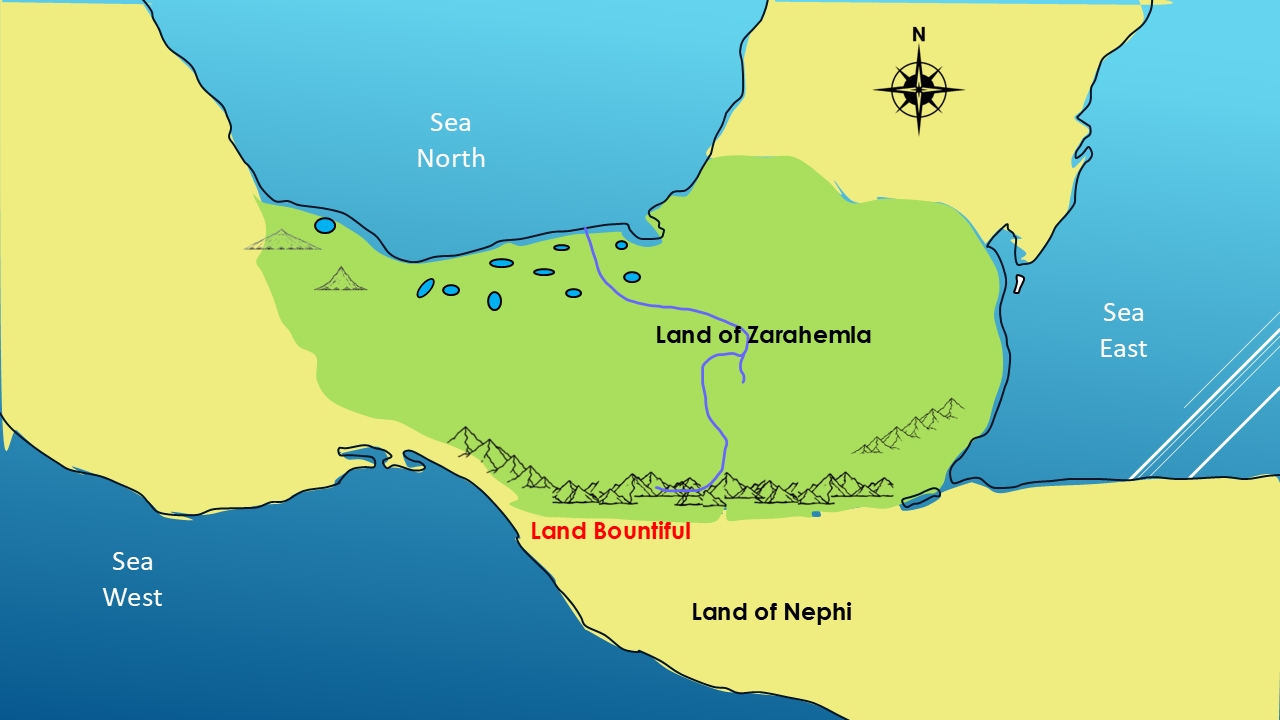
We have the LAND BOUNTIFUL
It is WEST BY THE SEASHORE
Then we have the ancient city of IZAPA
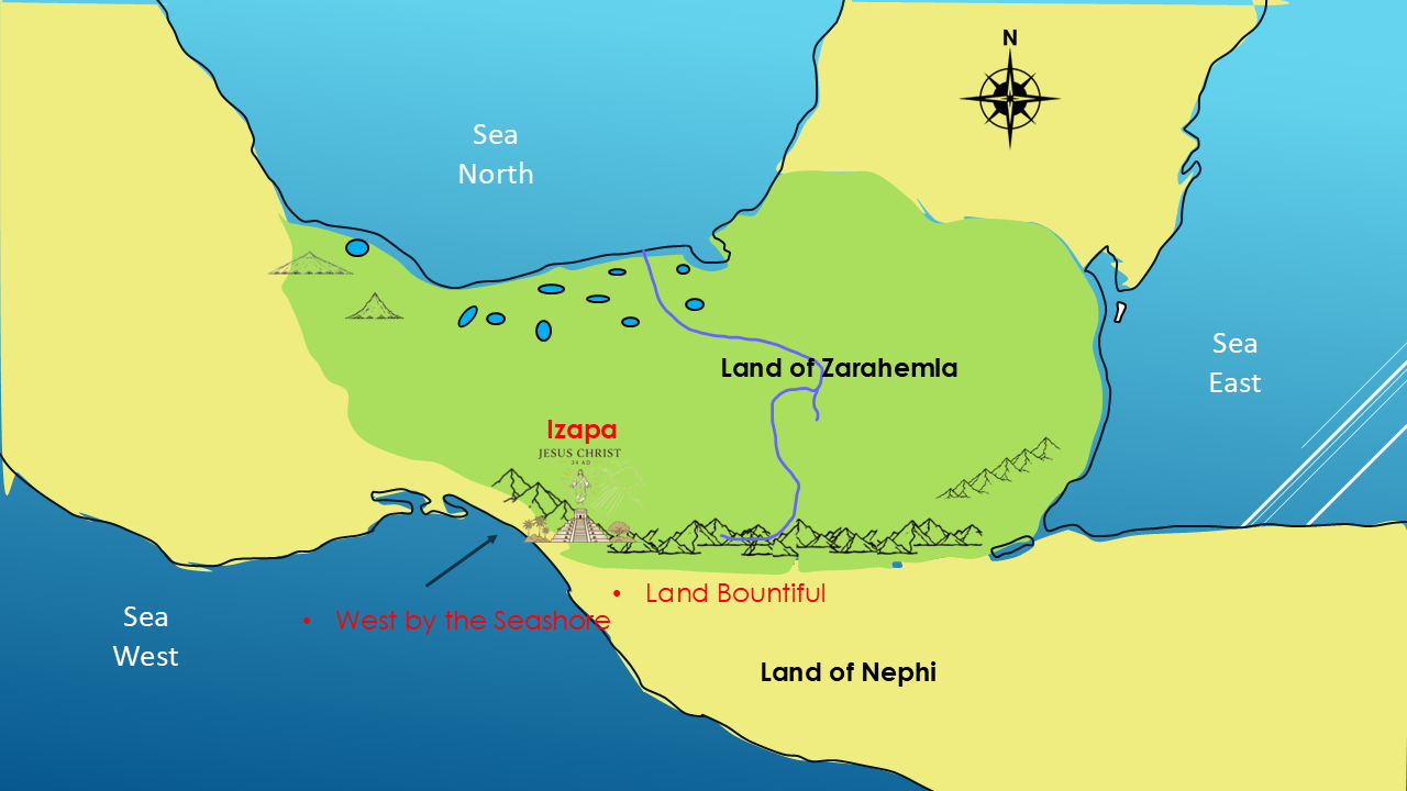
It was a MAJOR CEREMONIAL CENTER
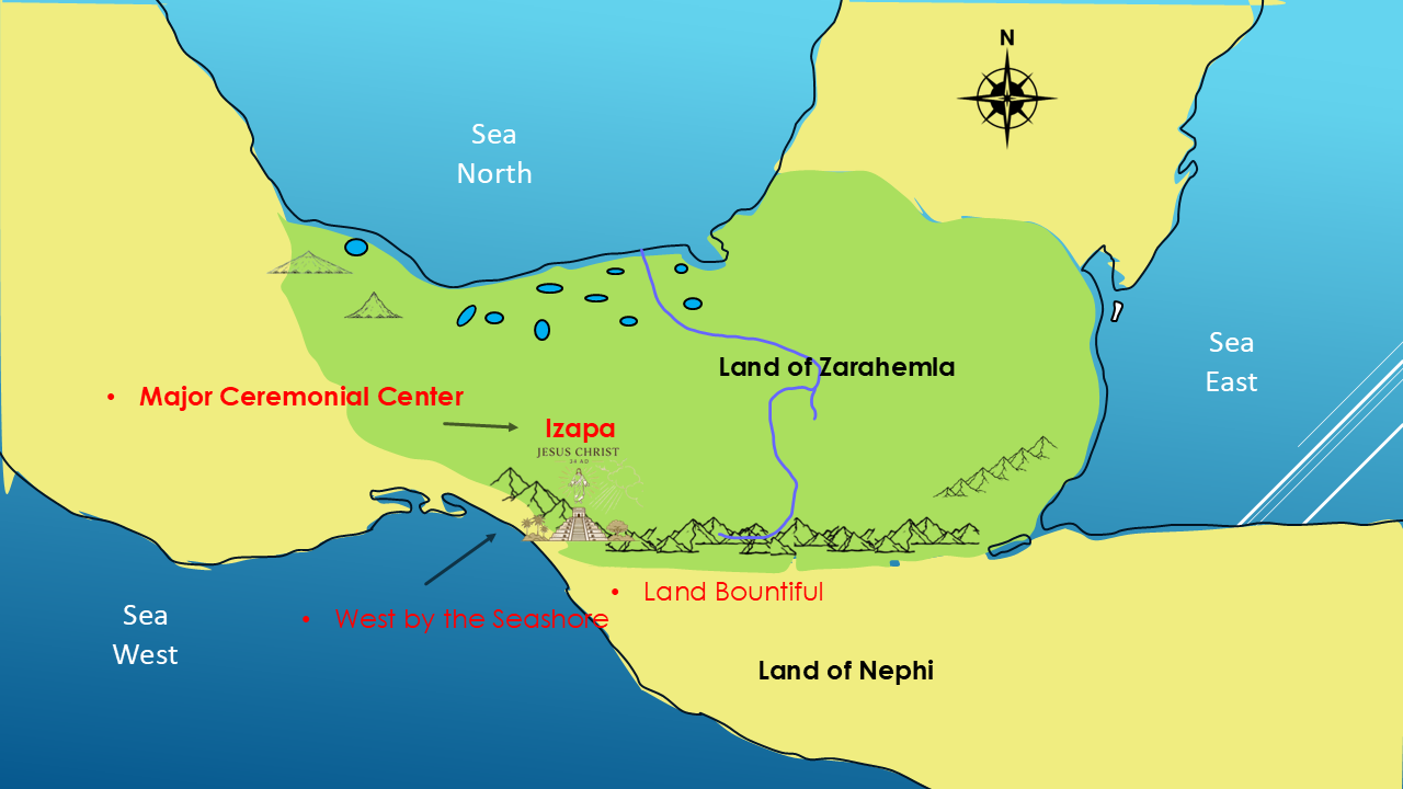
It has NEAR EASTERN MEASUREMENTS?
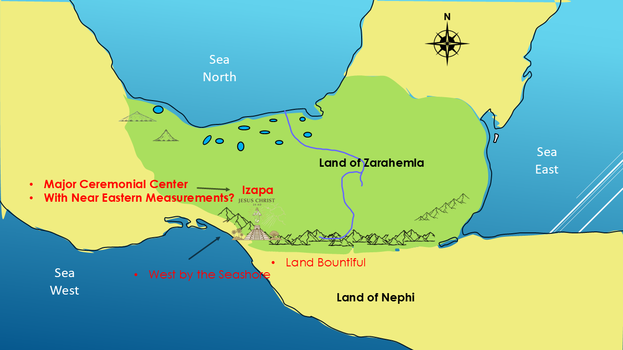
It has similar TEMPLE PROPORTIONS to the Solomon Temple in Jerusalem?
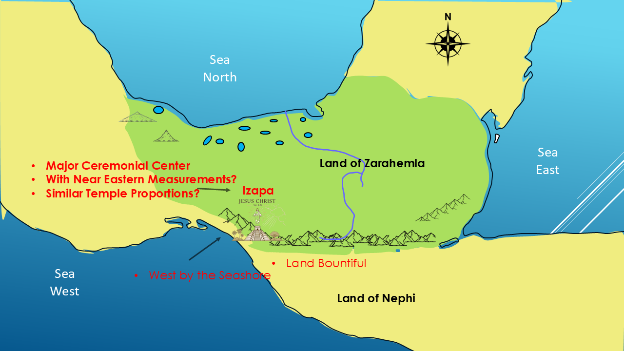
So, let's put these clues together.
The Book of Mormon describes a Land Bountiful.
The people gathered there around a temple.
Jesus Christ appeared to them after His resurrection.
Later, Mormon describes the land of Joshua as being west by the seashore.
And in this same general region we find Izapa—a major ancient ceremonial center with monumental architecture.
We also have reported evidence of a 495-millimeter measurement that Garth Norman believed corresponded to an ancient Near Eastern cubit.
And another researcher has argued that the layout and proportions of Izapa correspond to the sacred architecture described in the Bible.
Are these connections?
Coincidences?
Or evidence of something much more significant?
Is Izapa the temple at Bountiful?
We don't know.
But now...
you have something real to investigate.
Moving on to the next clue. WHY JOSHUA?
That western coastal area appears to have been significant throughout Nephite history.
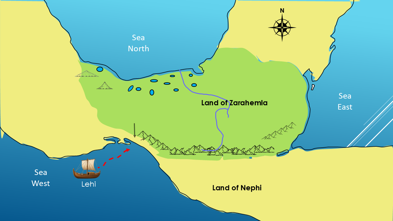
It may have been connected to Lehi's first landing.
Lehi eventually died there, and was presumably buried there.
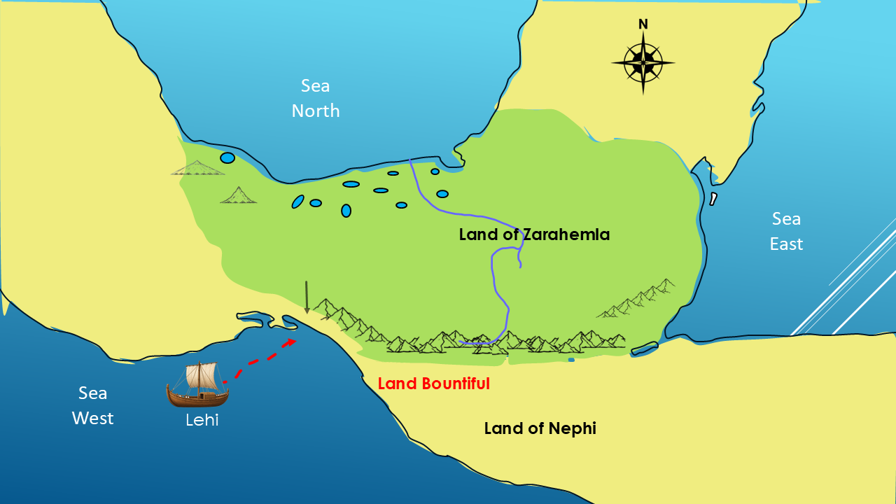
And the fertile area along that western coast was called the land Bountiful.
But there is another reason this area may have been especially significant.
The most important event to occur at Bountiful may have been the appearance of Jesus Christ Himself to the people gathered around the temple.
And then, more than 300 years later, Mormon's army retreats to this same general area.
But by then, Mormon calls it:
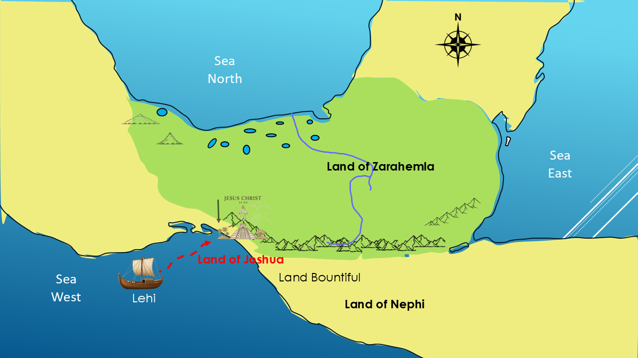
“the land of Joshua.”
So here's our next question:
WHY JOSHUA?
Over more than 1,000 years of Nephite history, could the same general area have been known by different names?
The Book of Mormon describes:
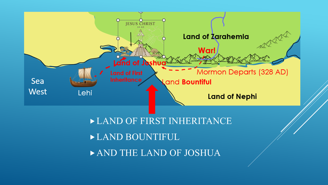
The Land of First Inheritance
The Land Bountiful.
Later:
The Land of Joshua.
And perhaps there is another clue.
Think about a modern example.
Where was the Great Salt Lake in 1847?
At the time, the area was part of Mexico.
Later, it was associated with the territory of Deseret.
And today, it is in Utah.
The location didn't move.
The name changed.
If one place can have different names in only 150-plus years, what might we expect over a thousand-year period in the Book of Mormon?
So perhaps the land of Bountiful and the land of Joshua were different names for the same general area.
But why would Mormon call it Joshua?
Now we've come to an intriguing possibility.
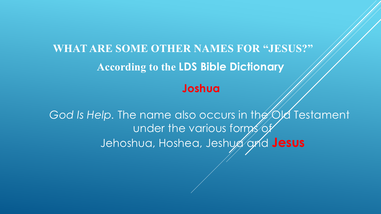
The LDS Bible Dictionary says:
“Joshua…occurs in the O.T. under the various forms Jehoshua, Hoshea, Jeshua, and JESUS.”
So ask yourself:
WHY WOULD MORMON NAME THIS AREA “JOSHUA”?
Could the name have been connected to Jesus Christ?
Could Mormon have been preserving a name associated with the Lord's appearance at Bountiful more than 300 years earlier?
We don't know for sure.
It could be.
It could be a coincidence.
Or it could be another clue.
You decide how much weight to give it.
BRINGING THE CLUES TOGETHER
Let's put the clues together.
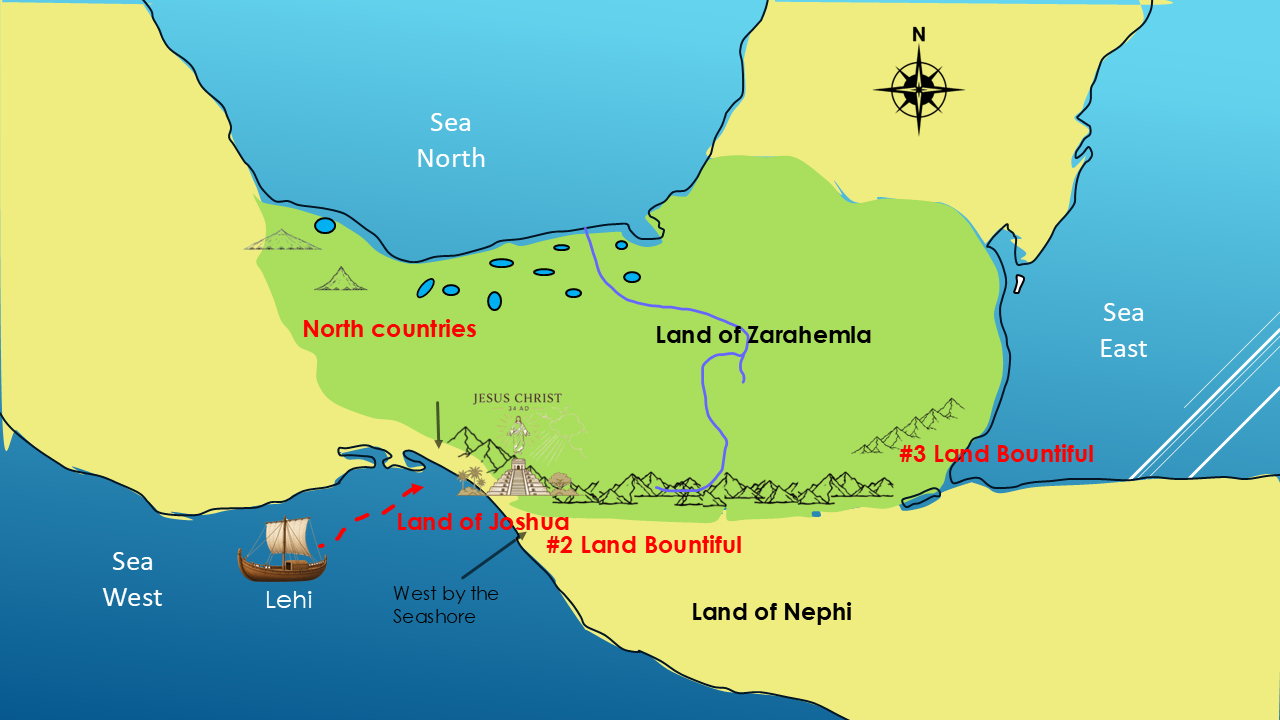
The people were gathered around a temple.
The temple was in the land Bountiful.
Jesus Christ appeared there after His resurrection.
Later, Mormon describes a land:
“west by the seashore.”
That land was called:
“Joshua.”
And Joshua is a biblical name associated with Jesus.
So, which of our two Bountiful locations best fits the evidence?
The Book of Mormon gives us the clues.
We've put those clues on the map.
And now you can decide what you think the evidence shows.
THE SERIES CONCLUSION
This concludes my Part 10 in the series The Big Picture of the Book of Mormon.
But the investigation isn't over.
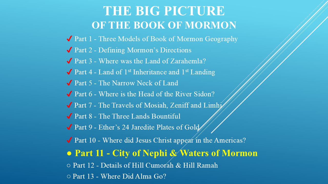
There are still some very important locations to investigate.
Where was the City of Nephi?
Where were the Waters of Mormon?
Where was the Land of Mormon?
Where did Alma go after fleeing King Noah?
And what were the details surrounding the Hill Cumorah and Hill Ramah?
I believe the Book of Mormon gives us clues to each of these questions.
If these clues are making sense to you, please press the Like button.
So, if you want to continue the investigation, make sure you're subscribed to the Mormon Mann Channel.
FINAL QUESTION
When I began this journey, I wanted to answer one question:
“Where did these events happen?”
But after following Mormon's descriptions from place to place, another question began to emerge.
“How did Joseph Smith produce a record with this level of geographical detail, internal consistency, and complexity?”
We've followed the rivers.
We've followed the mountains.
We've followed the seas.
We've identified lands, cities, wildernesses, borders, and directions.
And we've placed Mormon's descriptions on a modern map.
So now, after everything we've investigated together...
How did Joseph Smith do it?
I'll let you answer that question for yourself.
But here's something to consider:
Joseph Smith said he translated the gold plates by the gift and power of God.
Those plates contained an ancient record that had been compiled and preserved by prophets, including Mormon, more than a thousand years before Joseph Smith ever saw them.
And the geographical details we've just investigated are part of that record.
So perhaps the question isn't simply:
“Where did these events happen?”
Perhaps the bigger question is:
“How did Joseph Smith know all of this?”
But don't take my word for it.
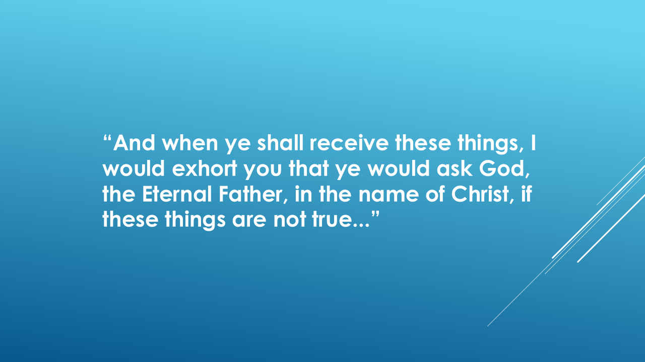
Moroni gave the reader a way to find out for themselves.
He wrote:
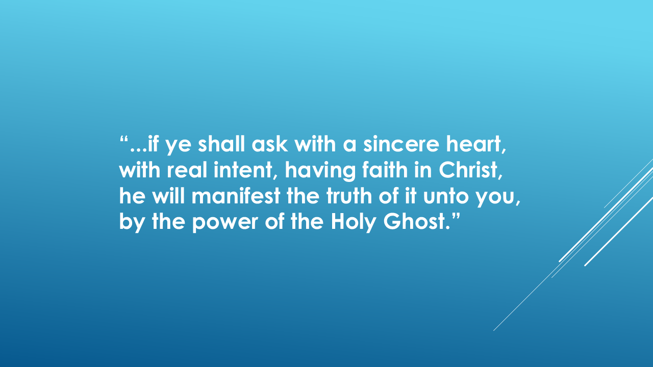
And then he gave this promise:
And finally:
“And by the power of the Holy Ghost ye may know the truth of all things.”
So, we've investigated the evidence.
We've followed Mormon's descriptions.
We've put them on a modern map.
And now Moroni asks you to take the final step:
PRAY ABOUT IT.
Ask God.
Ask sincerely.
Let the Holy Ghost reveal the truth of all things!
And then decide for yourself.
I'm Kendall, the Mormon Mann.
Thank you for joining me on The Big Picture of the Book of Mormon.
And remember:
Don't just accept the conclusion.
Investigate the evidence.
Goodbye until next time and have a blessed day.