
The Big Picture of the Book of Mormon
The Three Book of Mormon Geography Models
Which One Fits Mormon's Directions?
Part 1 of 13
What if Mormon left enough geographical clues in the Book of Mormon to locate where its events actually happened?
What if those clues point to one specific location in the Americas? Today we're going to compare three competing models on where the location of the Book of Mormon took place and see which one best fits Mormon's own descriptions.
What if we could take the Book of Mormon's own geographical descriptions...
and actually put them on a map?
Not somebody's theory.
Not somebody's tradition.
Not where we think the Book of Mormon should have happened.
But simply this:
What did Mormon actually describe?
And then...
which of the proposed geographical models follows those descriptions?
That's what we're going to investigate.
I'm Kendall, the Mormon Mann.
First, I want to let you know that I am not an authority from The Church of Jesus Christ of Latter-day Saints, I am simply a member of the Church. (Slide 5)
I want to establish the fact that the official Church of Jesus Christ of Latter-day Saints’ position on the location of the Book of Mormon is that it takes place “Somewhere in the Americas”.
And I want to make something else clear.
I already have a spiritual testimony that the Book of Mormon is true.
I believe that the angel Moroni delivered the gold plates to Joseph Smith, and that Joseph Smith, through the power of God, translated those plates.
I testify that the Book of Mormon is true.
So, I'm not doing this investigation because I need to prove the Book of Mormon is true to myself.
I'm doing it for FUN!
I find this absolutely invigorating.
To me, it's like putting together a giant puzzle...
or doing a connect-the-dots exercise where Mormon has given us the dots, and we're going to see what picture they create.
And that's really the approach we're going to take throughout this series.
We're going to look at the clues.
We're going to follow the directions.
We're going to put the pieces together.
And then we'll see which model best fits what Mormon actually wrote.
So...
moving right along.
Welcome to The Big Picture of the Book of Mormon.
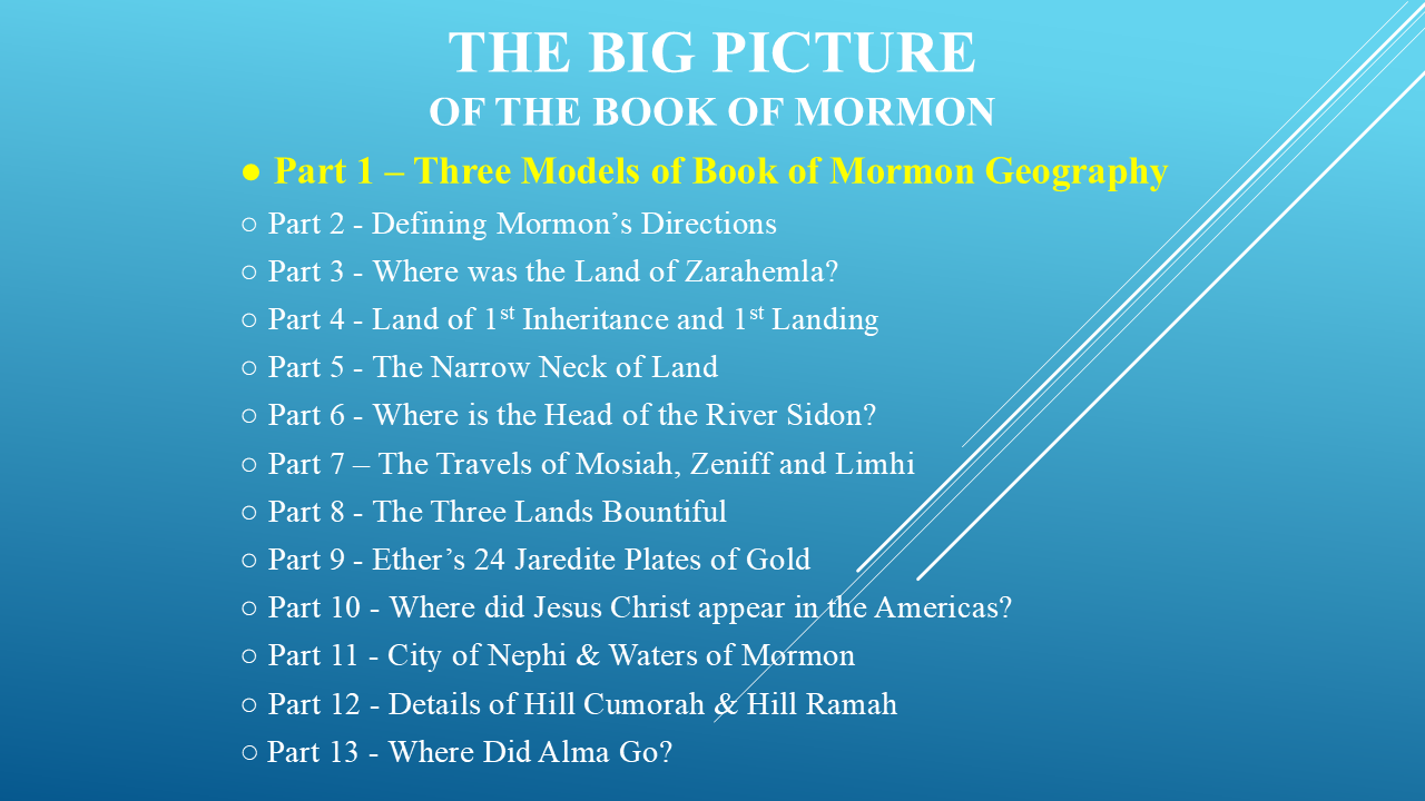
This series is a geographical investigation into the places, directions, mountains, rivers, seas, wildernesses and cities described by Mormon and the other Book of Mormon writers.
We're going to take those descriptions...
put them on modern maps...
and see where the clues lead us.
A SPIRITUAL TEST AND A GEOGRAPHICAL INVESTIGATION
Before we begin, I want to make one thing very clear.
The Book of Mormon itself gives us a method for determining whether it is true.
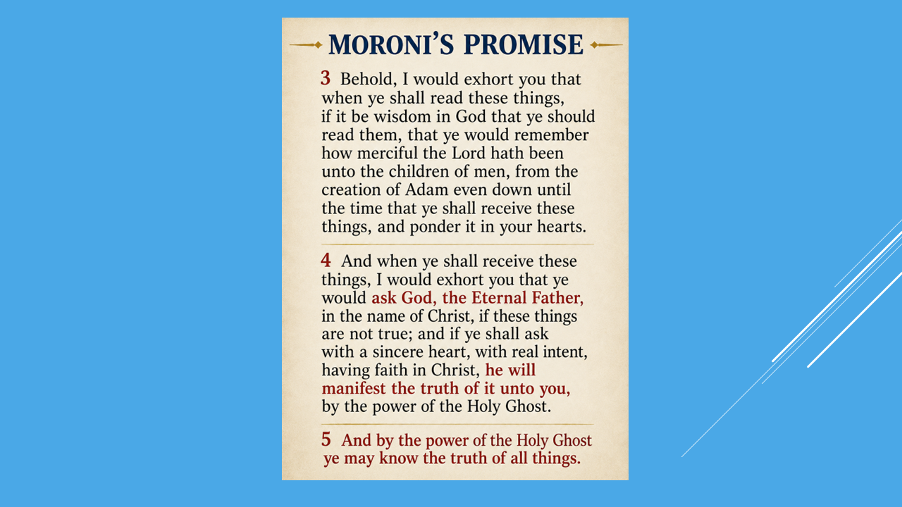
Moroni invites the reader to read these things, remember the mercy of God, ponder them in their hearts, and then ask God with a sincere heart, real intent, and faith in Christ.
That spiritual promise is extremely important.
But that's not what this particular series is about.
This series is about geography.
I'm not trying to replace a spiritual testimony with geographical evidence.
I already have a testimony of the Book of Mormon.
What I'm interested in doing here is something different:
Let's investigate the geographical record.
Let's see what happens when we take Mormon's descriptions seriously.
THE RULES OF THE INVESTIGATION
So here's the approach we're going to take.
I'm going to try to keep this series geographical.
We're going to look at what the Book of Mormon actually says.
We're going to identify the geographical relationships.
And then we're going to ask a very simple question:
Does the geography fit?
That's our test.
And there's something else that's important.
I'm not asking you to simply accept my conclusion.
Follow the clues with me.
Check the passages.
Look at the maps.
And make your own judgment.
And that principle is important—not just for this investigation, but for how we approach the Book of Mormon itself.
Elder Jeffrey R. Holland once gave some very good advice about the importance of evidence.
That's exactly the approach I want to take. I'm not asking you to believe my conclusion. I'm asking you to look at the evidence.
THREE MODELS
Today we're starting with the three major geographical models that have been proposed for the location of the Book of Mormon.
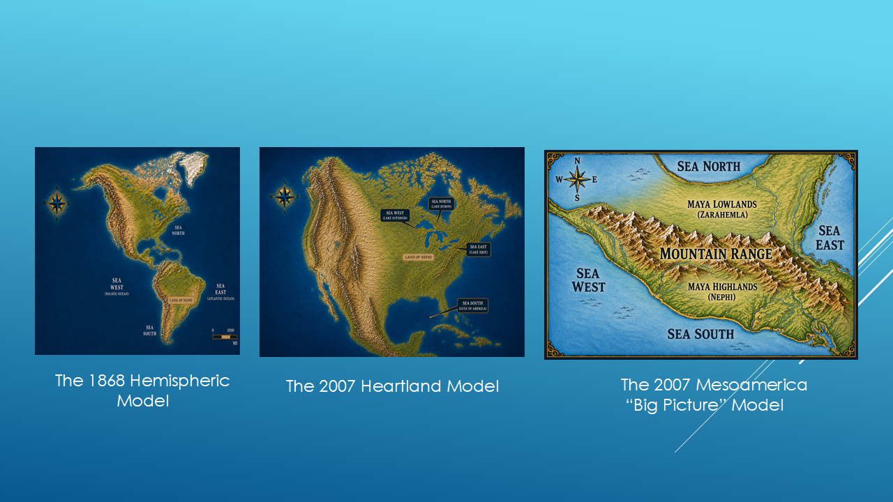
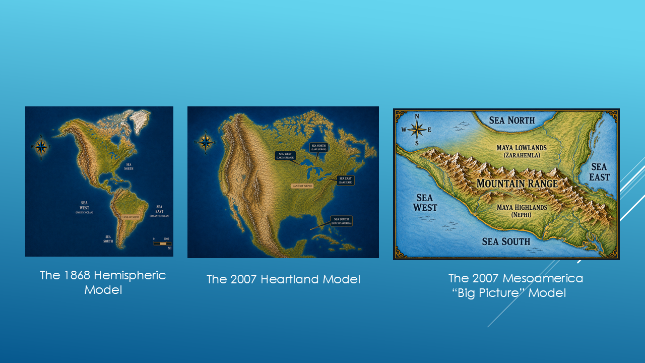
The first is the 1868 Hemispheric Model.
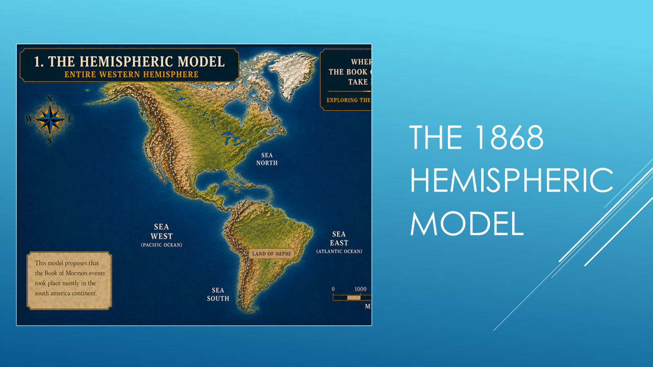
This model places the Land of Nephi in South America and uses the surrounding oceans as the Seas North, South, East and West.
The 2007 Heartland Model
The second model is: The 2007 Heartland Model. (Slide 7)
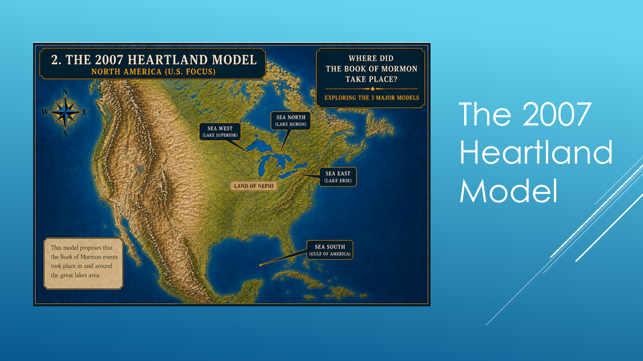
It looks at the Great Lakes area of the United States as being the central location of the Book of Mormon. The Great Lakes being the Seas North, South, East and West.
The 2007 Mesoamerica “Big Picture” Model
The third Model is the 2007 Mesoamerica “Big Picture” Model. (Slide 8)
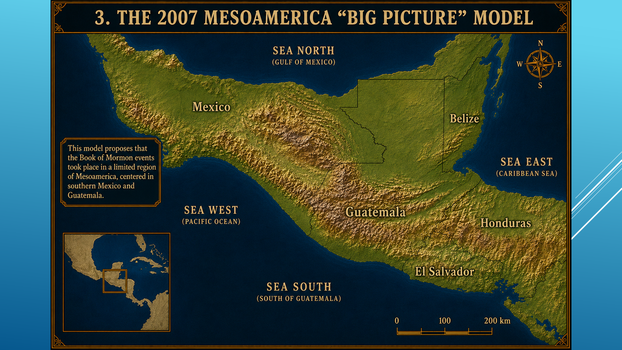
This model places the Book of Mormon geography in southern Mexico and Guatemala.
Here, the Gulf of Mexico represents the Sea North, the Pacific Ocean represents the Sea South and Sea West, and the Caribbean represents the Sea East.
So we have three models.
Three different geographical settings.
And now we're going to put them to the test.
The First Test – The Four Seas
Let's begin with Mormon's descriptions of the four seas.
Sea North.
Sea South.
Sea East.
Sea West.
Here is a brief look at the three different Models. (Slide 9)
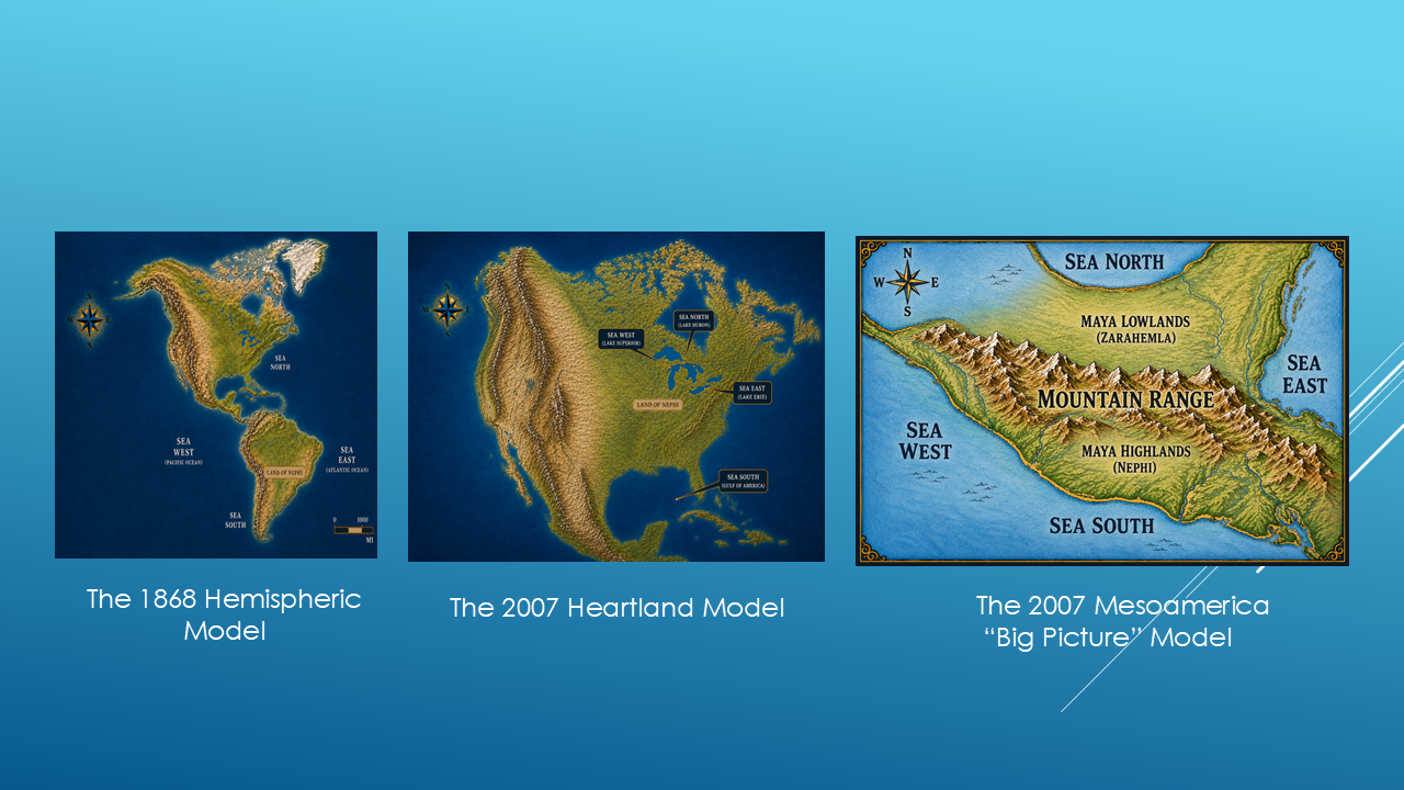
At first, this appears to be a pretty easy test.
And interestingly...
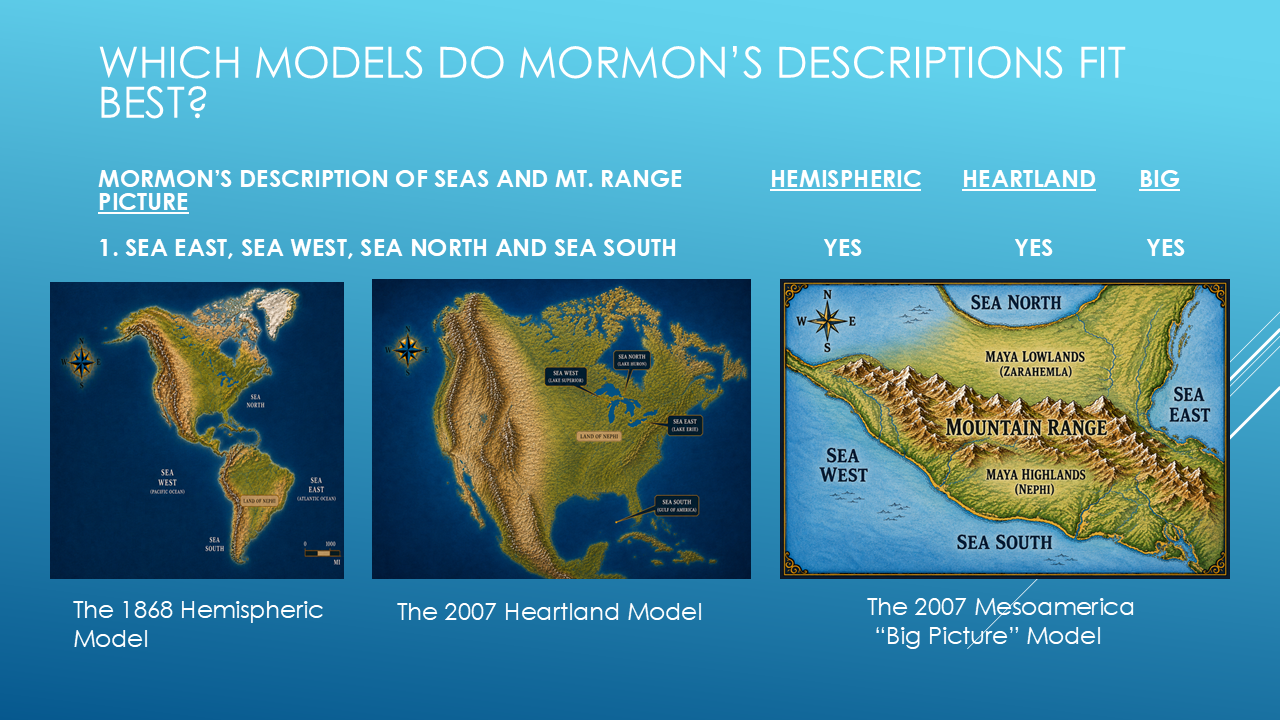
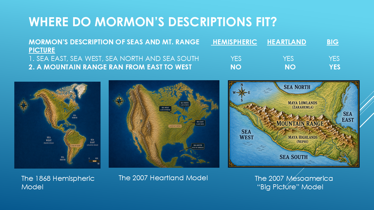
all three models can be made to accommodate four surrounding seas.
So at this point, we don't have a winner.
The first clue doesn't eliminate any of the three.
And that's important.
Because an investigation isn't about forcing every clue to support your favorite theory.
Sometimes a clue doesn't decide the question.
So let's move to the next one.
The Second Test – The East-West Mountain Range
Mormon describes a significant mountain range that ran East to West.
So here's our next question:
Where is the East to West mountain range?
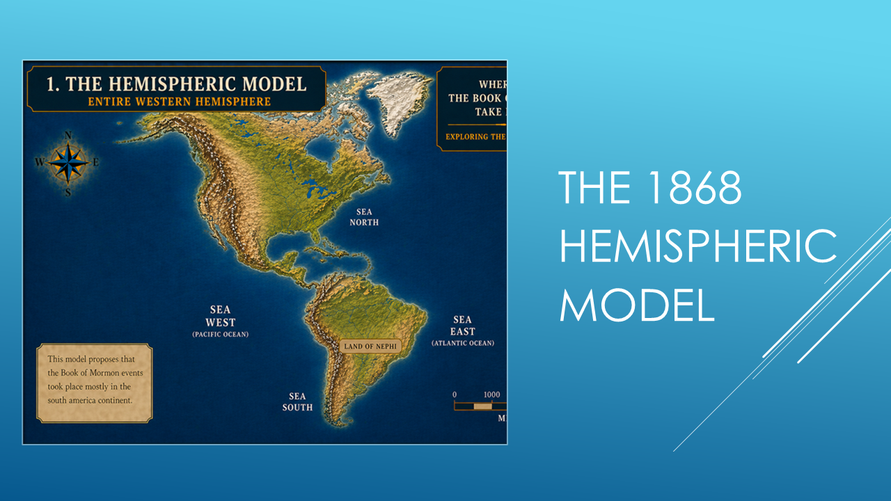
Look at the Hemispheric Model.
Where is the east-west mountain range that Mormon describes?
It's not there in the proposed location.
Now look at the Heartland Model.
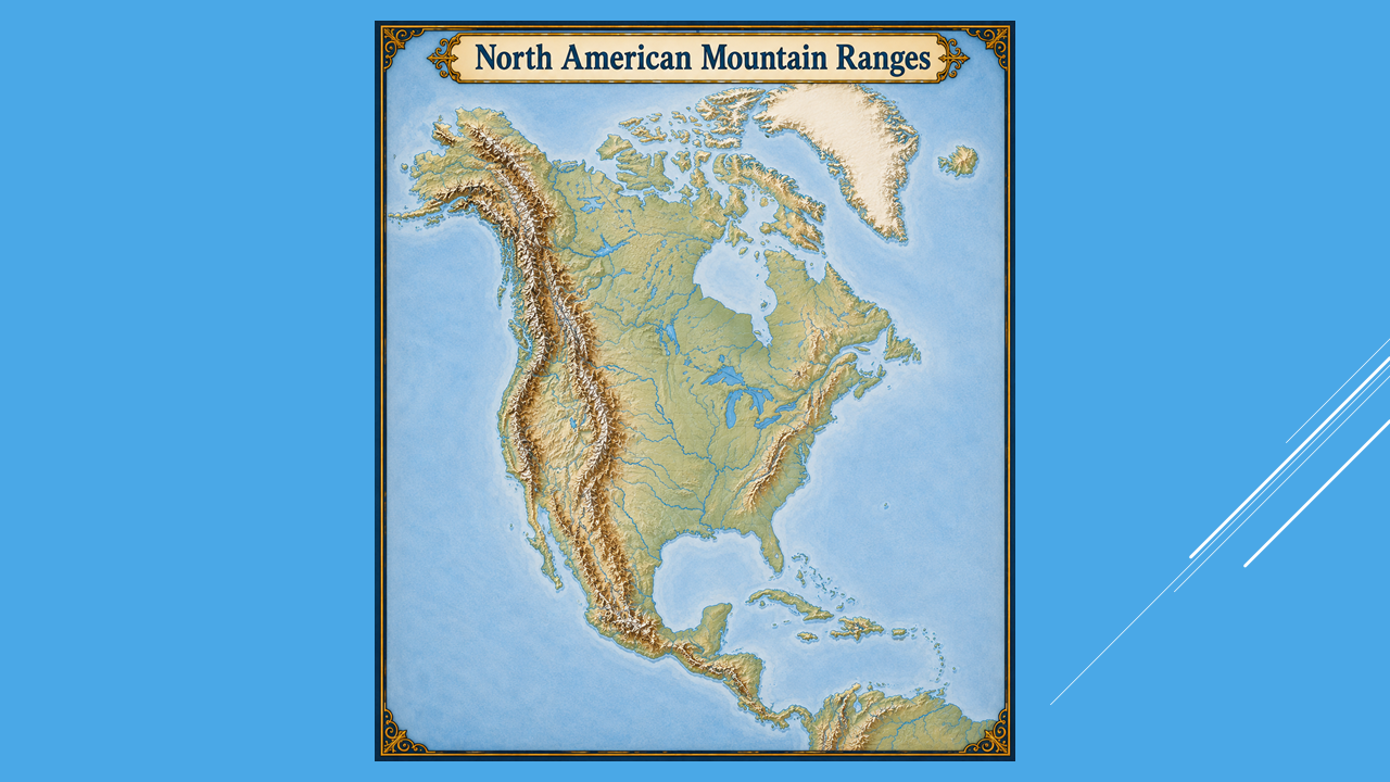
Again...
where is the mountain range?
The Appalachian Mountains are nearby, but they run generally north and south rather than east and west.
Now let’s look at the Mesoamerica model.
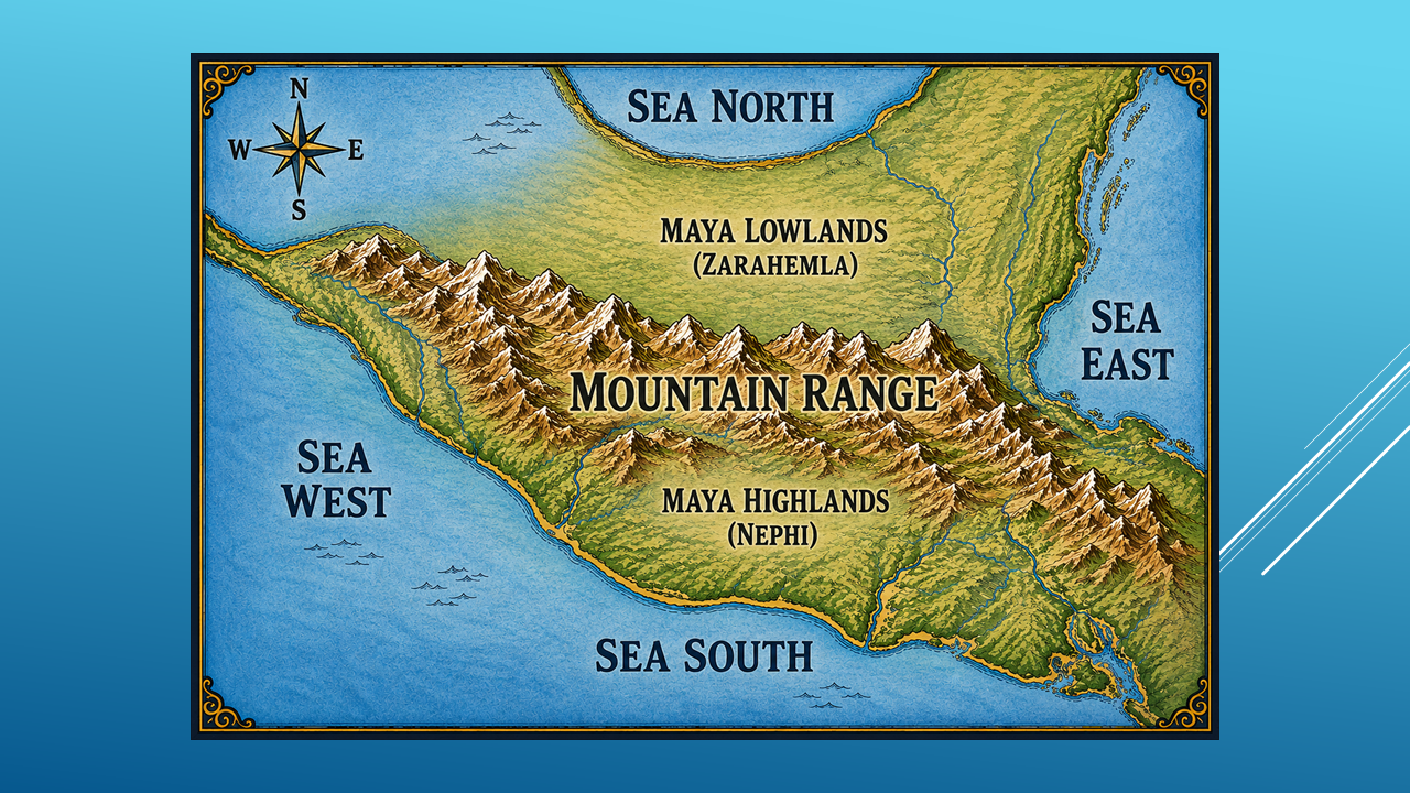
And this is where the investigation gets interesting.
We're no longer looking at a theoretical drawing.
We're looking at the actual topography of the region.
The mountain range runs across the land.
East to west.
Here we find something different.
There is a substantial mountain range running across the region.
So we have our first significant difference.
Two models don't appear to fit the description.
One does.
But we're not done.
THE THIRD TEST — FROM SEA TO SEA
Mormon gives us another geographical clue.
The mountain range doesn't simply exist.
It has a particular relationship to the seas.
So here's the question:
Does the mountain range extend from the Sea East to the Sea West?
Let's test all three.
The Hemispheric Model?
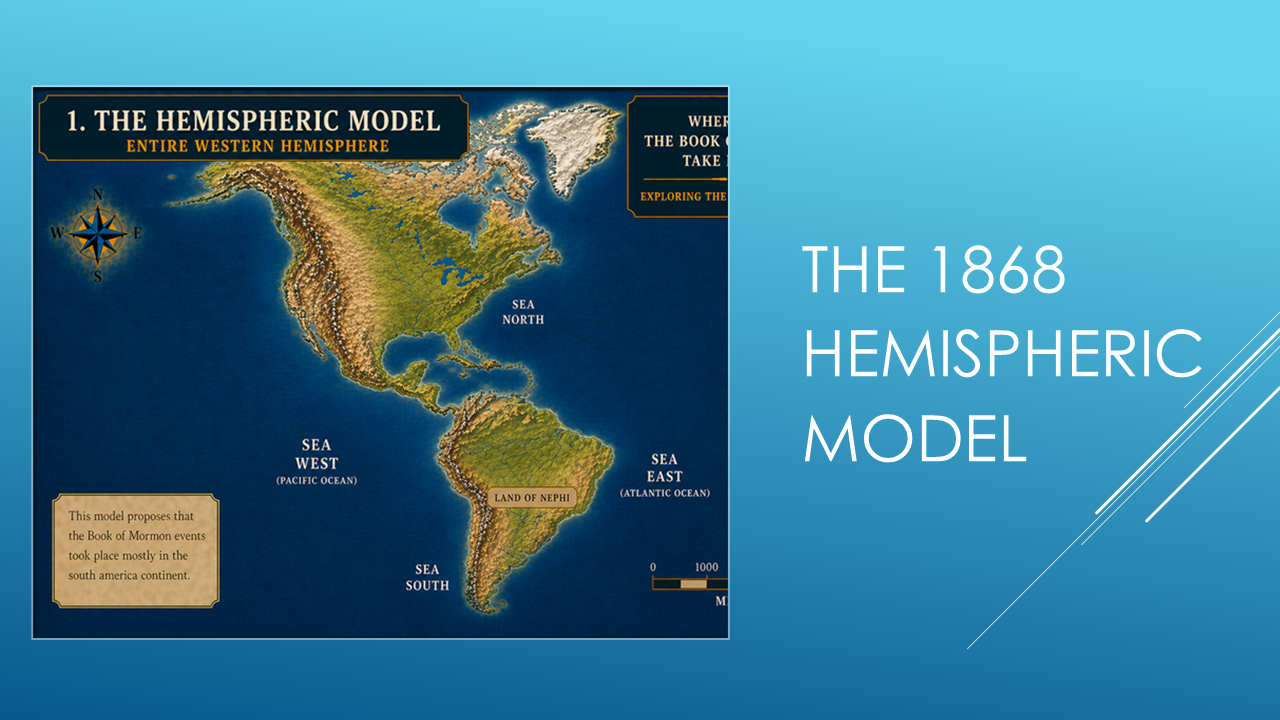
No corresponding east-west mountain range in the proposed location.
The Heartland Model?
Now let's step back and look at North America.
Most of the major mountain systems run generally north and south.
The Rocky Mountains.
The Sierra Nevada.
The Appalachian Mountains.
They generally follow that north-south pattern.
And look at the Great Lakes region where the Heartland Model is centered.
There is no comparable east-west mountain range running across the proposed Book of Mormon lands.
But in the Mesoamerica model...
there is a mountain range extending across the land between the two seas.
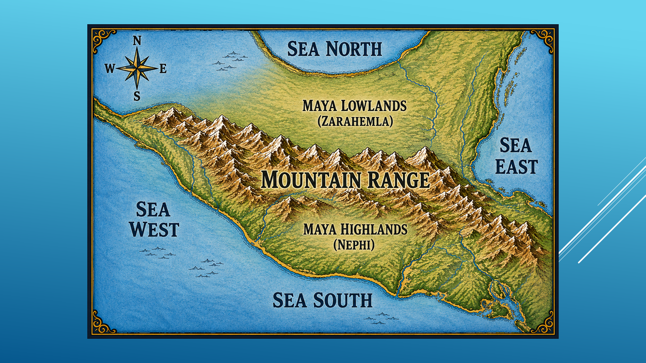
And this is where the investigation gets interesting.
We're no longer looking at a theoretical drawing.
We're looking at the actual topography of the region.
The mountain range runs across the land.
East to west.
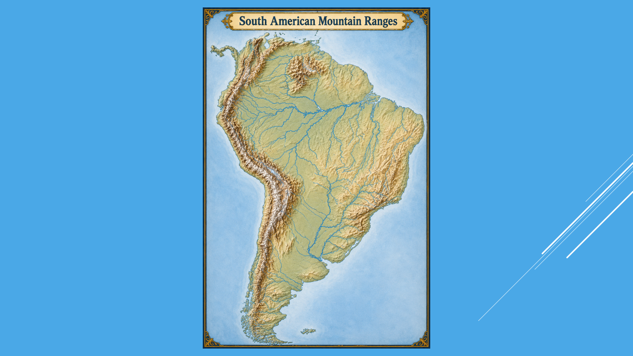
South America presents another possibility.
There is an east-west mountain range in the northern part of South America.
But now additional questions arise.
Does it provide the other geographical relationships Mormon describes?
Does it provide a Sea South?
Does it provide the lowlands north of the mountains?
Does it fit the rest of the network?
Those questions become important.
Because one clue by itself isn't enough.
We need to see whether the pieces continue to fit.
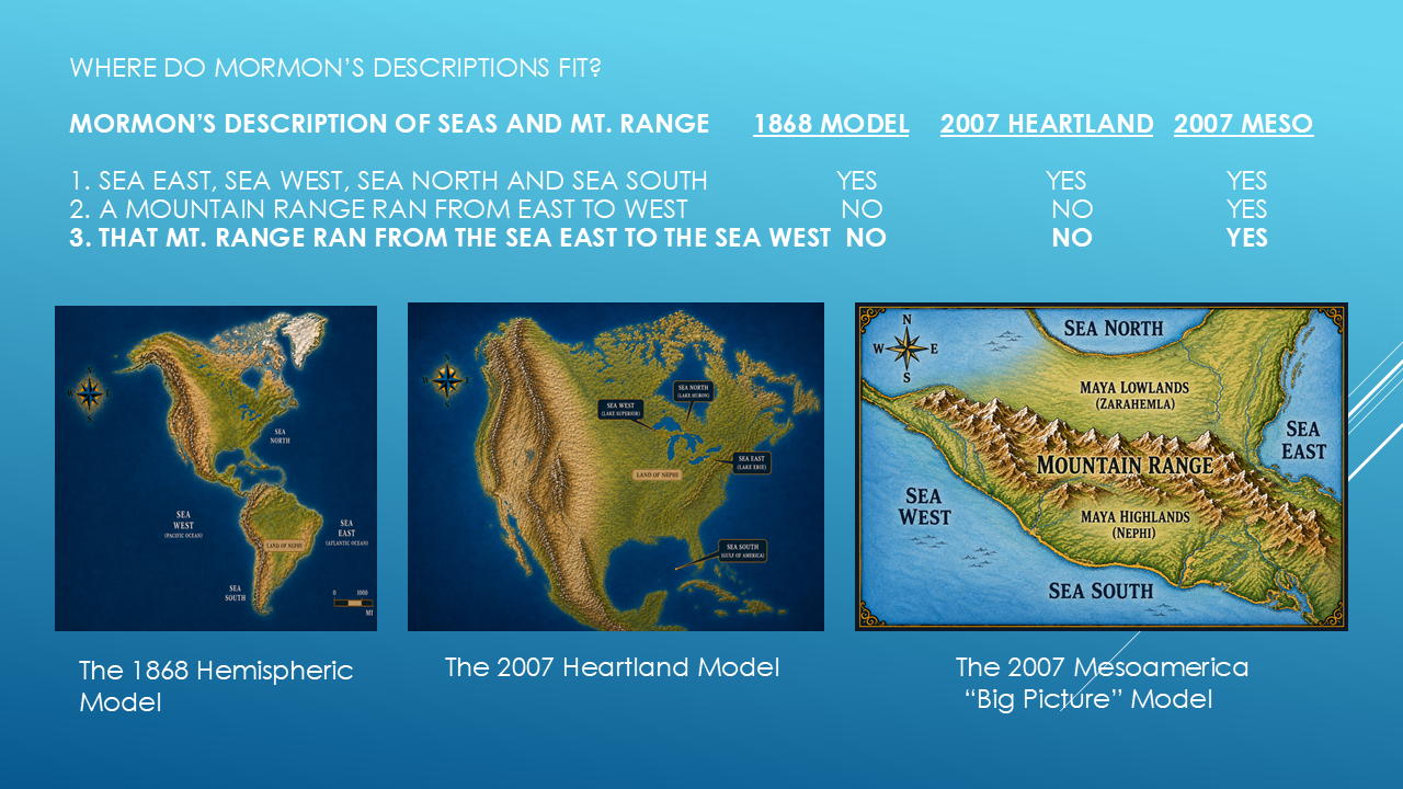
As you compare the description of the mountain range running from sea to sea…the only model that fits…is the Mesoamerican model.
THE FOURTH TEST — HIGHLANDS AND LOWLANDS
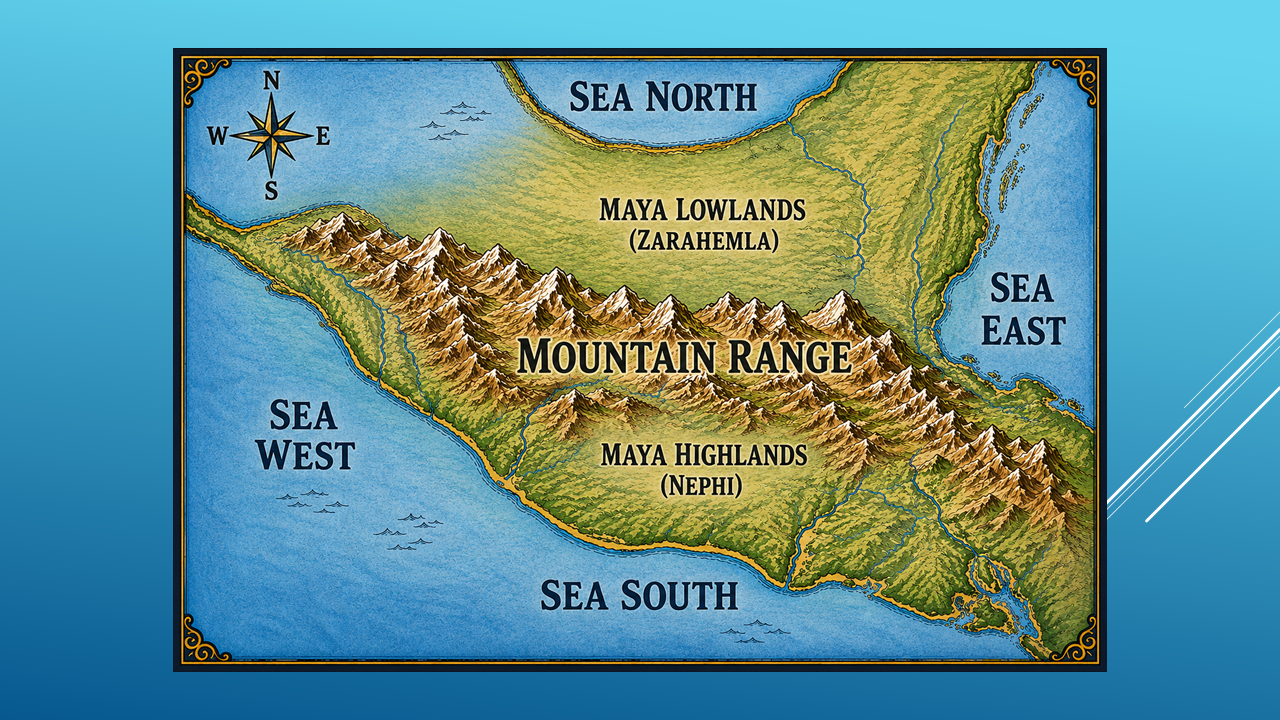
Here's another clue.
Mormon describes a relationship between a highland area and a lowland area.
So ask:
Does the mountain range divide the Land of Nephi from the lowland area of Zarahemla?
Look at Mesoamerica.
Here we have a major mountain range...
with highlands on one side...
and the lowlands on the other.
And suddenly the geography begins to look very different.
Look at the Hemispheric Model.
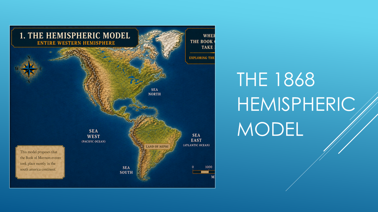
The relationship of the highlands vs the lowlands doesn't fit well.
Now look at the Heartland Model.
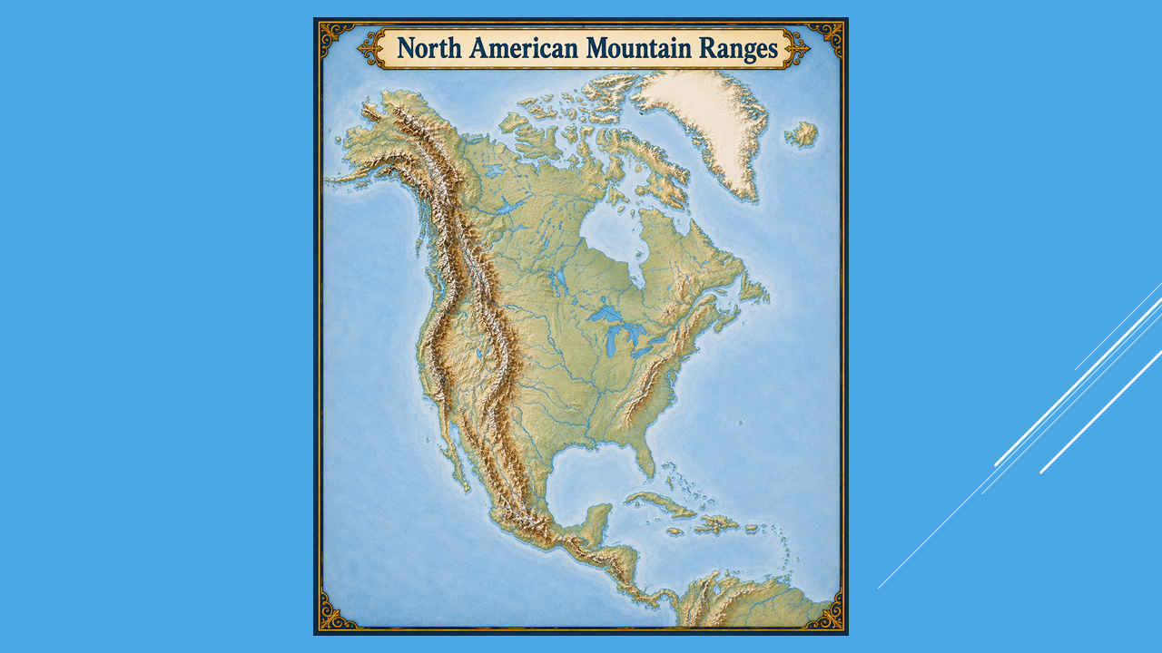
Again, the relationship of a highland and a lowland isn't there.
DON'T DECIDE YET!
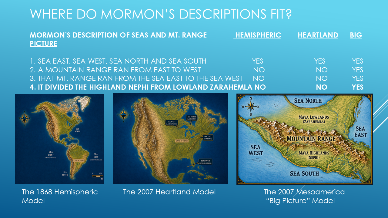
So far we've tested four descriptions:
The four seas.
The mountain range.
The mountain range extending between the seas.
And the relationship between the highlands and lowlands.
And one model is beginning to stand out.
As we work through this investigation, we'll keep a running score.
So far, the scorecard looks like this:
Hemispheric Model —1 out of 4.
Heartland Model — 1 out of 4.
Big Picture Model — 4 out of 4.
But those are only the results of the clues we've examined so far.
Another Book of Mormon Researcher
For your information, there are many authors of YouTube videos out there that have additional evidence of the Book of Mormon. One particular series is “A Marvelous Work” by Scott Christopher. You can look for him here on YouTube. (Slide 3)
The Fifth Test – Lehi’s Land of First Inheritance
Now we come to one of the most important geographical clues in the Book of Mormon:
Lehi's Land of First Inheritance.
In 2 Nephi 10:20 Nephi describes it as being by the Sea West…
“And now, the land of Nephi was the land of their fathers, and it was the land of their first inheritance…”
So let's test the models.
Now we come to one of the most important geographical clues in the Book of Mormon:
Lehi's Land of First Inheritance.
Mormon describes it as being by the Sea West.
So let's test the models.
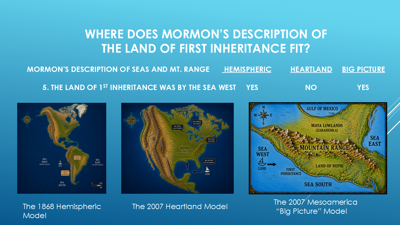
Does the proposed location of Lehi's First Inheritance fit?
The Hemispheric Model can accommodate this relationship.
The Mesoamerica model can also accommodate it.
But the Heartland Model presents a problem.
And again...
we don't eliminate a model simply because we don't like it.
We ask whether the geographical description fits.
The Hemispheric Model and the “Big Picture” model both fit the description. The Heartland Model does not.
Test #6 – Location of Land of First Inheritance
Now add another clue.
The Land of First Inheritance is described as being west of the Land of Nephi.
That's a very specific geographical relationship.
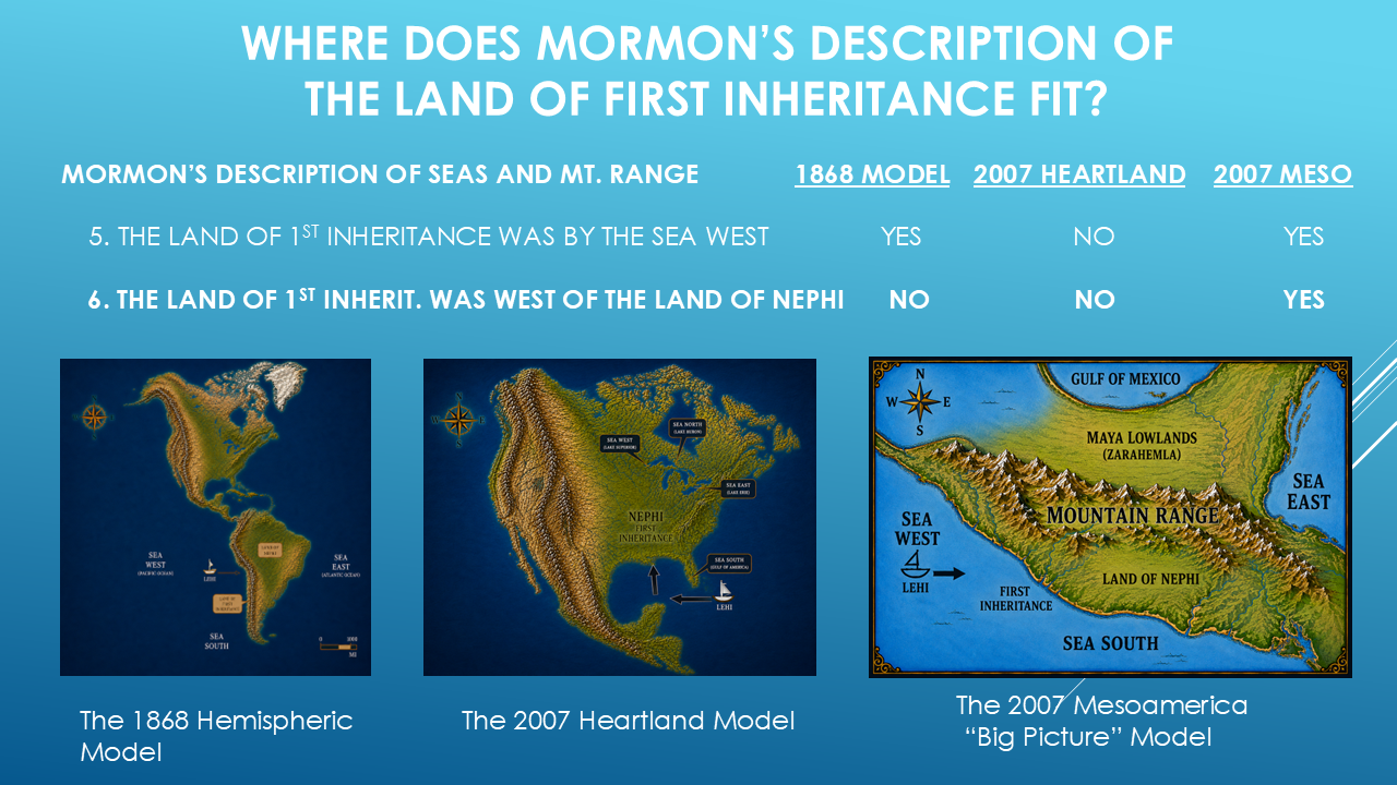
So now put the two locations on the map.
In the Hemispheric Model...
does First Inheritance lie west of Nephi?
The relationship becomes difficult.
In the Heartland Model...
again, the relationship doesn't fit well.
But in the Mesoamerica model...
the relationship fits.
First Inheritance is west of the Land of Nephi.
Now we're starting to see something important.
Individual clues are beginning to connect.
Let’s check the Current Standings
· Hemispheric 2 out of 6
· Heartland 1 out of 6
· Big Picture 6 out of 6
The Seventh Test – The River Sidon
Now we come to one of the most important geographical landmarks in the entire Book of Mormon.
The River Sidon.
Mormon refers to this river repeatedly.
And its location becomes critical because so many events occur around it.
So here's the next question:
Which proposed river fits Mormon's description?
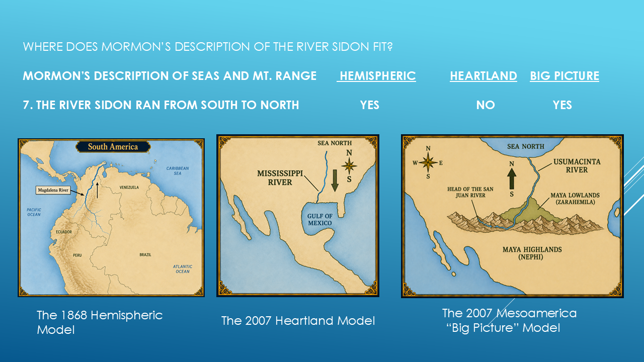
The Magdalena River in South America flows generally from south to north.
The Usumacinta River in southern Mexico and Guatemala also flows generally from south to north.
But the Mississippi River flows generally from north to south.
So if Mormon's description requires the River Sidon to flow from south to north...
the Mississippi presents a significant problem for the Heartland Model.
Two candidates remain.
And now we need another clue.
THE EIGHTH TEST — River Sidon a Head or a Headwaters?
Mormon gives us an especially interesting description of the River Sidon.
He refers to its head.
Not simply its distant headwaters.
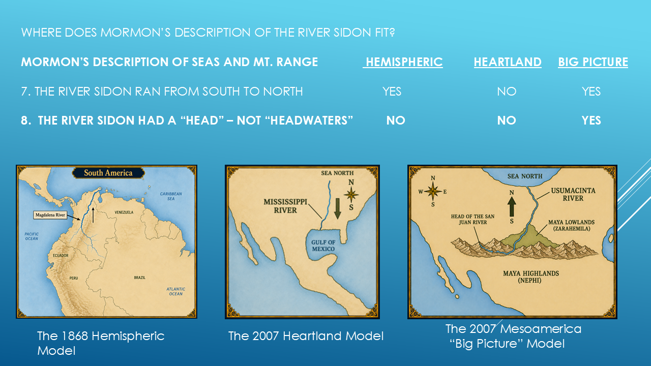
The Hemispheric Model, the river begins with headwaters.
The same is with the Heartland Model.
The Mesoamerican Model begins with a head…where it actually bubbles up from the side of a hill.
A specific geographical feature that becomes important in the Book of Mormon descriptions.
We're going to spend considerably more time on this in a later video.
But for now, let's simply ask:
Which proposed River Sidon has the geographical characteristics Mormon describes?
And this is where the models begin to separate even further.
The Hemispheric Model, the river begins with headwaters.
The same is with the Heartland Model.
The Mesoamerican Model begins with a head…where it actually bubbles up from the side of a hill.
A specific geographical feature that becomes important in the Book of Mormon descriptions.
We're going to spend considerably more time on this in a later video.
But for now, let's simply ask:
Which proposed River Sidon has the geographical characteristics Mormon describes?
Both of the Hemispheric Model and the Heartland Model do not fit this description. The “Big Picture” Model does fit Mormon’s description.
And this is where the models begin to separate even further.
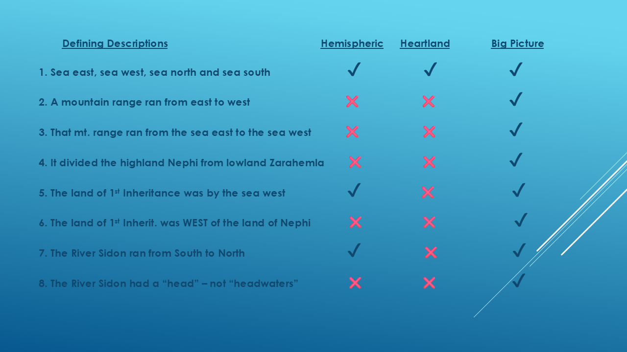
EIGHT CLUES
Let's stop for a moment.
We've now tested eight geographical descriptions.
The four seas.
The east-west mountain range.
The mountain range extending between the seas.
The highlands and lowlands.
Lehi's First Inheritance.
First Inheritance west of Nephi.
The direction of the River Sidon.
And the head of the River Sidon.
We've put three proposed models against those descriptions.
And now comes the question:
Which model follows Mormon's geographical directions best?
[Pause]
That's the question we're going to keep investigating.
Remember, we've only examined eight descriptions so far…let’s take a look at the final score card. (Slide 30)
After only eight tests, one model has pulled away from the others.
After only eight tests, one model has pulled away from the others.
Final Standings
· Hemispheric: 3 out of 8
· Heartland: 1 out of 8
· Big Picture: 8 out of 8
Add this slide here.
Final Standings
· Hemispheric: 3 out of 8
· Heartland: 1 out of 8
· Big Picture: 8 out of 8
The Land Northward Connection
Before moving on, I want to make an important observation.
Although the Heartland Model did not perform well in this particular test of Mormon's geographical descriptions, that does not mean that everything taught by Heartland researchers is incorrect.
So far, what we have examined point most strongly toward the Big Picture Model, the Book of Mormon itself records that large numbers of Nephites migrated into the land northward.
In Helaman chapter 3, Mormon describes people leaving Zarahemla, traveling great distances, and spreading throughout the land northward. Because of this, it is certainly possible that Book of Mormon peoples and influences extended far beyond the original lands described in these videos."
The scripture most often cited by people describing these travels is Helaman 3:3–12.
This is probably the strongest passage because it explicitly describes a large migration into the land northward.
Pay particular attention to these verses:
Many researchers have noted similarities between the mound-building cultures of North America and certain features found in ancient Mesoamerica. Those similarities deserve thoughtful consideration.
My purpose in this series is not to criticize the Heartland Model or the good people who support it. Rather, it is simply to determine where Mormon's own geographical descriptions fit best.
At this point in our study, those descriptions appear to point most strongly to the Mesoamerican "Big Picture" Model. However, that does not rule out the possibility that later migrations carried Book of Mormon peoples and influences into areas much farther north.
F. Richard Hauck’s Discovery
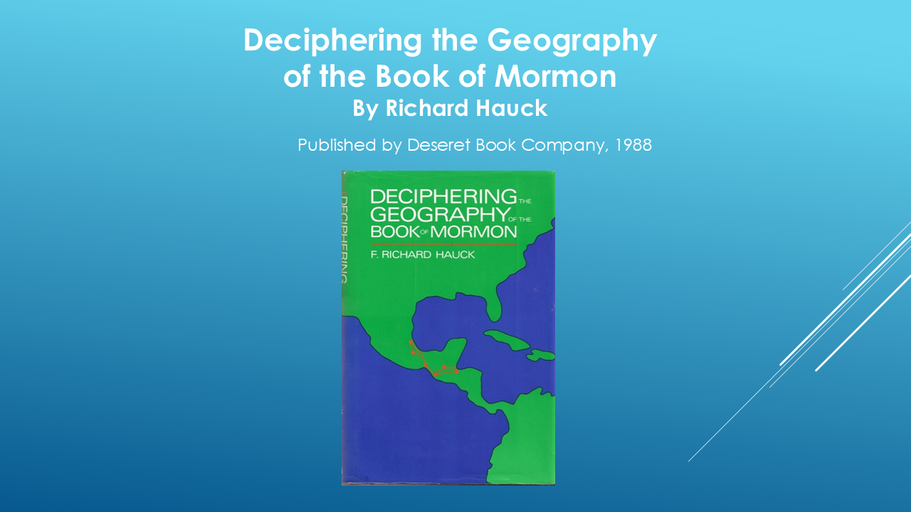
The leading LDS archeologist that helped put this theory together is F. Richard Hauck."
"In the 1980s, researcher Richard Hauck decided to approach the Book of Mormon in a completely different way. Rather than beginning with a location and trying to force the text to fit, he started with Mormon's geographical descriptions and built a map from the ground up."
Put Slide here:
Helaman 3:3
"And it came to pass in the forty and sixth year, there was much contention and many dissensions; in the which there were an exceedingly great many who departed out of the land of Zarahemla, and went forth unto the land northward to inherit the land."
Put Slide here.
Helaman 3:8
"And it came to pass that they did multiply and spread, and did go forth from the land southward to the land northward, and did spread insomuch that they began to cover the face of the whole earth..."
Put slide here.
Helaman 3:11
"...they did travel to an exceedingly great distance..."
Many researchers have noted similarities between the mound-building cultures of North America and certain features found in ancient Mesoamerica. Those similarities deserve thoughtful consideration.
My purpose in this series is not to criticize the Heartland Model or the good people who support it. Rather, it is simply to determine where Mormon's own geographical descriptions fit best.
At this point in our study, those descriptions appear to point most strongly to the Mesoamerican "Big Picture" Model. However, that does not rule out the possibility that later migrations carried Book of Mormon peoples and influences into areas much farther north.
HOW DID WE GET HERE?
[Slide 36 — Richard Hauck]
The Mesoamerica "Big Picture" Model didn't simply appear on a modern map.
In the 1980s, Richard Hauck developed a graphical representation of Book of Mormon geographical relationships based on the descriptions found in the text.
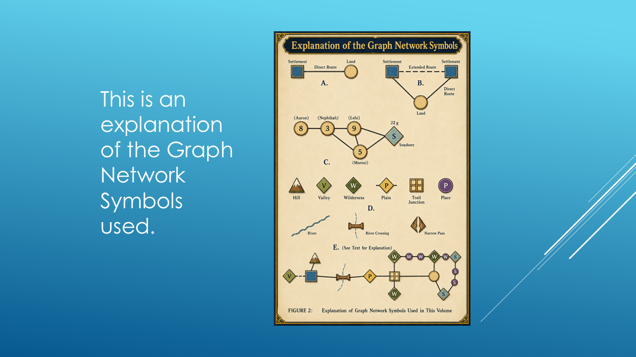
Instead of beginning with a modern map...
he began with relationships.
Cities.
Lands.
Wildernesses.
Rivers.
Roads.
Directions.
And other geographical features.
He represented them using symbols.
And those relationships created what became a detailed graph network of the Book of Mormon geography.
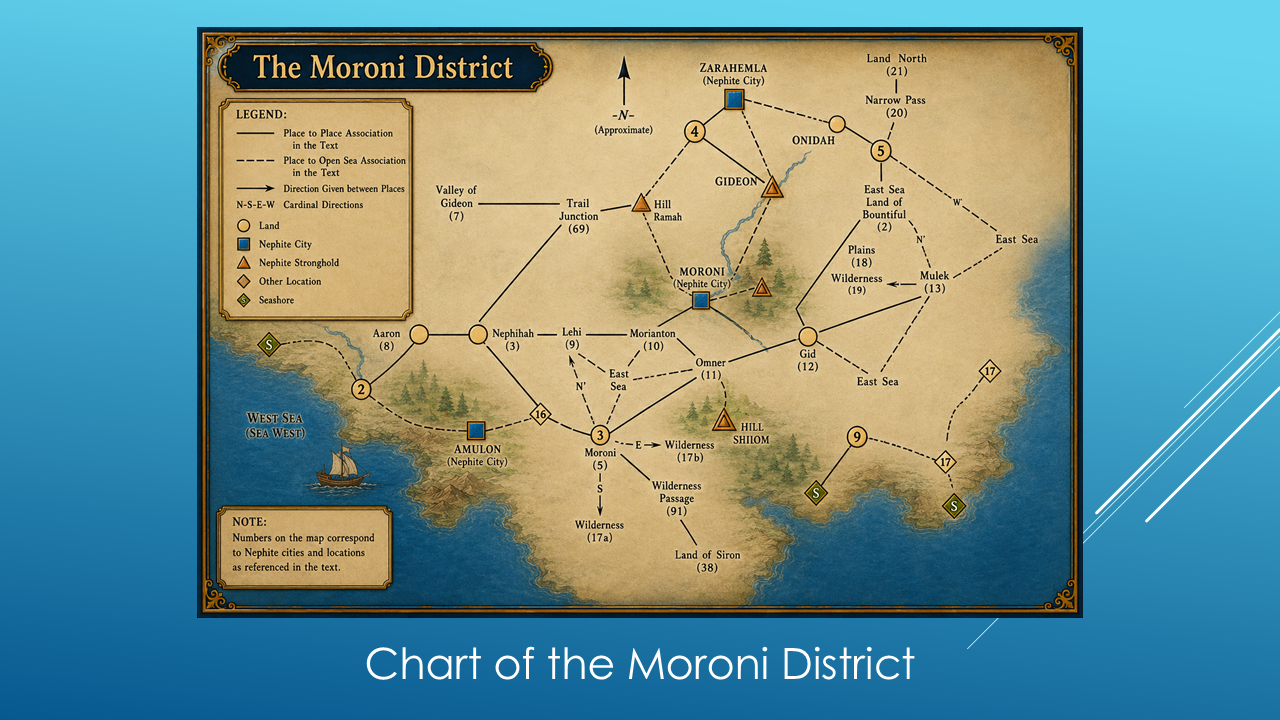
THE AREA BASE NETWORK
For example, here's the Moroni District.
This isn't a conventional geographical map.
It's a network of relationships.
This place is connected to that place.
This wilderness is connected to this land.
This route goes in this direction.
This river connects these areas.
And when all of those relationships are assembled...
we begin to get something very interesting.
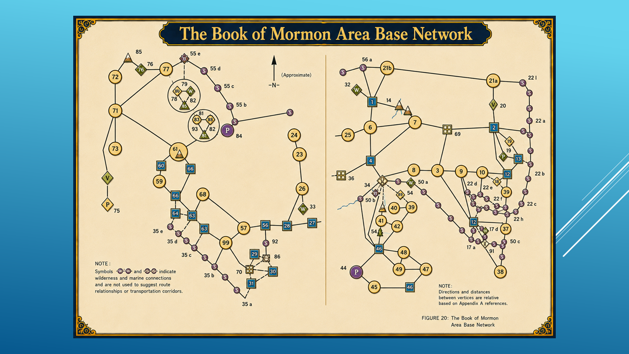
Hauck called this larger system:
The Book of Mormon Area Base Network.
The important thing about this approach is that the network is built from the Book of Mormon's geographical descriptions.
Then...
the network can be tested against the real world.
THE BIG TEST
So the next step was to take this Book of Mormon Area Base Network...
and compare it with the geography of the Americas.
Starting down here...
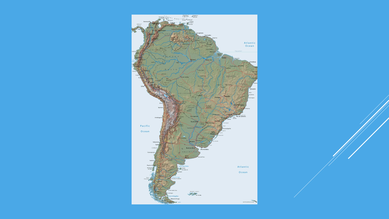
and working north...
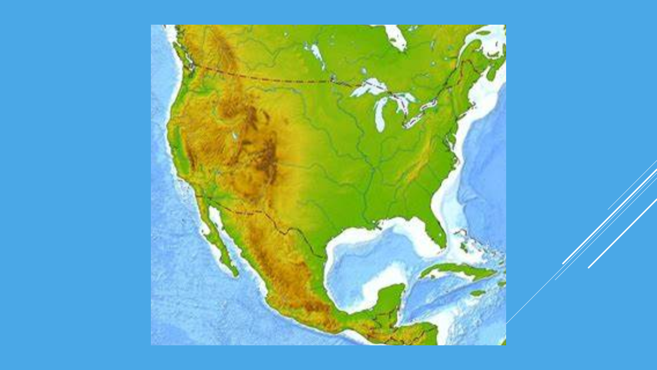
we can test the relationships against actual terrain.
And something remarkable happens.
The network doesn't fit equally well everywhere.
It begins to narrow down.
The only place the Book of Mormon “Area Base Network” …fits…is in the Southern Mexico – Guatemala area. (Slide 28)
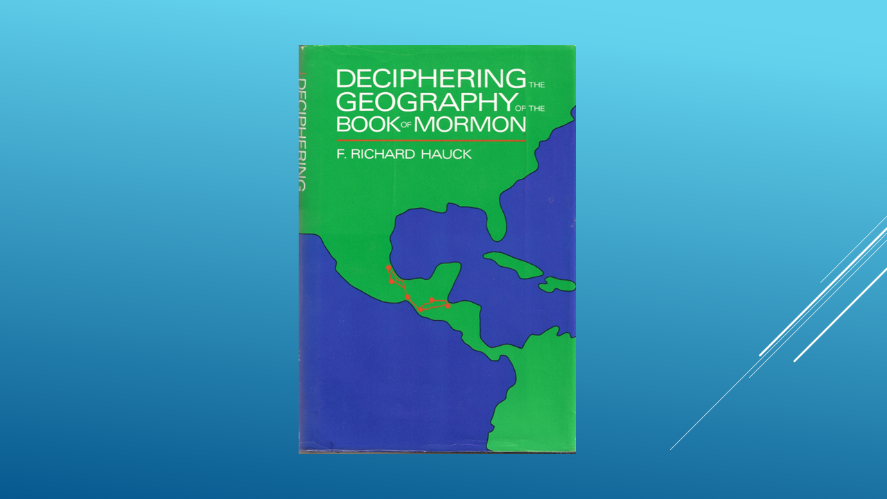
Here is a closer look at the map of the Book of Mormon area. (Slide 32)
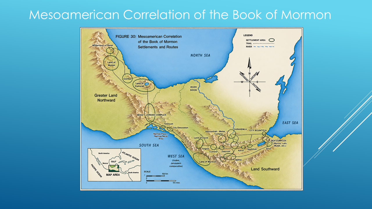
And that brings us to the geographical area we're going to investigate throughout this series.
BUT WE'RE NOT DONE
Now, I want to make something very clear.
I'm not asking you to accept this map because I showed it to you.
We're going to test it.
In the coming videos, we're going to take Mormon's descriptions one at a time.
We're going to identify the lands.
The seas.
The directions.
The mountains.
The rivers.
The wildernesses.
The cities.
And the routes between them.
And we're going to see whether they continue to fit.
Because if they don't fit...
we should say so.
But if they do fit...
then the evidence becomes increasingly difficult to ignore
And that's where our investigation begins.
We've identified the three major models.
We've tested eight geographical clues.
And we've seen one model begin to pull ahead.
But there's a problem.
Before we can accurately place any of Mormon's lands, cities or rivers on a map...
we have to understand something absolutely fundamental:
What did Mormon mean when he said north, south, east and west?
Which way was Mormon’s UP…and which way was DOWN?
Because if we misunderstand Mormon's directions...
everything we put on the map could be wrong.
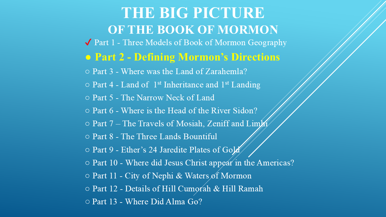
So, in Part 2, we're going to stop looking at the models...
and start with the most basic question of all:
Which way is north?
And then we'll work our way through Mormon's directions...
one clue at a time.
Thank you for your time…I will see you in Part 2 - The Basic Directions